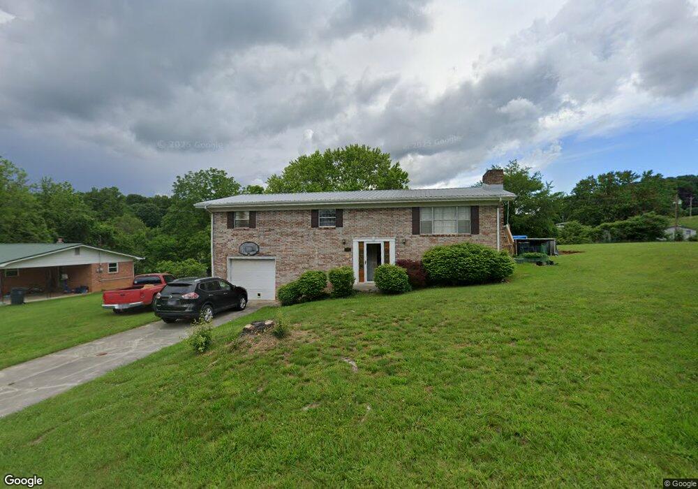
3469 Windsor Rd Morristown, TN 37813
Estimated Value: $194,000 - $295,000
--
Bed
3
Baths
1,392
Sq Ft
$180/Sq Ft
Est. Value
About This Home
This home is located at 3469 Windsor Rd, Morristown, TN 37813 and is currently estimated at $249,998, approximately $179 per square foot. 3469 Windsor Rd is a home located in Hamblen County with nearby schools including Union Heights Elementary School, East Ridge Middle School, and Morristown East High School.
Ownership History
Date
Name
Owned For
Owner Type
Purchase Details
Closed on
Sep 11, 2008
Sold by
Starke Kim
Bought by
Mcdonald Christopher
Current Estimated Value
Purchase Details
Closed on
Sep 5, 2006
Sold by
Household Financial Center
Bought by
Kim Starke
Purchase Details
Closed on
Apr 6, 2006
Bought by
Household Financial Center Inc
Purchase Details
Closed on
Jul 30, 1998
Bought by
Webb Calvin E
Purchase Details
Closed on
Aug 29, 1997
Bought by
Wadlington William B H
Purchase Details
Closed on
Mar 11, 1985
Bought by
Cross Charles E and Robertson Kathy J
Purchase Details
Closed on
May 28, 1971
Bought by
Roberts Gary and Roberts Sara
Create a Home Valuation Report for This Property
The Home Valuation Report is an in-depth analysis detailing your home's value as well as a comparison with similar homes in the area
Home Values in the Area
Average Home Value in this Area
Purchase History
| Date | Buyer | Sale Price | Title Company |
|---|---|---|---|
| Mcdonald Christopher | $99,000 | -- | |
| Kim Starke | $92,000 | -- | |
| Household Financial Center Inc | $91,500 | -- | |
| Webb Calvin E | $64,000 | -- | |
| Wadlington William B H | $57,000 | -- | |
| Cross Charles E | $47,500 | -- | |
| Roberts Gary | -- | -- |
Source: Public Records
Tax History Compared to Growth
Tax History
| Year | Tax Paid | Tax Assessment Tax Assessment Total Assessment is a certain percentage of the fair market value that is determined by local assessors to be the total taxable value of land and additions on the property. | Land | Improvement |
|---|---|---|---|---|
| 2024 | $665 | $33,775 | $4,150 | $29,625 |
| 2023 | $665 | $33,775 | $0 | $0 |
| 2022 | $642 | $32,575 | $4,150 | $28,425 |
| 2021 | $642 | $32,575 | $4,150 | $28,425 |
| 2020 | $642 | $32,575 | $4,150 | $28,425 |
| 2019 | $552 | $25,925 | $3,275 | $22,650 |
| 2018 | $552 | $25,925 | $3,275 | $22,650 |
| 2017 | $552 | $25,925 | $3,275 | $22,650 |
| 2016 | $516 | $25,925 | $3,275 | $22,650 |
| 2015 | $480 | $25,925 | $3,275 | $22,650 |
| 2014 | -- | $25,925 | $3,275 | $22,650 |
| 2013 | -- | $27,250 | $0 | $0 |
Source: Public Records
Map
Nearby Homes
- 1744 Carroll Rd
- 2137 Highview Dr
- 1496 Dover Rd
- 1689 Carroll Rd
- 1148 George Byrd Rd
- 2205 Kingswood Dr
- 4271 Stansberry Rd
- 2840-2830 Robinson Creek Rd
- 4581 Lockley Ct
- 4270 Brockland Dr
- 1342 Slop Creek Rd
- 3661 Halifax Cir
- 1575 Thompson Creek Rd
- 4705 E Hampton Blvd
- 0 Thompson Creek Rd
- 4458 Brockland Dr
- 3080 Chucky River Rd
- 358 Dover Rd
- 670 Jones Franklin Rd
- 3465 Windsor Rd
- 3473 Windsor Rd
- 1705 Pembrook Dr
- 1638 Carroll Rd
- 3460 Windsor Rd
- 3480 Windsor Rd
- 1711 Pembrook Dr
- 1708 Pembrook Dr
- 1694 Carroll Rd
- 1715 Pembrook Dr
- 1647 Carroll Rd
- 1710 Carroll Rd
- 1726 Pembrook Dr
- 1720 Carroll Rd
- 1693 Carroll Rd
- 1631 Carroll Rd
- 1697 Carroll Rd
- 1675 Carroll Rd
- 1592 Carroll Rd
- 1726 Carroll Rd