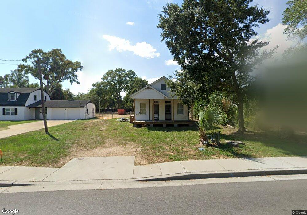
347 Forrest Ave Biloxi, MS 39530
Estimated Value: $127,074 - $189,000
3
Beds
--
Bath
1,182
Sq Ft
$143/Sq Ft
Est. Value
About This Home
This home is located at 347 Forrest Ave, Biloxi, MS 39530 and is currently estimated at $168,769, approximately $142 per square foot. 347 Forrest Ave is a home located in Harrison County with nearby schools including Gorenflo Elementary School, Biloxi Junior High School, and Biloxi High School.
Ownership History
Date
Name
Owned For
Owner Type
Purchase Details
Closed on
May 3, 2022
Sold by
Jones Ralph
Bought by
Davis Jason Earl and Davis Tomesha R
Current Estimated Value
Home Financials for this Owner
Home Financials are based on the most recent Mortgage that was taken out on this home.
Original Mortgage
$197,110
Interest Rate
4.42%
Mortgage Type
Credit Line Revolving
Purchase Details
Closed on
Apr 20, 2022
Sold by
Jones Patricia Jane
Bought by
Jones Ralph
Home Financials for this Owner
Home Financials are based on the most recent Mortgage that was taken out on this home.
Original Mortgage
$197,110
Interest Rate
4.42%
Mortgage Type
Credit Line Revolving
Create a Home Valuation Report for This Property
The Home Valuation Report is an in-depth analysis detailing your home's value as well as a comparison with similar homes in the area
Home Values in the Area
Average Home Value in this Area
Purchase History
| Date | Buyer | Sale Price | Title Company |
|---|---|---|---|
| Davis Jason Earl | -- | None Listed On Document | |
| Jones Ralph | -- | None Listed On Document |
Source: Public Records
Mortgage History
| Date | Status | Borrower | Loan Amount |
|---|---|---|---|
| Closed | Davis Jason Earl | $197,110 |
Source: Public Records
Tax History
| Year | Tax Paid | Tax Assessment Tax Assessment Total Assessment is a certain percentage of the fair market value that is determined by local assessors to be the total taxable value of land and additions on the property. | Land | Improvement |
|---|---|---|---|---|
| 2025 | $1,006 | $9,001 | $0 | $0 |
| 2024 | $964 | $8,705 | $0 | $0 |
| 2023 | $962 | $8,763 | $0 | $0 |
| 2022 | $962 | $8,763 | $0 | $0 |
| 2021 | $962 | $8,763 | $0 | $0 |
| 2020 | $856 | $7,792 | $0 | $0 |
| 2019 | $856 | $7,792 | $0 | $0 |
| 2018 | $856 | $7,792 | $0 | $0 |
| 2017 | $856 | $7,792 | $0 | $0 |
| 2015 | $835 | $7,600 | $0 | $0 |
| 2014 | -- | $9,204 | $0 | $0 |
| 2013 | -- | $7,600 | $2,406 | $5,193 |
Source: Public Records
Map
Nearby Homes
- 367 Forrest Ave
- 1091 Frank P Corso St
- 1076 Cherokee St
- 1054 Columbus St
- 1085 Cherokee St
- 1050 Frank P Corso St
- 392 Porter Ave
- 1067 Division St
- 262 Forrest Ave
- 265 Benachi Ave Unit A & B
- 258 Querens Ave
- 1126 Judge Sekul Ave
- 255 Benachi Ave Unit A&B
- 403 Gill Ave
- 000 Graham Ave
- 245 Benachi Ave
- 970 Division St
- 224 Querens Ave
- 252 Seal Ave
- 328 Bohn St
- 343 Forrest Ave
- 357 Forrest Ave
- 1112 Grady St
- 339 Forrest Ave
- 359 Forrest Ave
- 342 Forrest Ave
- 342 Forrest Ave
- 363 Forrest Ave
- 358 Forrest Ave
- 1095 Columbus St
- 1095 Columbus St
- 1088 Columbus St
- 1091 Columbus St
- 1097 Park Ct S
- 371 Forrest Ave
- 1089 Columbus St
- 331 Forrest Ave
- 1093 Park Ct S
- 345 Porter Ave
- 357 Porter Ave
Your Personal Tour Guide
Ask me questions while you tour the home.