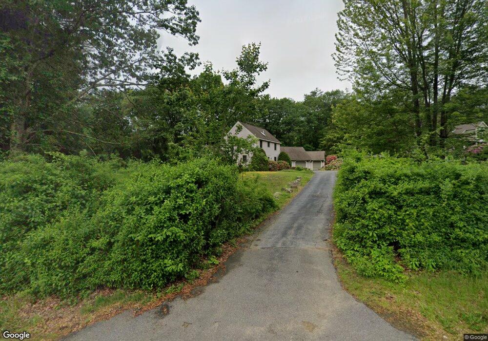
347 Mammoth Rd Londonderry, NH 03053
Estimated Value: $571,000 - $661,000
3
Beds
3
Baths
1,870
Sq Ft
$332/Sq Ft
Est. Value
About This Home
This home is located at 347 Mammoth Rd, Londonderry, NH 03053 and is currently estimated at $621,616, approximately $332 per square foot. 347 Mammoth Rd is a home with nearby schools including Matthew Thornton Elementary School, Londonderry Middle School, and Londonderry Senior High School.
Ownership History
Date
Name
Owned For
Owner Type
Purchase Details
Closed on
Dec 15, 1997
Sold by
Williams D Dean and Williams Kathryn T
Bought by
Hatch Robert E and Hatch Pamela
Current Estimated Value
Home Financials for this Owner
Home Financials are based on the most recent Mortgage that was taken out on this home.
Original Mortgage
$117,600
Outstanding Balance
$19,738
Interest Rate
7.14%
Estimated Equity
$601,878
Create a Home Valuation Report for This Property
The Home Valuation Report is an in-depth analysis detailing your home's value as well as a comparison with similar homes in the area
Home Values in the Area
Average Home Value in this Area
Purchase History
| Date | Buyer | Sale Price | Title Company |
|---|---|---|---|
| Hatch Robert E | $147,000 | -- |
Source: Public Records
Mortgage History
| Date | Status | Borrower | Loan Amount |
|---|---|---|---|
| Open | Hatch Robert E | $117,600 |
Source: Public Records
Tax History Compared to Growth
Tax History
| Year | Tax Paid | Tax Assessment Tax Assessment Total Assessment is a certain percentage of the fair market value that is determined by local assessors to be the total taxable value of land and additions on the property. | Land | Improvement |
|---|---|---|---|---|
| 2024 | $8,091 | $501,300 | $180,000 | $321,300 |
| 2023 | $7,845 | $501,300 | $180,000 | $321,300 |
| 2022 | $7,355 | $398,000 | $135,000 | $263,000 |
| 2021 | $7,315 | $398,000 | $135,000 | $263,000 |
| 2020 | $7,622 | $379,000 | $113,400 | $265,600 |
| 2019 | $7,349 | $379,000 | $113,400 | $265,600 |
| 2018 | $6,603 | $304,700 | $93,800 | $210,900 |
| 2017 | $6,585 | $304,700 | $93,800 | $210,900 |
| 2016 | $6,551 | $304,700 | $93,800 | $210,900 |
| 2015 | $6,405 | $304,700 | $93,800 | $210,900 |
| 2014 | $6,426 | $304,700 | $93,800 | $210,900 |
| 2011 | -- | $295,200 | $93,800 | $201,400 |
Source: Public Records
Map
Nearby Homes
- 367 Mammoth Rd
- 16 King Henry Dr
- 57 Hardy Rd
- 61 Hardy Rd
- 9 King John Dr
- 20 Wedgewood Dr
- 11 Elise Ave Unit Lot 91
- 22 Stage Coach Cir
- 4 Woodbine Dr
- 13 Woodbine Dr
- 35 Red Deer Rd
- 5 Hickory Hill Dr
- 12 Abington Dr
- 272 Winding Pond Rd Unit 272
- 267 Winding Pond Rd
- 244 Winding Pond Rd
- 69 Litchfield Rd
- 75 Rockingham Rd
- 29 Rolling Ridge Rd
- 17 Westminster Dr
- 349 Mammoth Rd
- 352 Mammoth Rd Unit L
- 330 Mammoth Rd
- 352 Mammoth Rd
- 69 Shasta Dr
- 346 Mammoth Rd
- 67 Shasta Dr
- 348 Mammoth Rd
- 353 Mammoth Rd
- 345-347 Mammoth Rd
- 65 Shasta Dr
- 350 Mammoth Rd
- 355 Mammoth Rd
- 63 Shasta Dr
- 354 Mammoth Rd
- 357 Mammoth Rd
- 68 Shasta Dr
- 59 Shasta Dr
- 5 Mountain Home Rd
- 62 Shasta Dr