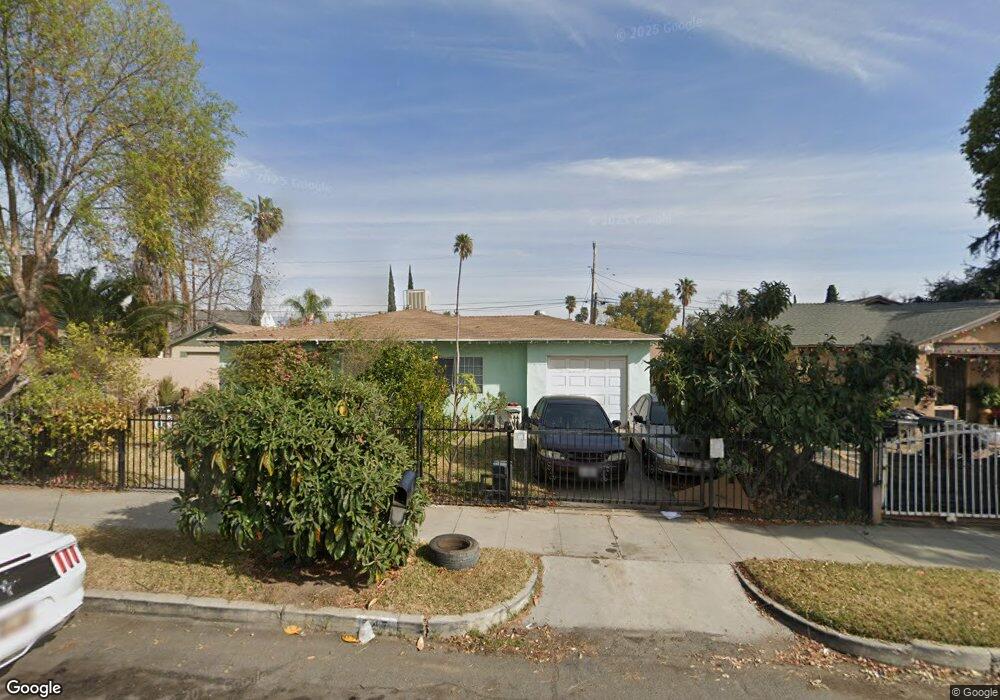
347 N Date Ave Rialto, CA 92376
Estimated Value: $454,000 - $536,000
2
Beds
1
Bath
1,008
Sq Ft
$477/Sq Ft
Est. Value
About This Home
This home is located at 347 N Date Ave, Rialto, CA 92376 and is currently estimated at $480,409, approximately $476 per square foot. 347 N Date Ave is a home located in San Bernardino County with nearby schools including Sam V. Curtis Elementary School, Rialto Middle School, and Eisenhower High School.
Ownership History
Date
Name
Owned For
Owner Type
Purchase Details
Closed on
Jun 9, 2004
Sold by
Ibarra Ines
Bought by
Ibarra Alejandro B
Current Estimated Value
Home Financials for this Owner
Home Financials are based on the most recent Mortgage that was taken out on this home.
Original Mortgage
$157,500
Outstanding Balance
$76,896
Interest Rate
6.09%
Mortgage Type
Purchase Money Mortgage
Estimated Equity
$403,513
Purchase Details
Closed on
May 20, 2004
Sold by
Medina Jose M and Mendoza Carmen F
Bought by
Ibarra Alejandro B
Home Financials for this Owner
Home Financials are based on the most recent Mortgage that was taken out on this home.
Original Mortgage
$157,500
Outstanding Balance
$76,896
Interest Rate
6.09%
Mortgage Type
Purchase Money Mortgage
Estimated Equity
$403,513
Purchase Details
Closed on
Oct 17, 2001
Sold by
Allevato Eugenio and Allevato Linda L
Bought by
Medina Jose M and Mendoza Carmen E
Create a Home Valuation Report for This Property
The Home Valuation Report is an in-depth analysis detailing your home's value as well as a comparison with similar homes in the area
Home Values in the Area
Average Home Value in this Area
Purchase History
| Date | Buyer | Sale Price | Title Company |
|---|---|---|---|
| Ibarra Alejandro B | -- | Ticor Title Co | |
| Ibarra Alejandro B | $210,000 | Ticor Title Co | |
| Medina Jose M | $89,000 | First American Title |
Source: Public Records
Mortgage History
| Date | Status | Borrower | Loan Amount |
|---|---|---|---|
| Open | Ibarra Alejandro B | $157,500 |
Source: Public Records
Tax History
| Year | Tax Paid | Tax Assessment Tax Assessment Total Assessment is a certain percentage of the fair market value that is determined by local assessors to be the total taxable value of land and additions on the property. | Land | Improvement |
|---|---|---|---|---|
| 2025 | $4,058 | $298,579 | $74,645 | $223,934 |
| 2024 | $3,904 | $292,724 | $73,181 | $219,543 |
| 2023 | $4,137 | $286,984 | $71,746 | $215,238 |
| 2022 | $3,830 | $281,357 | $70,339 | $211,018 |
| 2021 | $3,806 | $275,840 | $68,960 | $206,880 |
| 2020 | $3,818 | $273,012 | $68,253 | $204,759 |
| 2019 | $3,827 | $267,659 | $66,915 | $200,744 |
| 2018 | $3,427 | $240,600 | $84,200 | $156,400 |
| 2017 | $3,248 | $223,800 | $78,300 | $145,500 |
| 2016 | $2,796 | $213,200 | $74,600 | $138,600 |
| 2015 | $2,716 | $203,000 | $71,000 | $132,000 |
| 2014 | $2,604 | $203,000 | $71,000 | $132,000 |
Source: Public Records
Map
Nearby Homes
- 251 E Ramona Dr
- 210 N Riverside Ave
- 530 N Sycamore Ave
- 228 N Orange Ave
- 565 N Riverside Ave
- 538 N Oakdale Ave
- 117 N Orange Ave
- 332 E Rosewood St
- 508 N Joyce Ave
- 525 E 3rd St
- 133 E Van Koevering St
- 352 Alice Ave
- 230 N Millard Ave
- 109 S Joyce Ave
- 114 S Acacia Ave
- 361 Allen St
- 645 E King St
- 347 N Eucalyptus Ave Unit 24
- 185 N Eucalyptus Ave Unit 53
- 160 S Eucalyptus Ave
- 339 N Date Ave
- 353 N Date Ave
- 340 N Magnolia Ave
- 338 N Magnolia Ave
- 346 N Magnolia Ave Unit 2
- 346 N Magnolia Ave Unit 1
- 346 N Magnolia Ave
- 346 N Magnoia Ave
- 334 N Magnolia Ave
- 350 N Magnolia Ave
- 331 N Date Ave Unit B
- 331 N Date Ave
- 344 N Date Ave
- 340 N Date Ave
- 328 N Magnolia Ave
- 348 N Date Ave
- 334 N Date Ave
- 327 N Date Ave
- 358 N Date Ave
- 217 E Foothill Blvd
Your Personal Tour Guide
Ask me questions while you tour the home.