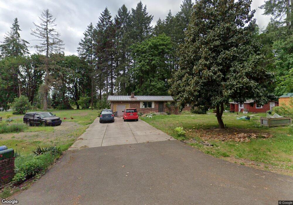
34716 NW 21st Ave La Center, WA 98629
Estimated Value: $439,000 - $479,000
3
Beds
1
Bath
1,008
Sq Ft
$457/Sq Ft
Est. Value
About This Home
This home is located at 34716 NW 21st Ave, La Center, WA 98629 and is currently estimated at $461,010, approximately $457 per square foot. 34716 NW 21st Ave is a home located in Clark County with nearby schools including La Center Elementary School, La Center Middle School, and La Center High School.
Ownership History
Date
Name
Owned For
Owner Type
Purchase Details
Closed on
Dec 2, 2015
Sold by
Cole Lorraine M and Cole Forrest Willard
Bought by
Bravo Gabriel and Bravo Marilu
Current Estimated Value
Home Financials for this Owner
Home Financials are based on the most recent Mortgage that was taken out on this home.
Original Mortgage
$206,959
Outstanding Balance
$163,011
Interest Rate
3.75%
Mortgage Type
FHA
Estimated Equity
$297,999
Create a Home Valuation Report for This Property
The Home Valuation Report is an in-depth analysis detailing your home's value as well as a comparison with similar homes in the area
Home Values in the Area
Average Home Value in this Area
Purchase History
| Date | Buyer | Sale Price | Title Company |
|---|---|---|---|
| Bravo Gabriel | $226,000 | Stewart Title Vancouver |
Source: Public Records
Mortgage History
| Date | Status | Borrower | Loan Amount |
|---|---|---|---|
| Open | Bravo Gabriel | $206,959 |
Source: Public Records
Tax History Compared to Growth
Tax History
| Year | Tax Paid | Tax Assessment Tax Assessment Total Assessment is a certain percentage of the fair market value that is determined by local assessors to be the total taxable value of land and additions on the property. | Land | Improvement |
|---|---|---|---|---|
| 2025 | $3,845 | $409,723 | $209,709 | $200,014 |
| 2024 | $3,742 | $397,750 | $209,709 | $188,041 |
| 2023 | $3,380 | $403,818 | $213,377 | $190,441 |
| 2022 | $3,274 | $351,922 | $175,274 | $176,648 |
| 2021 | $3,097 | $302,748 | $146,219 | $156,529 |
| 2020 | $3,022 | $269,036 | $130,239 | $138,797 |
| 2019 | $2,976 | $256,694 | $122,975 | $133,719 |
| 2018 | $2,703 | $259,348 | $0 | $0 |
| 2017 | $2,180 | $232,093 | $0 | $0 |
| 2016 | $2,142 | $197,533 | $0 | $0 |
| 2015 | $2,142 | $161,624 | $0 | $0 |
| 2014 | -- | $34,700 | $0 | $0 |
| 2013 | -- | $34,700 | $0 | $0 |
Source: Public Records
Map
Nearby Homes
- 2817 NW Eddy Rock Rd
- 1316 W 17th Ave
- 0 W 18th Ct
- 1303 W 17th Ave
- 1300 W 15th Ave
- 35706 NW 14th Ave
- 35224 NW 32nd Ave
- 516 W 20th Way
- 410 W 20th Way
- 404 W 20th Way
- 403 W 19th St
- 1025 NW Pacific Hwy
- 818 NW 359th St
- 310 W 20th Way
- 1503 W Alder Place
- 1509 W Alder Place
- 143 W 20th Way
- 149 W 20th Way
- Silverton Plan at Stephens Hillside Farm
- Baker Plan at Stephens Hillside Farm
- 34704 NW 21st Ave
- 34710 NW 21st Ave
- 34709 NW 21st Ave
- 0 NW 21st Ave Unit 707351
- 0 NW 21st Ave Unit 3007845
- 0 NW 21st Ave
- 34515 NW 21st Ave
- 34706 NW 21st Ave
- 2401 NW Wellman Rd
- 2001 NW Bolen St
- 34502 NW 21st Ave
- 34601 NW 21st Ave
- 34714 NW Pacific Hwy
- 34410 NW 21st Ave
- 34710 NW Pacific Hwy
- 000 NW 21st Ave
- 000 NW 21st Ave Unit 1
- 2010 NW Hunter Ln
- 2601 NW Wellman Rd
- 35006 NW 26th Ave