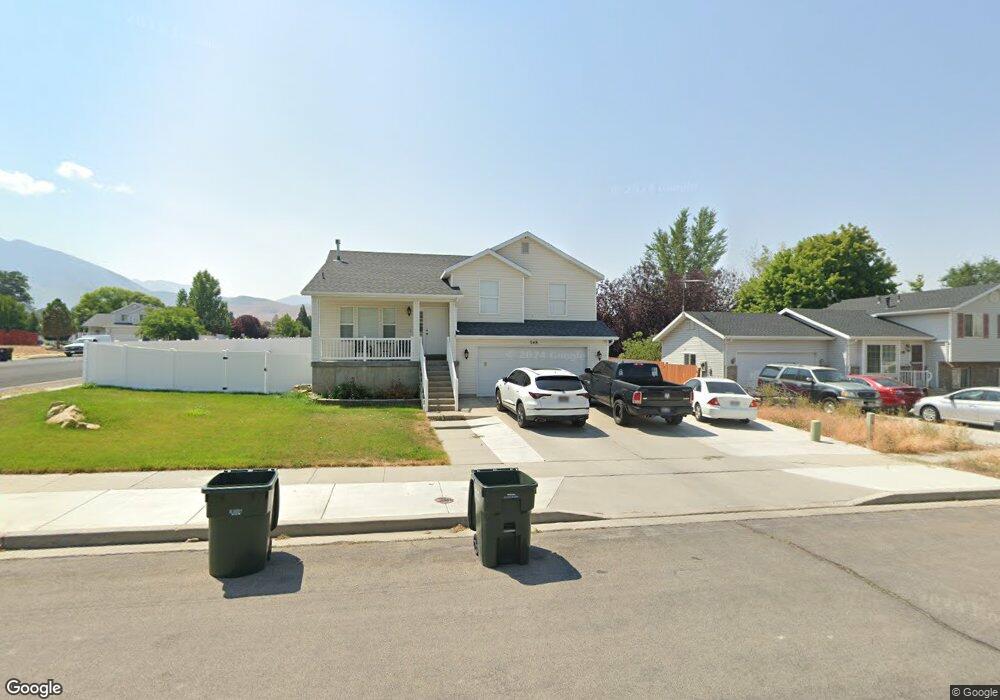
348 E 740 N Tooele, UT 84074
Estimated Value: $439,000 - $455,000
5
Beds
3
Baths
2,362
Sq Ft
$188/Sq Ft
Est. Value
About This Home
This home is located at 348 E 740 N, Tooele, UT 84074 and is currently estimated at $445,110, approximately $188 per square foot. 348 E 740 N is a home located in Tooele County with nearby schools including Sterling Elementary School, Tooele Junior High School, and Tooele High School.
Ownership History
Date
Name
Owned For
Owner Type
Purchase Details
Closed on
Aug 17, 2016
Sold by
Erickson Lance E
Bought by
Cheney Branden and Cheney Jennifer M
Current Estimated Value
Home Financials for this Owner
Home Financials are based on the most recent Mortgage that was taken out on this home.
Original Mortgage
$229,305
Outstanding Balance
$182,544
Interest Rate
3.41%
Mortgage Type
New Conventional
Estimated Equity
$262,566
Purchase Details
Closed on
Jun 9, 2006
Sold by
Nunez Aurelio and Gonzalez Gullermina
Bought by
Cano Tifny and Cano Luis
Home Financials for this Owner
Home Financials are based on the most recent Mortgage that was taken out on this home.
Original Mortgage
$162,652
Interest Rate
6.55%
Mortgage Type
FHA
Create a Home Valuation Report for This Property
The Home Valuation Report is an in-depth analysis detailing your home's value as well as a comparison with similar homes in the area
Purchase History
| Date | Buyer | Sale Price | Title Company |
|---|---|---|---|
| Cheney Branden | -- | Security Title Insurance Age | |
| Cano Tifny | -- | Equity Title Production Fac |
Source: Public Records
Mortgage History
| Date | Status | Borrower | Loan Amount |
|---|---|---|---|
| Open | Cheney Branden | $229,305 | |
| Previous Owner | Cano Tifny | $162,652 |
Source: Public Records
Tax History
| Year | Tax Paid | Tax Assessment Tax Assessment Total Assessment is a certain percentage of the fair market value that is determined by local assessors to be the total taxable value of land and additions on the property. | Land | Improvement |
|---|---|---|---|---|
| 2025 | $2,924 | $443,372 | $83,000 | $360,372 |
| 2024 | $3,201 | $244,359 | $45,650 | $198,709 |
| 2023 | $3,201 | $232,648 | $43,474 | $189,174 |
| 2022 | $2,723 | $234,260 | $43,381 | $190,879 |
| 2021 | $2,281 | $164,183 | $17,353 | $146,830 |
| 2020 | $2,162 | $269,911 | $31,550 | $238,361 |
| 2019 | $2,106 | $258,560 | $31,550 | $227,010 |
| 2018 | $1,996 | $232,381 | $40,000 | $192,381 |
| 2017 | $1,430 | $197,503 | $32,500 | $165,003 |
| 2016 | $1,177 | $96,790 | $17,875 | $78,915 |
| 2015 | $1,177 | $85,567 | $0 | $0 |
| 2014 | -- | $85,567 | $0 | $0 |
Source: Public Records
Map
Nearby Homes
- 367 E 740 N
- 516 N Broadway Ave
- 332 E 880 N
- 261 E 670 N Unit 220
- 252 E 715 N Unit 216
- 779 N 560 E
- 337 E 910 N
- 535 E 670 N
- 603 Valley View Dr
- 698 Brook Ave E
- 294 E 600 N
- 180 1000 N
- 151 E 730 N
- 237 E 960 N Unit D
- 590 N Brook Ave
- 455 Lindy Way
- 677 Kings Landing
- 550 Seagull Dr
- 647 E 980 N
- 876 N Fox Run Dr