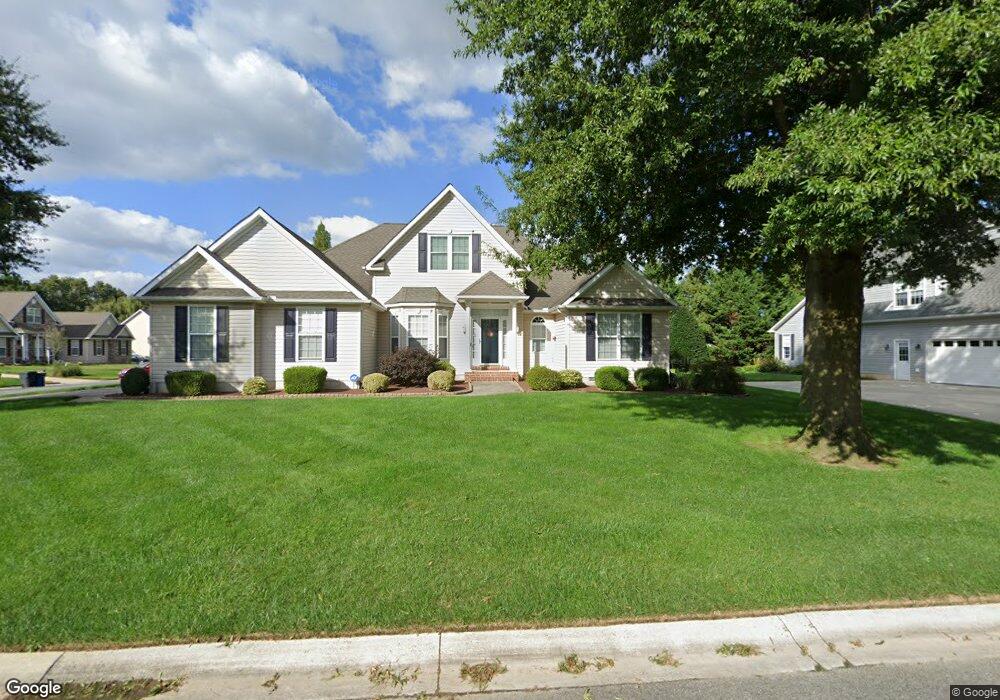
348 Orchard Grove Dr Camden Wyoming, DE 19934
Rising Sun-Lebanon NeighborhoodEstimated Value: $448,106 - $529,000
4
Beds
3
Baths
2,528
Sq Ft
$199/Sq Ft
Est. Value
About This Home
This home is located at 348 Orchard Grove Dr, Camden Wyoming, DE 19934 and is currently estimated at $502,027, approximately $198 per square foot. 348 Orchard Grove Dr is a home located in Kent County with nearby schools including Star Hill Elementary School, F. Niel Postlethwait Middle School, and Caesar Rodney High School.
Ownership History
Date
Name
Owned For
Owner Type
Purchase Details
Closed on
Oct 30, 2013
Sold by
Pero Joseph E and Pero Barbara A
Bought by
Pero Joseph E and Pero Barbara A
Current Estimated Value
Home Financials for this Owner
Home Financials are based on the most recent Mortgage that was taken out on this home.
Original Mortgage
$420,000
Interest Rate
2.29%
Mortgage Type
Reverse Mortgage Home Equity Conversion Mortgage
Create a Home Valuation Report for This Property
The Home Valuation Report is an in-depth analysis detailing your home's value as well as a comparison with similar homes in the area
Home Values in the Area
Average Home Value in this Area
Purchase History
| Date | Buyer | Sale Price | Title Company |
|---|---|---|---|
| Pero Joseph E | -- | None Available |
Source: Public Records
Mortgage History
| Date | Status | Borrower | Loan Amount |
|---|---|---|---|
| Closed | Pero Joseph E | $420,000 |
Source: Public Records
Tax History Compared to Growth
Tax History
| Year | Tax Paid | Tax Assessment Tax Assessment Total Assessment is a certain percentage of the fair market value that is determined by local assessors to be the total taxable value of land and additions on the property. | Land | Improvement |
|---|---|---|---|---|
| 2025 | $1,822 | $434,700 | $111,900 | $322,800 |
| 2024 | $1,822 | $434,700 | $111,900 | $322,800 |
| 2023 | $1,646 | $63,000 | $4,800 | $58,200 |
| 2022 | $1,517 | $63,000 | $4,800 | $58,200 |
| 2021 | $1,633 | $63,000 | $4,800 | $58,200 |
| 2020 | $1,533 | $63,000 | $4,800 | $58,200 |
| 2019 | $1,464 | $63,000 | $4,800 | $58,200 |
| 2018 | $1,365 | $60,500 | $4,800 | $55,700 |
| 2017 | $1,333 | $60,500 | $0 | $0 |
| 2016 | $1,158 | $60,500 | $0 | $0 |
| 2015 | $1,038 | $60,500 | $0 | $0 |
| 2014 | $1,067 | $60,500 | $0 | $0 |
Source: Public Records
Map
Nearby Homes
- 55 Orchard Grove Ct
- 464 Orchard Grove Dr
- 106 Steffens Blvd
- 83 Homestead Dr
- 45 Brookfield Dr
- 42 Brookfield Dr
- 103 Osprey Ct
- 57 Sisal Way
- LOT 102 AST King Henry Ct
- LOT 105 SYC Brookfield Dr
- 138 Cilento Dr
- Aster Plan at Brookfield
- Linden Plan at Brookfield
- Beech Plan at Brookfield
- Garrett Plan at Brookfield
- Sycamore Plan at Brookfield
- Red Maple Plan at Brookfield
- 256 Headstart Ln
- 224 King Henry Ct
- Lot 22 Bee Brookfield Dr
- 326 Orchard Grove Dr
- 343 Orchard Grove Dr
- 15 Orchard Grove Ct
- 365 Orchard Grove Dr
- 306 Orchard Grove Dr
- 37 Orchard Grove Ct
- 309 Orchard Grove Dr
- 36 Pear Blossom Ln
- 284 Orchard Grove Dr
- 381 Orchard Grove Dr
- 442 Orchard Grove Dr Unit 3
- 442 Orchard Grove Dr
- 37 Pear Blossom Ln
- 58 Pear Blossom Ln
- 79 Orchard Grove Ct
- 399 Orchard Grove Dr
- 283 Orchard Grove Dr
- 283 Orchard Grove Dr
- 484 Orchard Grove Dr
- 294 Orchard Grove Way