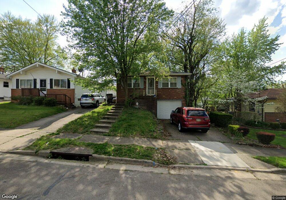
348 Stanley Rd Akron, OH 44312
Ellet NeighborhoodEstimated Value: $151,000 - $160,000
3
Beds
2
Baths
1,092
Sq Ft
$143/Sq Ft
Est. Value
About This Home
This home is located at 348 Stanley Rd, Akron, OH 44312 and is currently estimated at $156,184, approximately $143 per square foot. 348 Stanley Rd is a home located in Summit County with nearby schools including Ellet High School, Summit Academy Akron Elementary School, and Akron Preparatory school.
Ownership History
Date
Name
Owned For
Owner Type
Purchase Details
Closed on
Oct 12, 2022
Sold by
Bowling Chad J
Bought by
Chadman Properties Llc
Current Estimated Value
Purchase Details
Closed on
Jul 26, 2011
Sold by
Secretary Of Housing & Urban Development
Bought by
Pompeo Shelby D
Home Financials for this Owner
Home Financials are based on the most recent Mortgage that was taken out on this home.
Original Mortgage
$42,000
Interest Rate
4.53%
Mortgage Type
Purchase Money Mortgage
Purchase Details
Closed on
Mar 9, 2011
Sold by
Stefanov Mary Kathleen and Stefanov William
Bought by
Citimortgage Inc
Purchase Details
Closed on
Jan 19, 2011
Sold by
Citimortgage Inc
Bought by
Secretary Of Housing & Urban Development
Create a Home Valuation Report for This Property
The Home Valuation Report is an in-depth analysis detailing your home's value as well as a comparison with similar homes in the area
Home Values in the Area
Average Home Value in this Area
Purchase History
| Date | Buyer | Sale Price | Title Company |
|---|---|---|---|
| Chadman Properties Llc | -- | None Listed On Document | |
| Pompeo Shelby D | $27,000 | Lakeside Title | |
| Citimortgage Inc | $56,000 | None Available | |
| Secretary Of Housing & Urban Development | -- | None Available |
Source: Public Records
Mortgage History
| Date | Status | Borrower | Loan Amount |
|---|---|---|---|
| Previous Owner | Pompeo Shelby D | $42,000 |
Source: Public Records
Tax History
| Year | Tax Paid | Tax Assessment Tax Assessment Total Assessment is a certain percentage of the fair market value that is determined by local assessors to be the total taxable value of land and additions on the property. | Land | Improvement |
|---|---|---|---|---|
| 2025 | $2,211 | $40,842 | $9,230 | $31,612 |
| 2024 | $2,211 | $40,842 | $9,230 | $31,612 |
| 2023 | $2,211 | $40,842 | $9,230 | $31,612 |
| 2022 | $2,088 | $30,251 | $6,836 | $23,415 |
| 2021 | $2,090 | $30,251 | $6,836 | $23,415 |
| 2020 | $2,059 | $30,260 | $6,840 | $23,420 |
| 2019 | $2,014 | $26,880 | $6,490 | $20,390 |
| 2018 | $1,988 | $26,880 | $6,490 | $20,390 |
| 2017 | $2,196 | $26,880 | $6,490 | $20,390 |
| 2016 | $2,197 | $28,480 | $6,490 | $21,990 |
| 2015 | $2,196 | $28,480 | $6,490 | $21,990 |
| 2014 | $2,179 | $28,480 | $6,490 | $21,990 |
| 2013 | $2,027 | $26,950 | $6,490 | $20,460 |
Source: Public Records
Map
Nearby Homes
- 472 Stephens Rd
- 274 Fulmer Ave
- 1832 Springfield Center Rd
- 2138 Forest Oak Dr
- 545 Fulmer Ave
- 1863 Harding Ave
- 581 Stanley Rd
- 260 Prairie Dr
- 111 Akers Ave
- 2199 Kelty Ct Unit 29
- 2226 Quayle Dr
- 1628 Merrill Ave
- 1622 Merrill Ave Unit 1624
- 577 Essex St
- 640 Plainfield Rd
- 2331 E Market St
- 20 Verdun Dr
- 110 Eastholm Ave
- 187 Highpoint Ave
- 2511 Ogden Ave
- 352 Stanley Rd
- 356 Stanley Rd
- 342 Stanley Rd
- 342 Stanley Rd
- 360 Stanley Rd
- 336 Stanley Rd
- 349 Hillman Rd
- 339 Hillman Rd
- 332 Stanley Rd
- 351 Hillman Rd
- 337 Stanley Rd
- 335 Hillman Rd
- 345 Stanley Rd
- 351 Stanley Rd
- 355 Stanley Rd
- 357 Hillman Rd Unit 359
- 368 Stanley Rd
- 331 Stanley Rd
- 331 Hillman Rd
- 359 Hillman Rd
Your Personal Tour Guide
Ask me questions while you tour the home.