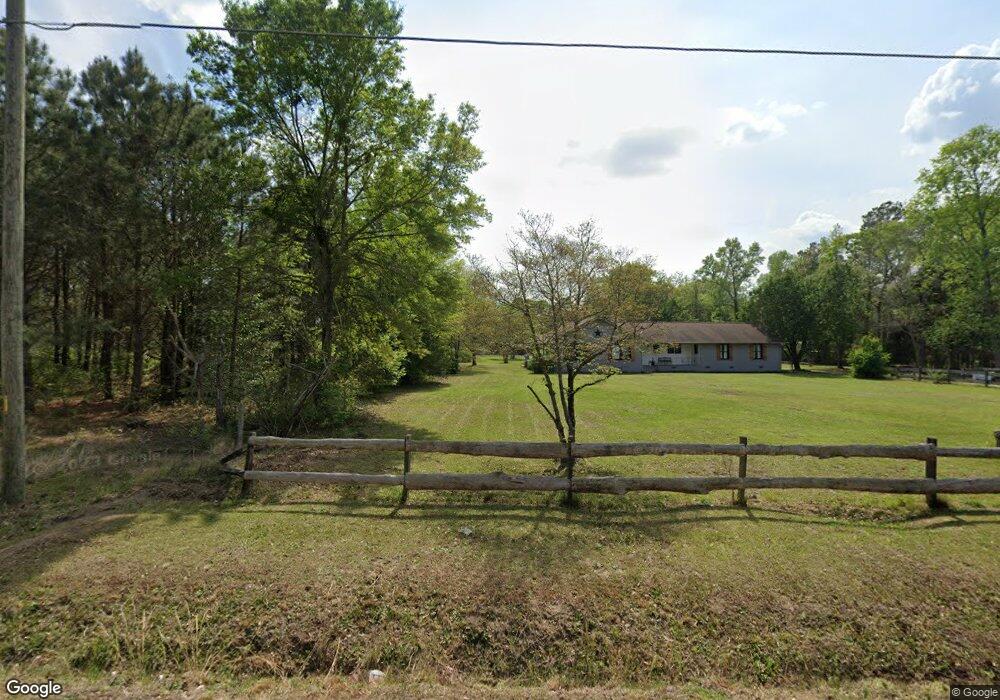
3484 A B Carter Rd Fayetteville, NC 28312
Cedar Creek NeighborhoodEstimated Value: $317,000 - $369,000
3
Beds
3
Baths
2,338
Sq Ft
$143/Sq Ft
Est. Value
About This Home
This home is located at 3484 A B Carter Rd, Fayetteville, NC 28312 and is currently estimated at $333,456, approximately $142 per square foot. 3484 A B Carter Rd is a home located in Cumberland County with nearby schools including Sunnyside Elementary School, Mac Williams Middle, and Cape Fear High School.
Ownership History
Date
Name
Owned For
Owner Type
Purchase Details
Closed on
Feb 24, 2010
Sold by
Robertson Jerald
Bought by
Anderson George S
Current Estimated Value
Home Financials for this Owner
Home Financials are based on the most recent Mortgage that was taken out on this home.
Original Mortgage
$179,273
Outstanding Balance
$118,470
Interest Rate
5%
Mortgage Type
VA
Estimated Equity
$214,986
Create a Home Valuation Report for This Property
The Home Valuation Report is an in-depth analysis detailing your home's value as well as a comparison with similar homes in the area
Home Values in the Area
Average Home Value in this Area
Purchase History
| Date | Buyer | Sale Price | Title Company |
|---|---|---|---|
| Anderson George S | $176,000 | -- |
Source: Public Records
Mortgage History
| Date | Status | Borrower | Loan Amount |
|---|---|---|---|
| Open | Anderson George S | $179,273 |
Source: Public Records
Tax History Compared to Growth
Tax History
| Year | Tax Paid | Tax Assessment Tax Assessment Total Assessment is a certain percentage of the fair market value that is determined by local assessors to be the total taxable value of land and additions on the property. | Land | Improvement |
|---|---|---|---|---|
| 2024 | $2,364 | $205,170 | $37,812 | $167,358 |
| 2023 | $2,364 | $205,170 | $37,812 | $167,358 |
| 2022 | $2,290 | $205,170 | $37,812 | $167,358 |
| 2021 | $2,290 | $205,170 | $37,812 | $167,358 |
| 2019 | $2,290 | $223,600 | $37,812 | $185,788 |
| 2018 | $2,206 | $223,600 | $37,812 | $185,788 |
| 2017 | $2,206 | $223,600 | $37,812 | $185,788 |
| 2016 | $1,770 | $190,800 | $37,108 | $153,692 |
| 2015 | $1,770 | $190,800 | $37,108 | $153,692 |
| 2014 | $1,770 | $190,800 | $37,108 | $153,692 |
Source: Public Records
Map
Nearby Homes
- 1645 Percheron Path Unit (Lot 54)
- 1639 Percheron Path Unit (Lot 53)
- 1633 Percheron Path
- 1615 Percheron Path Unit (Lot 50)
- 1606 Percheron Path
- 3224 Peruvian Ct
- 1607 Percheron Path Unit (Lot 49)
- 3212 Peruvian Ct Unit (Lot 5)
- 1553 Percheron Path
- 3211 Peruvian Ct
- 1547 Percheron Path Unit (Lot 46)
- 1372 Halibut St
- 1536 Percheron Path
- 1522 Percheron Path
- 1366 Halibut St Unit 13
- 1366 Halibut St
- 1365 Halibut St
- 1515 Percheron Path
- 1357 Halibut St Unit 21
- 1357 Halibut St
- 3500 A B Carter Rd
- 3464 A B Carter Rd
- 3495 A B Carter Rd
- 3520 A B Carter Rd
- 3509 A B Carter Rd
- 3485 A B Carter Rd
- 3516 A B Carter Rd
- 3537 A B Carter Rd
- 3431 A B Carter Rd
- 3508 A B Carter Rd
- 3467 A B Carter Rd
- 3543 A B Carter Rd
- 3549 A B Carter Rd
- 3396 A B Carter Rd
- 3512 A B Carter Rd
- 3569 Peaceful Farm Dr
- 3605 A B Carter Rd
- 3350 A B Carter Rd
- 3450 Peaceful Farm Dr
- 3534 A B Carter Rd