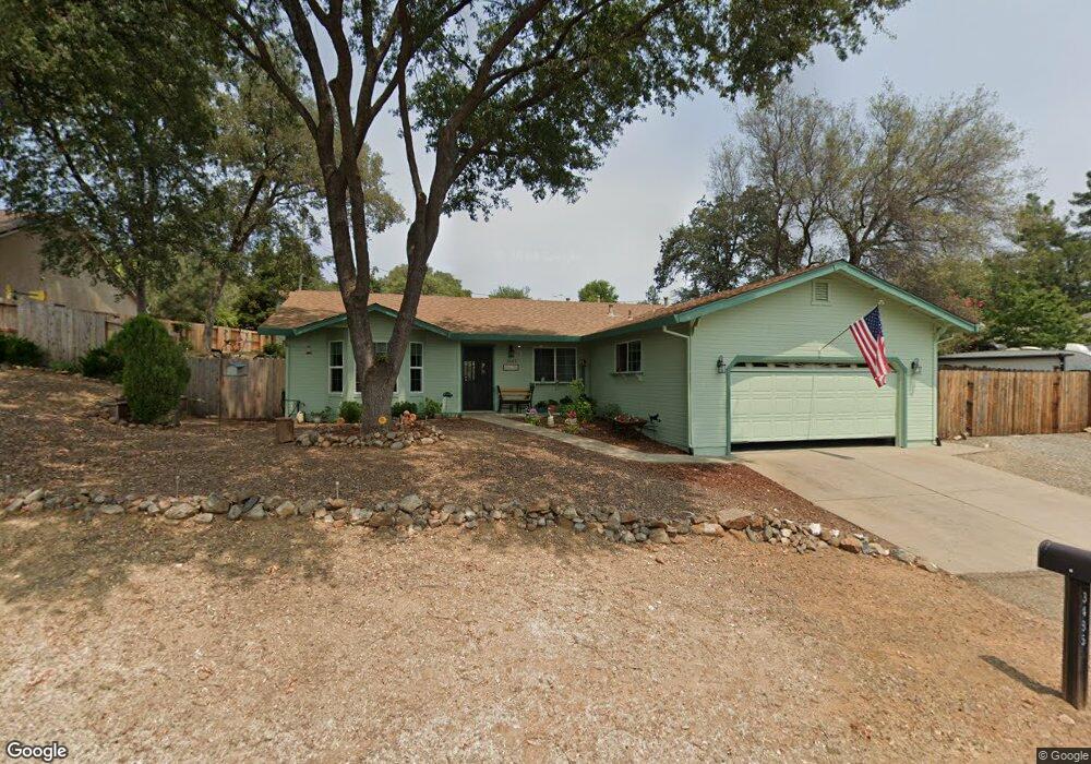
3485 Dunbar Rd Rescue, CA 95672
Estimated Value: $449,000 - $632,000
3
Beds
2
Baths
1,668
Sq Ft
$318/Sq Ft
Est. Value
About This Home
This home is located at 3485 Dunbar Rd, Rescue, CA 95672 and is currently estimated at $530,494, approximately $318 per square foot. 3485 Dunbar Rd is a home located in El Dorado County with nearby schools including Rescue Elementary School, Pleasant Grove Middle School, and Ponderosa High School.
Ownership History
Date
Name
Owned For
Owner Type
Purchase Details
Closed on
Dec 17, 2003
Sold by
Duncan Vernon E and Duncan Janet L
Bought by
Duncan Vernon E and Duncan Janet L
Current Estimated Value
Purchase Details
Closed on
Jul 25, 1994
Sold by
Barton Robert W and Barton Holly
Bought by
Duncan Vernon E and Duncan Janet L
Home Financials for this Owner
Home Financials are based on the most recent Mortgage that was taken out on this home.
Original Mortgage
$23,500
Interest Rate
8.38%
Mortgage Type
Seller Take Back
Create a Home Valuation Report for This Property
The Home Valuation Report is an in-depth analysis detailing your home's value as well as a comparison with similar homes in the area
Home Values in the Area
Average Home Value in this Area
Purchase History
| Date | Buyer | Sale Price | Title Company |
|---|---|---|---|
| Duncan Vernon E | -- | -- | |
| Duncan Vernon E | $48,500 | Placer Title Company |
Source: Public Records
Mortgage History
| Date | Status | Borrower | Loan Amount |
|---|---|---|---|
| Closed | Duncan Vernon E | $23,500 |
Source: Public Records
Tax History Compared to Growth
Tax History
| Year | Tax Paid | Tax Assessment Tax Assessment Total Assessment is a certain percentage of the fair market value that is determined by local assessors to be the total taxable value of land and additions on the property. | Land | Improvement |
|---|---|---|---|---|
| 2025 | $2,802 | $267,943 | $83,070 | $184,873 |
| 2024 | $2,802 | $262,691 | $81,442 | $181,249 |
| 2023 | $2,751 | $257,542 | $79,846 | $177,696 |
| 2022 | $2,713 | $252,493 | $78,281 | $174,212 |
| 2021 | $2,680 | $247,544 | $76,747 | $170,797 |
| 2020 | $2,643 | $245,007 | $75,961 | $169,046 |
| 2019 | $2,597 | $240,204 | $74,472 | $165,732 |
| 2018 | $2,524 | $235,495 | $73,012 | $162,483 |
| 2017 | $2,475 | $230,879 | $71,581 | $159,298 |
| 2016 | $2,449 | $226,353 | $70,178 | $156,175 |
| 2015 | $2,405 | $222,955 | $69,125 | $153,830 |
| 2014 | $2,364 | $218,590 | $67,772 | $150,818 |
Source: Public Records
Map
Nearby Homes
- 3058 Royce Dr
- 2962 Windsor Ct
- 2401 Cold Harbor Way
- 2681 Cameron Park Dr Unit 91
- 2681 Cameron Park Dr Unit 145
- 2681 Cameron Park Dr Unit 48
- 2681 Cameron Park Dr Unit 47
- 2573 Chesapeake Bay Cir
- 2537 Chesapeake Bay Cir
- 3363 Cimmarron Rd
- 0 La Crescenta Dr Unit 225010571
- 3207 Aquamarine Ct
- 3281 La Canada Dr
- 3394 La Canada Dr
- 3435 La Cienega Way
- 3300 Paiute Ct
- 2784 Cactus Ct
- 2672 Cambridge Rd
- 4266 Fremonts Loop
- 3406 Bristol Ct
- 3479 Dunbar Rd
- 2562 Starbuck Rd
- 3501 Dunbar Rd
- 3502 Royce Ct
- 3504 Royce Ct
- 3484 Dunbar Rd
- 3471 Dunbar Rd
- 3490 Dunbar Rd
- 3476 Dunbar Rd
- 3500 Royce Ct
- 3468 Dunbar Rd
- 3461 Dunbar Rd
- 2575 Starbuck Rd
- 2567 Starbuck Rd
- 3097 Royce Dr
- 2581 Starbuck Rd
- 2587 Hastings Dr
- 2561 Starbuck Rd
- 2585 Starbuck Rd
- 2581 Hastings Dr