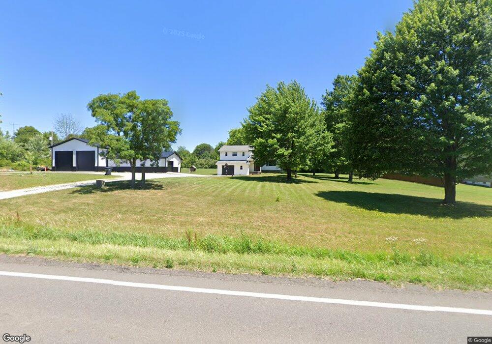
3488 State Route 183 Rootstown, OH 44272
Estimated Value: $210,000 - $344,823
3
Beds
3
Baths
2,154
Sq Ft
$132/Sq Ft
Est. Value
About This Home
This home is located at 3488 State Route 183, Rootstown, OH 44272 and is currently estimated at $283,456, approximately $131 per square foot. 3488 State Route 183 is a home located in Portage County with nearby schools including Southeast High School.
Ownership History
Date
Name
Owned For
Owner Type
Purchase Details
Closed on
Oct 5, 2011
Sold by
Diehl Hannah J and Diehl Christopher
Bought by
Steele Jonathon C and Austin Ashley N
Current Estimated Value
Home Financials for this Owner
Home Financials are based on the most recent Mortgage that was taken out on this home.
Original Mortgage
$121,831
Outstanding Balance
$81,858
Interest Rate
4.25%
Mortgage Type
FHA
Estimated Equity
$201,598
Purchase Details
Closed on
Mar 24, 2009
Sold by
Fannie Mae
Bought by
Barthels Hannah J
Home Financials for this Owner
Home Financials are based on the most recent Mortgage that was taken out on this home.
Original Mortgage
$83,825
Interest Rate
5.05%
Mortgage Type
Purchase Money Mortgage
Purchase Details
Closed on
Dec 12, 2008
Sold by
Roy James E
Bought by
Federal National Mortgage Association
Purchase Details
Closed on
Feb 24, 1994
Bought by
Roy James E and Roy Judith A
Create a Home Valuation Report for This Property
The Home Valuation Report is an in-depth analysis detailing your home's value as well as a comparison with similar homes in the area
Purchase History
| Date | Buyer | Sale Price | Title Company |
|---|---|---|---|
| Steele Jonathon C | $125,000 | Titleone | |
| Barthels Hannah J | $65,000 | Accutitle Agency Inc | |
| Federal National Mortgage Association | $82,000 | None Available | |
| Roy James E | $89,000 | -- |
Source: Public Records
Mortgage History
| Date | Status | Borrower | Loan Amount |
|---|---|---|---|
| Open | Steele Jonathon C | $121,831 | |
| Closed | Barthels Hannah J | $83,825 |
Source: Public Records
Tax History
| Year | Tax Paid | Tax Assessment Tax Assessment Total Assessment is a certain percentage of the fair market value that is determined by local assessors to be the total taxable value of land and additions on the property. | Land | Improvement |
|---|---|---|---|---|
| 2025 | $3,915 | $105,320 | $19,670 | $85,650 |
| 2024 | $3,823 | $105,320 | $19,670 | $85,650 |
| 2023 | $2,746 | $67,800 | $17,010 | $50,790 |
| 2022 | $2,848 | $67,800 | $17,010 | $50,790 |
| 2021 | $2,872 | $67,800 | $17,010 | $50,790 |
| 2020 | $2,595 | $58,870 | $15,470 | $43,400 |
| 2019 | $2,602 | $58,870 | $15,470 | $43,400 |
| 2018 | $2,449 | $52,220 | $14,980 | $37,240 |
| 2017 | $2,449 | $52,220 | $14,980 | $37,240 |
| 2016 | $2,440 | $52,220 | $14,980 | $37,240 |
| 2015 | $2,336 | $52,220 | $14,980 | $37,240 |
| 2014 | $2,296 | $50,120 | $14,980 | $35,140 |
| 2013 | $2,237 | $50,120 | $14,980 | $35,140 |
Source: Public Records
Map
Nearby Homes
- 6747 Giddings Rd
- 3798 State Route 183
- 3545 Porter Rd
- 2639 Ohio 183
- 4087 Industry
- 0 Tallmadge Rd Unit 5189301
- 0 Tallmadge Rd Unit 5189314
- 8464 & 8446 Tallmadge Rd
- 8492 & 8476 Tallmadge Rd
- 941 Porter Rd
- 4200 Hattrick Rd
- 1491 Whittlesey Ave
- 2434 Taft Ave
- 4958 Bassett Rd
- 1454 Hillcrest Dr
- 1314 Bank St
- 0 Waterloo Rd Unit 5191339
- 1352 Hillcrest Dr
- 0 Yale Rd Unit 5190725
- 0 John Thomas
- 3506 State Route 183
- 3487 State Route 183
- 3450 State Route 183
- 3430 Ohio 183
- 3430 State Route 183
- 3525 State Route 183
- 3546 State Route 183
- 3410 State Route 183
- 3559 State Route 183
- 3571 Ohio 183
- 321917 St Rt 183
- 6803 Giddings Rd
- 6890 Giddings Rd
- 6904 Giddings Rd
- 1600 Giddings Rd
- 9 Giddings Rd
- 10 Giddings Rd
- 0 Giddings Rd
- 3 Giddings Rd
- 4 Giddings Rd
Your Personal Tour Guide
Ask me questions while you tour the home.