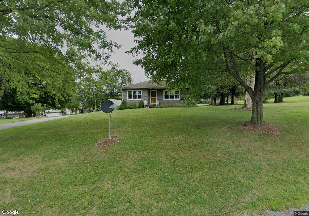
349 Cove Lane Rd Roaring Spring, PA 16673
Estimated Value: $152,000 - $183,477
2
Beds
1
Bath
1,236
Sq Ft
$137/Sq Ft
Est. Value
About This Home
This home is located at 349 Cove Lane Rd, Roaring Spring, PA 16673 and is currently estimated at $169,619, approximately $137 per square foot. 349 Cove Lane Rd is a home located in Blair County with nearby schools including Spring Cove Elementary School, Spring Cove Middle School, and Central High School.
Ownership History
Date
Name
Owned For
Owner Type
Purchase Details
Closed on
Jul 27, 2022
Sold by
Burket Jared D
Bought by
Ef Smith Inc
Current Estimated Value
Purchase Details
Closed on
Jan 7, 2022
Sold by
Mock Amber D
Bought by
Mock Amber D and Burket Jared D
Home Financials for this Owner
Home Financials are based on the most recent Mortgage that was taken out on this home.
Original Mortgage
$110,000
Interest Rate
3.05%
Mortgage Type
New Conventional
Purchase Details
Closed on
Sep 30, 2015
Sold by
Moyer Clifford C
Bought by
Mock Amber D
Home Financials for this Owner
Home Financials are based on the most recent Mortgage that was taken out on this home.
Original Mortgage
$116,400
Interest Rate
3.95%
Mortgage Type
New Conventional
Purchase Details
Closed on
Aug 24, 2011
Sold by
Moyer Clifford C and Moyer Deborah L
Bought by
Moyer Clifford C
Create a Home Valuation Report for This Property
The Home Valuation Report is an in-depth analysis detailing your home's value as well as a comparison with similar homes in the area
Home Values in the Area
Average Home Value in this Area
Purchase History
| Date | Buyer | Sale Price | Title Company |
|---|---|---|---|
| Ef Smith Inc | $170,000 | Haberstroh Sullivan & George L | |
| Mock Amber D | -- | Colonial Title Llc | |
| Mock Amber D | $120,000 | None Available | |
| Moyer Clifford C | -- | None Available |
Source: Public Records
Mortgage History
| Date | Status | Borrower | Loan Amount |
|---|---|---|---|
| Previous Owner | Mock Amber D | $110,000 | |
| Previous Owner | Mock Amber D | $116,400 |
Source: Public Records
Tax History Compared to Growth
Tax History
| Year | Tax Paid | Tax Assessment Tax Assessment Total Assessment is a certain percentage of the fair market value that is determined by local assessors to be the total taxable value of land and additions on the property. | Land | Improvement |
|---|---|---|---|---|
| 2025 | $2,067 | $120,600 | $36,000 | $84,600 |
| 2024 | $1,942 | $120,600 | $36,000 | $84,600 |
| 2023 | $1,891 | $120,600 | $36,000 | $84,600 |
| 2022 | $1,864 | $120,600 | $36,000 | $84,600 |
| 2021 | $1,864 | $120,600 | $36,000 | $84,600 |
| 2020 | $1,861 | $120,600 | $36,000 | $84,600 |
| 2019 | $1,805 | $120,600 | $36,000 | $84,600 |
| 2018 | $1,763 | $120,600 | $36,000 | $84,600 |
| 2017 | $14,863 | $120,600 | $36,000 | $84,600 |
| 2016 | $407 | $11,250 | $450 | $10,800 |
| 2015 | $407 | $11,250 | $450 | $10,800 |
| 2014 | $407 | $11,250 | $450 | $10,800 |
Source: Public Records
Map
Nearby Homes
- 817 New St
- 717 New St
- 932 Beech St
- 1194 Spang St Unit ext.
- 304 Poplar St
- 234 Cherry St
- 452 Shawnee Dr
- 1310 Cove Lane Rd
- 476 Wilbur Forest Dr
- 1066 Oak Terrace Dr
- 1246 Oak Terrace Dr
- 1105 Oak Terrace Dr
- 15033 Dunnings Hwy
- 563 Lock Mountain Rd
- 304 W Penn St
- . Heverly Ave
- 331 N Nicodemus St
- 0 Dunnings Hwy Unit 63202
- 682 Piney Creek Rd
- 106 Arden St
- 389 Cove Lane Rd
- 329 Cove Lane Rd
- 7550 Woodbury Pike
- 332 Woodbury Pike
- 908 Walnut St
- 908 Walnut St
- 1060 E Main St
- 900 Spruce St
- 1048 E Main St
- 1054 E Main St
- 7566 Woodbury Pike
- 1042 E Main St
- 901 Spruce St
- 403 Pennsylvania 36
- Rt. 36 Woodbury Pike
- 0 Pennsylvania 36
- Rt 36 Woodbury Pike
- 0 Woodbury Pike
- 1074 E Main St
- 1036 E Main St