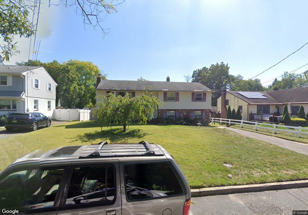
349 E Stafford Ave Laurel Springs, NJ 08021
Estimated Value: $329,659 - $385,000
--
Bed
--
Bath
1,962
Sq Ft
$180/Sq Ft
Est. Value
About This Home
This home is located at 349 E Stafford Ave, Laurel Springs, NJ 08021 and is currently estimated at $353,165, approximately $180 per square foot. 349 E Stafford Ave is a home located in Camden County with nearby schools including Laurel Springs School, Saint John Paul II Regional School, and South Jersey Sudbury School.
Ownership History
Date
Name
Owned For
Owner Type
Purchase Details
Closed on
Mar 29, 2000
Sold by
Bowers Kathleen M
Bought by
Mcdonald Timothy A and Schmid Katrina L
Current Estimated Value
Home Financials for this Owner
Home Financials are based on the most recent Mortgage that was taken out on this home.
Original Mortgage
$108,900
Outstanding Balance
$37,765
Interest Rate
8.4%
Estimated Equity
$315,400
Purchase Details
Closed on
Apr 10, 1997
Sold by
Miller Edward F
Bought by
Bowers Kathleen M
Home Financials for this Owner
Home Financials are based on the most recent Mortgage that was taken out on this home.
Original Mortgage
$70,000
Interest Rate
7.88%
Create a Home Valuation Report for This Property
The Home Valuation Report is an in-depth analysis detailing your home's value as well as a comparison with similar homes in the area
Home Values in the Area
Average Home Value in this Area
Purchase History
| Date | Buyer | Sale Price | Title Company |
|---|---|---|---|
| Mcdonald Timothy A | $123,500 | -- | |
| Bowers Kathleen M | $100,000 | -- |
Source: Public Records
Mortgage History
| Date | Status | Borrower | Loan Amount |
|---|---|---|---|
| Open | Mcdonald Timothy A | $108,900 | |
| Previous Owner | Bowers Kathleen M | $70,000 |
Source: Public Records
Tax History Compared to Growth
Tax History
| Year | Tax Paid | Tax Assessment Tax Assessment Total Assessment is a certain percentage of the fair market value that is determined by local assessors to be the total taxable value of land and additions on the property. | Land | Improvement |
|---|---|---|---|---|
| 2025 | $10,121 | $181,900 | $39,000 | $142,900 |
| 2024 | $9,808 | $181,900 | $39,000 | $142,900 |
| 2023 | $9,808 | $181,900 | $39,000 | $142,900 |
| 2022 | $9,652 | $181,900 | $39,000 | $142,900 |
| 2021 | $9,562 | $181,900 | $39,000 | $142,900 |
| 2020 | $9,448 | $181,900 | $39,000 | $142,900 |
| 2019 | $955 | $181,900 | $39,000 | $142,900 |
| 2018 | $9,273 | $181,900 | $39,000 | $142,900 |
| 2017 | $8,997 | $181,900 | $39,000 | $142,900 |
| 2016 | $8,987 | $119,700 | $29,900 | $89,800 |
| 2015 | $8,780 | $119,700 | $29,900 | $89,800 |
| 2014 | $8,645 | $119,700 | $29,900 | $89,800 |
Source: Public Records
Map
Nearby Homes
- 104 W Park Ave
- 427 W Maple Ave
- 135 Madison Ave
- 109 State Ave
- 25 State Ave
- 205 State Ave
- 202 Broadway
- 118 1st Ave
- 135 Mount Vernon Ave
- 513 N White Horse Pike
- 335 2nd Ave
- 5 S White Horse Pike
- 514 Park Ave
- 323 3rd Ave
- 13 Hidden Dr
- 42 Trowbridge Ln Unit DD
- 503 Laurel Rd
- 450 Hawthorne St
- 605 4th Ave
- 531 6th Ave
- 345 E Stafford Ave
- 353 E Stafford Ave
- 341 E Stafford Ave
- 326 E Atlantic Ave
- 337 E Stafford Ave
- 106 Columbia Ave
- 112 Columbia Ave
- 54 Columbia Ave
- 333 E Stafford Ave
- 118 Columbia Ave
- 50 Columbia Ave
- 100 Columbia Ave
- 352 E Stafford Ave
- 124 Columbia Ave
- 329 E Stafford Ave
- 360 E Stafford Ave
- 46 Columbia Ave
- 342 E Stafford Ave
- 362 E Stafford Ave
- 130 Columbia Ave