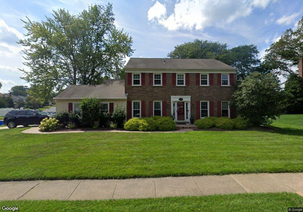
349 Flint Rd Langhorne, PA 19047
Estimated Value: $720,692 - $779,000
4
Beds
3
Baths
2,602
Sq Ft
$285/Sq Ft
Est. Value
About This Home
This home is located at 349 Flint Rd, Langhorne, PA 19047 and is currently estimated at $741,673, approximately $285 per square foot. 349 Flint Rd is a home located in Bucks County with nearby schools including Pearl S. Buck Elementary School, Maple Point Middle School, and Neshaminy High School.
Ownership History
Date
Name
Owned For
Owner Type
Purchase Details
Closed on
Oct 25, 2004
Sold by
Laliotes John S and Laliotes Ann B
Bought by
Bressler James and Bressler Allison
Current Estimated Value
Home Financials for this Owner
Home Financials are based on the most recent Mortgage that was taken out on this home.
Original Mortgage
$332,800
Outstanding Balance
$166,299
Interest Rate
5.8%
Mortgage Type
Fannie Mae Freddie Mac
Estimated Equity
$575,374
Purchase Details
Closed on
Dec 20, 1990
Bought by
Laliotes John S and Laliotes Ann B
Create a Home Valuation Report for This Property
The Home Valuation Report is an in-depth analysis detailing your home's value as well as a comparison with similar homes in the area
Home Values in the Area
Average Home Value in this Area
Purchase History
| Date | Buyer | Sale Price | Title Company |
|---|---|---|---|
| Bressler James | $416,000 | -- | |
| Laliotes John S | $230,000 | -- |
Source: Public Records
Mortgage History
| Date | Status | Borrower | Loan Amount |
|---|---|---|---|
| Open | Bressler James | $332,800 |
Source: Public Records
Tax History
| Year | Tax Paid | Tax Assessment Tax Assessment Total Assessment is a certain percentage of the fair market value that is determined by local assessors to be the total taxable value of land and additions on the property. | Land | Improvement |
|---|---|---|---|---|
| 2025 | $9,444 | $43,380 | $6,880 | $36,500 |
| 2024 | $9,444 | $43,380 | $6,880 | $36,500 |
| 2023 | $9,294 | $43,380 | $6,880 | $36,500 |
| 2022 | $9,050 | $43,380 | $6,880 | $36,500 |
| 2021 | $8,845 | $42,400 | $6,880 | $35,520 |
| 2020 | $8,739 | $42,400 | $6,880 | $35,520 |
| 2019 | $8,544 | $42,400 | $6,880 | $35,520 |
| 2018 | $8,388 | $42,400 | $6,880 | $35,520 |
| 2017 | $8,173 | $42,400 | $6,880 | $35,520 |
| 2016 | $8,173 | $42,400 | $6,880 | $35,520 |
| 2015 | $8,363 | $42,400 | $6,880 | $35,520 |
| 2014 | $8,363 | $42,400 | $6,880 | $35,520 |
Source: Public Records
Map
Nearby Homes
- 302 Mallard Ln
- 476 Gladstone Rd
- 320 Laurel Oaks Dr
- 1004 Waterford Rd
- 11104 Cornerstone Dr Unit 23
- 559 Palmer Farm Dr
- 13202 Cornerstone Dr Unit 30
- 14304 Cornerstone Dr Unit 169
- 548 Palmer Farm Dr
- 475 Franklin Cir
- 2406 Lynbrooke Dr Unit 174
- 2307 Lynbrooke Dr Unit 102
- 2607 Lynbrooke Dr
- 2203 Waterford Rd Unit 86
- 8504 Spruce Mill Dr Unit 707
- 415 Chestnut Ct
- 4202 Waltham Ct Unit 270
- 7703 Spruce Mill Dr
- 235 Argyle Rd
- 770 Woodbourne Rd
Your Personal Tour Guide
Ask me questions while you tour the home.