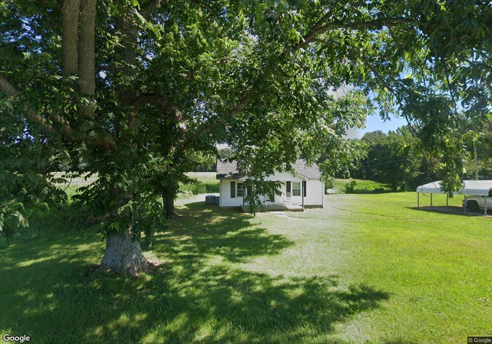
349 Foster Rd Gleason, TN 38229
Estimated Value: $38,000 - $109,000
Studio
1
Bath
780
Sq Ft
$89/Sq Ft
Est. Value
About This Home
This home is located at 349 Foster Rd, Gleason, TN 38229 and is currently estimated at $69,139, approximately $88 per square foot. 349 Foster Rd is a home located in Weakley County.
Ownership History
Date
Name
Owned For
Owner Type
Purchase Details
Closed on
Jun 13, 2025
Sold by
Radford Clint A
Bought by
Radford Corey and Radford Kaylene
Current Estimated Value
Home Financials for this Owner
Home Financials are based on the most recent Mortgage that was taken out on this home.
Original Mortgage
$36,326
Outstanding Balance
$36,326
Interest Rate
7.25%
Mortgage Type
New Conventional
Estimated Equity
$32,813
Purchase Details
Closed on
Apr 27, 2018
Sold by
Radford Autumn E
Bought by
Radford Clint A
Purchase Details
Closed on
Jan 14, 2012
Sold by
Radford Scotty
Bought by
Radford Clint A and Radford Autumn E
Home Financials for this Owner
Home Financials are based on the most recent Mortgage that was taken out on this home.
Original Mortgage
$43,000
Interest Rate
4%
Mortgage Type
Commercial
Purchase Details
Closed on
Apr 30, 1988
Bought by
Radford Scotty Sandra
Create a Home Valuation Report for This Property
The Home Valuation Report is an in-depth analysis detailing your home's value as well as a comparison with similar homes in the area
Purchase History
| Date | Buyer | Sale Price | Title Company |
|---|---|---|---|
| Radford Corey | $35,000 | None Listed On Document | |
| Radford Clint A | -- | None Available | |
| Radford Clint A | $42,000 | -- | |
| Radford Scotty Sandra | $23,000 | -- |
Source: Public Records
Mortgage History
| Date | Status | Borrower | Loan Amount |
|---|---|---|---|
| Open | Radford Corey | $36,326 | |
| Previous Owner | Radford Clint A | $43,000 |
Source: Public Records
Tax History Compared to Growth
Tax History
| Year | Tax Paid | Tax Assessment Tax Assessment Total Assessment is a certain percentage of the fair market value that is determined by local assessors to be the total taxable value of land and additions on the property. | Land | Improvement |
|---|---|---|---|---|
| 2025 | $195 | $14,200 | $0 | $0 |
| 2024 | $195 | $14,200 | $2,375 | $11,825 |
| 2023 | $195 | $14,200 | $2,375 | $11,825 |
| 2022 | $208 | $10,550 | $1,575 | $8,975 |
| 2021 | $208 | $10,550 | $1,575 | $8,975 |
| 2020 | $208 | $10,550 | $1,575 | $8,975 |
| 2019 | $208 | $10,550 | $1,575 | $8,975 |
| 2018 | $208 | $10,550 | $1,575 | $8,975 |
| 2017 | $219 | $10,275 | $1,350 | $8,925 |
| 2016 | $219 | $10,275 | $0 | $0 |
| 2015 | $219 | $10,270 | $0 | $0 |
| 2014 | $219 | $10,270 | $0 | $0 |
Source: Public Records
Map
Nearby Homes
- 45 Highway 140 W
- 2175 Highway 140 W
- 567 Rawls Rd
- 500 Ross Rd
- 3515 Tennessee 140
- 3515 Highway 140 S
- 3515 Highway 140 W
- 1003 Shuff Rd
- 0 Ables Rd
- 0 Jewell Store Rd Unit 2504970
- 0 Jewell Store Rd Unit 134900
- 0 Tennessee 22
- 1305 Banks Levey Rd
- 3723 Tennessee 22
- 5605 Tennessee 140
- 2345 E Grove Rd
- 305 Phelps St
- 5605 Hwy 140 W
- 703 N Cedar St
- 505 N Cedar St
- 277 Foster Rd
- 458 Foster Rd
- 5217 Paris Hwy
- 5104 Paris Hwy 54
- 5104 Paris Hwy Unit 54
- 4404 Tennessee 190
- 4404 Highway 190
- 5307 Paris Hwy Unit 54
- 4306 Gleason Como Rd Unit 4306
- 4207 Gleason Como Rd
- 4207 Gleason Como Rd Unit 4207
- 162 Jennifers Ln
- 162 Jennifers Ln
- 441 Woodard Rd
- 572 Woodard Rd
- 133 Woodard Rd
- 650 Woodard Rd
- 5025 Paris Hwy Unit 54
- 4479 Highway 190
- 4355 Gleason Como Rd