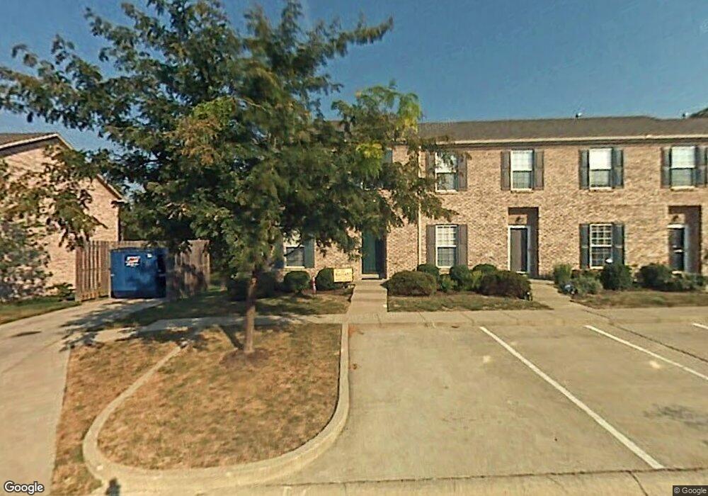
349 Furlong View Ct Lexington, KY 40511
Masterson Station NeighborhoodEstimated Value: $209,000 - $355,893
3
Beds
3
Baths
1,327
Sq Ft
$194/Sq Ft
Est. Value
About This Home
This home is located at 349 Furlong View Ct, Lexington, KY 40511 and is currently estimated at $257,223, approximately $193 per square foot. 349 Furlong View Ct is a home located in Fayette County with nearby schools including Sandersville Elementary School, Leestown Middle School, and Bryan Station High School.
Ownership History
Date
Name
Owned For
Owner Type
Purchase Details
Closed on
Jun 22, 2009
Sold by
Housing/Urban Dev & Sec
Bought by
Shell David Alan
Current Estimated Value
Home Financials for this Owner
Home Financials are based on the most recent Mortgage that was taken out on this home.
Original Mortgage
$91,473
Interest Rate
4.77%
Mortgage Type
Unknown
Purchase Details
Closed on
Mar 30, 2009
Sold by
Darby Sabra D
Bought by
Housing/Urban Dev & Sec
Create a Home Valuation Report for This Property
The Home Valuation Report is an in-depth analysis detailing your home's value as well as a comparison with similar homes in the area
Home Values in the Area
Average Home Value in this Area
Purchase History
| Date | Buyer | Sale Price | Title Company |
|---|---|---|---|
| Shell David Alan | $90,000 | -- | |
| Housing/Urban Dev & Sec | $95,000 | -- |
Source: Public Records
Mortgage History
| Date | Status | Borrower | Loan Amount |
|---|---|---|---|
| Open | Housing/Urban Dev & Sec | $86,416 | |
| Closed | Housing/Urban Dev & Sec | $91,473 |
Source: Public Records
Tax History Compared to Growth
Tax History
| Year | Tax Paid | Tax Assessment Tax Assessment Total Assessment is a certain percentage of the fair market value that is determined by local assessors to be the total taxable value of land and additions on the property. | Land | Improvement |
|---|---|---|---|---|
| 2024 | $1,546 | $128,000 | $0 | $0 |
| 2023 | $1,546 | $128,000 | $0 | $0 |
| 2022 | $1,596 | $128,000 | $0 | $0 |
| 2021 | $1,216 | $97,500 | $0 | $0 |
| 2020 | $1,216 | $97,500 | $0 | $0 |
| 2019 | $1,216 | $97,500 | $0 | $0 |
| 2018 | $1,216 | $97,500 | $0 | $0 |
| 2017 | $1,092 | $92,000 | $0 | $0 |
| 2015 | $1,262 | $92,000 | $0 | $0 |
| 2014 | $1,262 | $92,000 | $0 | $0 |
| 2012 | $1,262 | $115,900 | $0 | $0 |
Source: Public Records
Map
Nearby Homes
- 349 Silver Creek Way
- 297 Lucille Dr
- 293 Lucille Dr
- 276 Valley Brook Dr
- 2720 Mission Hills Dr
- 2766 Sandersville Rd
- 2625 Mable Ln
- 2745 Michelle Park
- 2705 Michelle Park
- 2720 Michelle Park
- 306 Alex Ln
- 2617 Buck Ln
- 188 Lucille Dr
- 2528 Maggie Cove
- 261 Ferndale Pass
- 2649 Michelle Park
- 559 Estrella Dr
- 2805 Morsen Point
- 601 Hopewell Park
- 624 Kenova Trace
- 351 Furlong View Ct
- 347 Furlong View Ct
- 355 Furlong View Ct
- 345 Furlong View Ct
- 357 Furlong View Ct
- 343 Furlong View Ct
- 359 Furlong View Ct
- 359 Furlong Ct
- 341 Furlong View Ct
- 348 Furlong View Ct
- 350 Furlong View Ct
- 352 Furlong View Ct
- 354 Furlong View Ct
- 361 Furlong View Ct
- 339 Furlong View Ct
- 346 Furlong View Ct
- 356 Furlong View Ct
- 363 Furlong View Ct
- 344 Furlong View Ct
- 337 Furlong View Ct