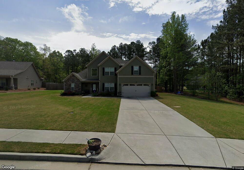
35 Arbor Ridge Unit 11 Bethlehem, GA 30620
Estimated Value: $365,000 - $423,000
4
Beds
3
Baths
2,314
Sq Ft
$171/Sq Ft
Est. Value
About This Home
This home is located at 35 Arbor Ridge Unit 11, Bethlehem, GA 30620 and is currently estimated at $394,640, approximately $170 per square foot. 35 Arbor Ridge Unit 11 is a home located in Barrow County with nearby schools including Kennedy Elementary School, Westside Middle School, and Apalachee High School.
Ownership History
Date
Name
Owned For
Owner Type
Purchase Details
Closed on
May 31, 2017
Sold by
Reynolds Realty Const Llc
Bought by
Muldrow Dion Andre and Muldrow Rachel Marie
Current Estimated Value
Home Financials for this Owner
Home Financials are based on the most recent Mortgage that was taken out on this home.
Original Mortgage
$200,206
Outstanding Balance
$165,841
Interest Rate
3.87%
Mortgage Type
FHA
Estimated Equity
$228,799
Purchase Details
Closed on
Mar 7, 2017
Sold by
Gowall Construction Llc
Bought by
Reynolds Realty Construction L
Home Financials for this Owner
Home Financials are based on the most recent Mortgage that was taken out on this home.
Original Mortgage
$146,250
Interest Rate
4.17%
Mortgage Type
Purchase Money Mortgage
Create a Home Valuation Report for This Property
The Home Valuation Report is an in-depth analysis detailing your home's value as well as a comparison with similar homes in the area
Home Values in the Area
Average Home Value in this Area
Purchase History
| Date | Buyer | Sale Price | Title Company |
|---|---|---|---|
| Muldrow Dion Andre | $203,900 | -- | |
| Reynolds Realty Construction L | $35,000 | -- |
Source: Public Records
Mortgage History
| Date | Status | Borrower | Loan Amount |
|---|---|---|---|
| Open | Muldrow Dion Andre | $200,206 | |
| Previous Owner | Reynolds Realty Construction L | $146,250 |
Source: Public Records
Tax History Compared to Growth
Tax History
| Year | Tax Paid | Tax Assessment Tax Assessment Total Assessment is a certain percentage of the fair market value that is determined by local assessors to be the total taxable value of land and additions on the property. | Land | Improvement |
|---|---|---|---|---|
| 2024 | $3,488 | $127,187 | $18,000 | $109,187 |
| 2023 | $3,002 | $127,187 | $18,000 | $109,187 |
| 2022 | $2,793 | $86,300 | $18,000 | $68,300 |
| 2021 | $2,901 | $86,300 | $18,000 | $68,300 |
| 2020 | $2,807 | $86,300 | $18,000 | $68,300 |
| 2019 | $2,738 | $83,067 | $18,000 | $65,067 |
| 2018 | $2,662 | $81,067 | $16,000 | $65,067 |
| 2017 | $286 | $9,600 | $9,600 | $0 |
Source: Public Records
Map
Nearby Homes
- 305 Punkin Junction Rd
- 29 Kielder Dr
- 59 Thetford Way
- 670 Loganville Hwy
- 304 Rydal Way
- 306 Rydal Way
- 297 Rydal Way
- 683 Loganville Hwy
- 176 Market St
- 236 Vision St
- 338 Rydal Way
- Cosmos Plan at Rivington Walk
- 335 Rydal Way
- 337 Rydal Way
- 339 Rydal Way
- 341 Rydal Way
- 0 Carson Wages Rd Unit 7617509
- 0 Carson Wages Rd Unit 10348307
- 0 Clarence Edwards Rd Unit 10587376
- 422 Aberdeen Way
- 51 Arbor Ridge Unit 12
- 12 Arbor Point Unit 10
- 0 Arbor Ridge Unit 16
- 65 Arbor Ridge Unit 13
- 0 Arbor Point Unit 8
- 59 Arbor Point
- 59 Arbor Point Unit 6
- 87 Arbor Ridge Unit 14
- 39 Arbor Point
- 23 Arbor Point Unit 4
- 118 Arbor Way
- 225 Arbor Way Unit 20
- 225 Arbor Way
- 79 Arbor Way Unit 3
- 0 Arbor Way Unit 8845447
- 344 Hills Point Ct
- 344 Hills Point Ct Unit /21
- 342 Hills Point Ct
- 344 Hill's Pointe Ct
- 344 Hill's Pointe Ct Unit /21