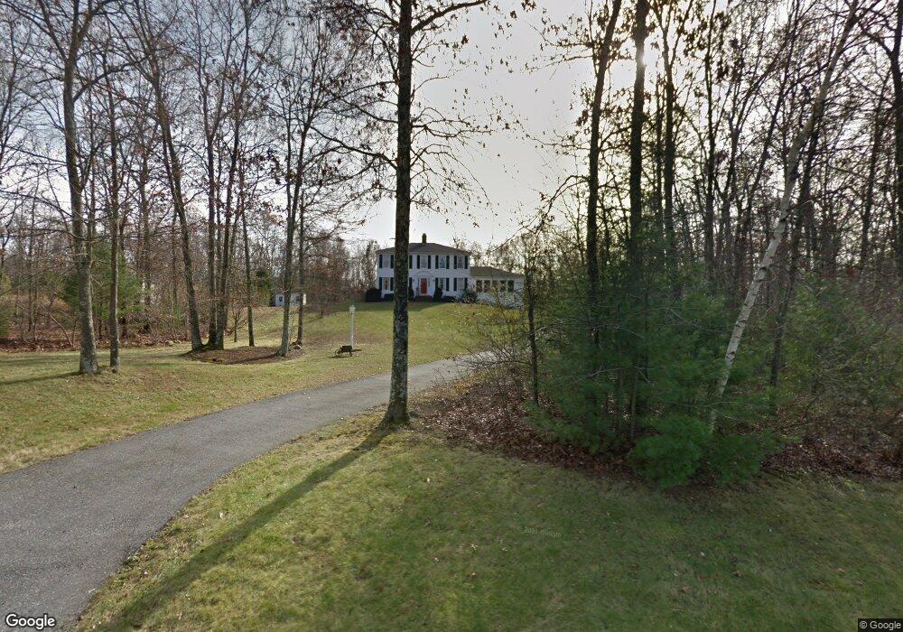
35 Benjamin Day Dr Wrentham, MA 02093
West Wrentham NeighborhoodEstimated Value: $792,784 - $1,159,000
3
Beds
3
Baths
2,448
Sq Ft
$387/Sq Ft
Est. Value
About This Home
This home is located at 35 Benjamin Day Dr, Wrentham, MA 02093 and is currently estimated at $948,446, approximately $387 per square foot. 35 Benjamin Day Dr is a home located in Norfolk County with nearby schools including Delaney Elementary School, Charles E Roderick, and Benjamin Franklin Classical Charter Public School.
Ownership History
Date
Name
Owned For
Owner Type
Purchase Details
Closed on
Jan 31, 2003
Sold by
Densmore Debra E and Desmore Gerald P
Bought by
Lempitksy Frank and Lempitksy Joanne
Current Estimated Value
Home Financials for this Owner
Home Financials are based on the most recent Mortgage that was taken out on this home.
Original Mortgage
$354,000
Outstanding Balance
$150,418
Interest Rate
6.09%
Mortgage Type
Purchase Money Mortgage
Estimated Equity
$798,028
Purchase Details
Closed on
Dec 16, 1993
Sold by
Treannie Tr Cynthia R
Bought by
Densmore Gerald P
Home Financials for this Owner
Home Financials are based on the most recent Mortgage that was taken out on this home.
Original Mortgage
$156,400
Interest Rate
7.03%
Mortgage Type
Purchase Money Mortgage
Create a Home Valuation Report for This Property
The Home Valuation Report is an in-depth analysis detailing your home's value as well as a comparison with similar homes in the area
Home Values in the Area
Average Home Value in this Area
Purchase History
| Date | Buyer | Sale Price | Title Company |
|---|---|---|---|
| Lempitksy Frank | $443,000 | -- | |
| Densmore Gerald P | $170,818 | -- |
Source: Public Records
Mortgage History
| Date | Status | Borrower | Loan Amount |
|---|---|---|---|
| Open | Lempitksy Frank | $354,000 | |
| Previous Owner | Densmore Gerald P | $100,000 | |
| Previous Owner | Densmore Gerald P | $56,812 | |
| Previous Owner | Densmore Gerald P | $156,400 |
Source: Public Records
Tax History
| Year | Tax Paid | Tax Assessment Tax Assessment Total Assessment is a certain percentage of the fair market value that is determined by local assessors to be the total taxable value of land and additions on the property. | Land | Improvement |
|---|---|---|---|---|
| 2025 | $7,676 | $662,300 | $289,100 | $373,200 |
| 2024 | $7,439 | $619,900 | $289,100 | $330,800 |
| 2023 | $7,169 | $568,100 | $263,000 | $305,100 |
| 2022 | $7,184 | $525,500 | $256,200 | $269,300 |
| 2021 | $7,412 | $526,800 | $239,500 | $287,300 |
| 2020 | $5,419 | $380,300 | $183,100 | $197,200 |
| 2019 | $5,250 | $371,800 | $183,100 | $188,700 |
| 2018 | $6,209 | $436,000 | $182,900 | $253,100 |
| 2017 | $5,794 | $406,600 | $179,400 | $227,200 |
| 2016 | $5,705 | $399,500 | $174,200 | $225,300 |
| 2015 | $5,474 | $365,400 | $167,500 | $197,900 |
| 2014 | $5,541 | $361,900 | $161,100 | $200,800 |
Source: Public Records
Map
Nearby Homes
- 9 Reagan Ave
- 10 Follett Dr
- 1620 West St
- 60 Grant Ave
- 900 Washington St Lot 2
- 1 Spring St
- 925 Washington St
- 25 Nature View Dr
- 18 Bubbling Brook Rd
- 20 Nature View Dr
- 365 W Wrentham Rd
- 172 Pine Swamp Rd
- 180 Pine Swamp Rd
- 56 Pine Swamp Rd
- 9 Brookfield Ln
- 9 Pebble Cir Unit 9
- 241 Prospect St
- 21 Palmetto Dr Unit 21
- 23 Palmetto Dr Unit 23
- 24 Palmetto Dr Unit 24
- 45 Benjamin Day Dr
- 25 Benjamin Day Dr
- 30 Benjamin Day Dr
- 55 Benjamin Day Dr
- 15 Benjamin Day Dr
- 40 Benjamin Day Dr
- 20 Benjamin Day Dr
- 3 Heaton Place
- 281 Williams St
- 275 Williams St
- 50 Benjamin Day Dr
- 7 Heaton Place
- 5 Benjamin Day Dr
- 10 Benjamin Day Dr
- 65 Benjamin Day Dr
- 6 Heaton Place
- 95 Jefferson Rd
- 285 Williams St
- 93 Jefferson Rd
- 97 Jefferson Rd
Your Personal Tour Guide
Ask me questions while you tour the home.