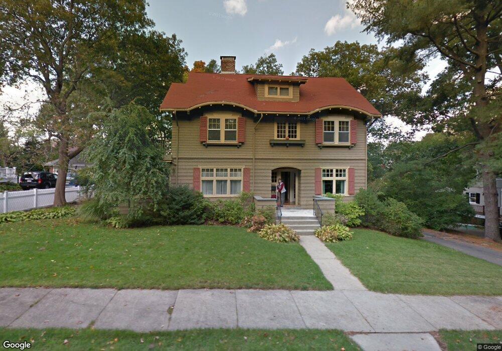
35 Brae Burn Rd Auburndale, MA 02466
Auburndale NeighborhoodEstimated Value: $1,887,000 - $2,353,000
7
Beds
4
Baths
2,616
Sq Ft
$807/Sq Ft
Est. Value
About This Home
This home is located at 35 Brae Burn Rd, Auburndale, MA 02466 and is currently estimated at $2,111,909, approximately $807 per square foot. 35 Brae Burn Rd is a home located in Middlesex County with nearby schools including Williams Elementary School, Peirce Elementary School, and F.A. Day Middle School.
Ownership History
Date
Name
Owned For
Owner Type
Purchase Details
Closed on
Jun 2, 2014
Sold by
Vernon Robin
Bought by
Washek Marie A and Zakak Victor H
Current Estimated Value
Home Financials for this Owner
Home Financials are based on the most recent Mortgage that was taken out on this home.
Original Mortgage
$800,000
Outstanding Balance
$609,868
Interest Rate
4.26%
Mortgage Type
Purchase Money Mortgage
Estimated Equity
$1,502,041
Purchase Details
Closed on
Jul 15, 1999
Sold by
Hitch Leslie P
Bought by
Melzer Stephen P and Vernon Robin
Create a Home Valuation Report for This Property
The Home Valuation Report is an in-depth analysis detailing your home's value as well as a comparison with similar homes in the area
Home Values in the Area
Average Home Value in this Area
Purchase History
| Date | Buyer | Sale Price | Title Company |
|---|---|---|---|
| Washek Marie A | $1,200,000 | -- | |
| Melzer Stephen P | $534,000 | -- |
Source: Public Records
Mortgage History
| Date | Status | Borrower | Loan Amount |
|---|---|---|---|
| Open | Washek Marie A | $800,000 | |
| Previous Owner | Melzer Stephen P | $50,000 | |
| Previous Owner | Melzer Stephen P | $460,000 |
Source: Public Records
Tax History Compared to Growth
Tax History
| Year | Tax Paid | Tax Assessment Tax Assessment Total Assessment is a certain percentage of the fair market value that is determined by local assessors to be the total taxable value of land and additions on the property. | Land | Improvement |
|---|---|---|---|---|
| 2025 | $18,295 | $1,866,800 | $1,093,400 | $773,400 |
| 2024 | $17,689 | $1,812,400 | $1,061,600 | $750,800 |
| 2023 | $16,904 | $1,660,500 | $818,700 | $841,800 |
| 2022 | $16,175 | $1,537,500 | $758,100 | $779,400 |
| 2021 | $14,053 | $1,306,000 | $715,200 | $590,800 |
| 2020 | $13,635 | $1,306,000 | $715,200 | $590,800 |
| 2019 | $13,251 | $1,268,000 | $694,400 | $573,600 |
| 2018 | $3,870 | $1,174,200 | $629,100 | $545,100 |
| 2017 | $12,318 | $1,107,700 | $593,500 | $514,200 |
| 2016 | $11,781 | $1,035,200 | $554,700 | $480,500 |
| 2015 | $10,212 | $879,600 | $471,300 | $408,300 |
Source: Public Records
Map
Nearby Homes
- 1639 Washington St
- 13 Weir St
- 17 Gilbert St
- 283 Woodland Rd
- 51 Bourne St
- 224 Auburn St Unit 224
- 224 Auburn St Unit A
- 226 Auburn St Unit 226
- 1754 Washington St
- 0 Duncan Rd Unit 72925240
- 62-64 Rowe St Unit B
- 17 Crescent St
- 10 Crescent St Unit 1
- 10 Crescent St Unit 2
- 1640 Commonwealth Ave
- 17 Lasell St
- 283 Melrose St
- 160 Pine St Unit 12
- 10 Ruane Rd
- 40 Sewall St
- 45 Brae Burn Rd
- 45 Brae Burn Rd Unit Rear
- 1841 Commonwealth Ave
- 29 Brae Burn Rd
- 1845 Commonwealth Ave
- 38 Brae Burn Rd
- 1855 Commonwealth Ave
- 32 Brae Burn Rd
- 42 Brae Burn Rd
- 19 Brae Burn Rd
- 1817 Commonwealth Ave
- 1817 Commonwealth Ave Unit 17
- 1863 Commonwealth Ave
- 22 Brae Burn Rd
- 1875 Commonwealth Ave
- 11 Brae Burn Rd
- 16 Brae Burn Rd
- 57 Windermere Rd
- 47 Windermere Rd
- 116 Auburn St