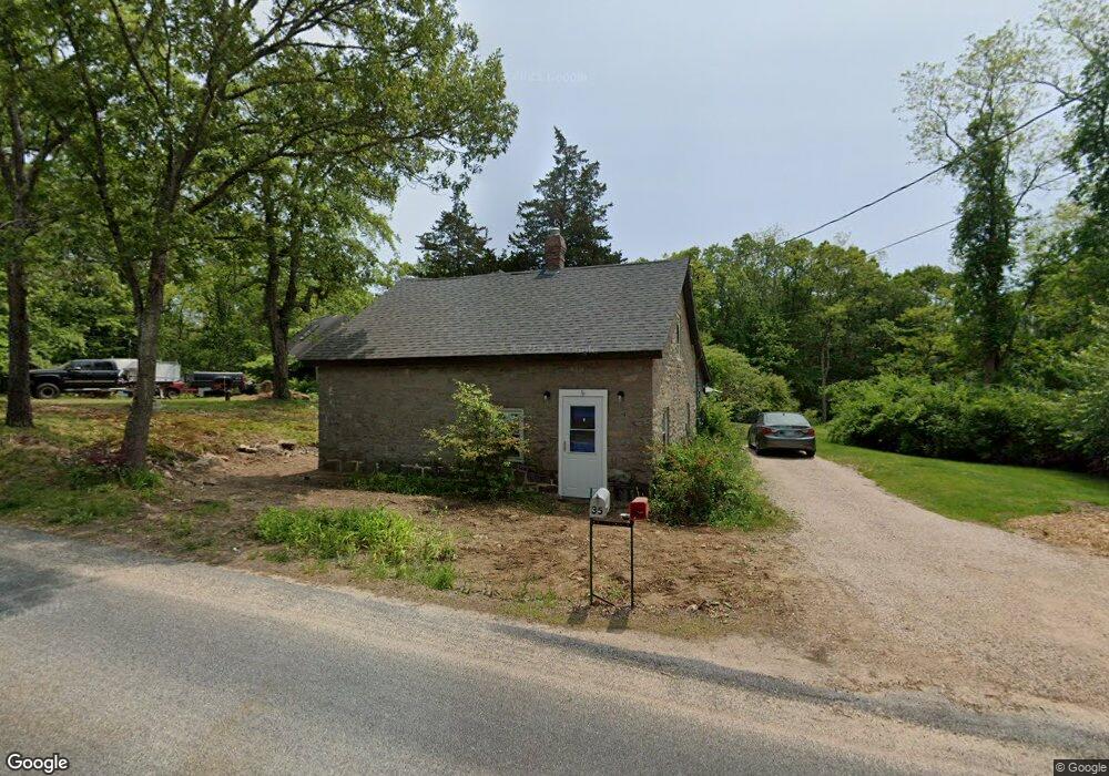
35 Buckeye Brook Rd Charlestown, RI 02813
Estimated Value: $466,224 - $595,000
1
Bed
1
Bath
1,386
Sq Ft
$380/Sq Ft
Est. Value
About This Home
This home is located at 35 Buckeye Brook Rd, Charlestown, RI 02813 and is currently estimated at $526,556, approximately $379 per square foot. 35 Buckeye Brook Rd is a home located in Washington County with nearby schools including Chariho Regional Middle School and Chariho High School.
Ownership History
Date
Name
Owned For
Owner Type
Purchase Details
Closed on
Jan 5, 1996
Sold by
Schneidenbach Paul
Bought by
Warren Wayne M and Warren Marsha
Current Estimated Value
Home Financials for this Owner
Home Financials are based on the most recent Mortgage that was taken out on this home.
Original Mortgage
$105,000
Outstanding Balance
$2,847
Interest Rate
7.34%
Estimated Equity
$523,709
Create a Home Valuation Report for This Property
The Home Valuation Report is an in-depth analysis detailing your home's value as well as a comparison with similar homes in the area
Home Values in the Area
Average Home Value in this Area
Purchase History
| Date | Buyer | Sale Price | Title Company |
|---|---|---|---|
| Warren Wayne M | $85,000 | -- |
Source: Public Records
Mortgage History
| Date | Status | Borrower | Loan Amount |
|---|---|---|---|
| Open | Warren Wayne M | $105,000 |
Source: Public Records
Tax History Compared to Growth
Tax History
| Year | Tax Paid | Tax Assessment Tax Assessment Total Assessment is a certain percentage of the fair market value that is determined by local assessors to be the total taxable value of land and additions on the property. | Land | Improvement |
|---|---|---|---|---|
| 2025 | $2,311 | $389,700 | $154,000 | $235,700 |
| 2024 | $2,252 | $389,700 | $154,000 | $235,700 |
| 2023 | $2,237 | $389,700 | $154,000 | $235,700 |
| 2022 | $2,234 | $273,400 | $95,000 | $178,400 |
| 2021 | $2,236 | $273,400 | $95,000 | $178,400 |
| 2020 | $2,250 | $273,400 | $95,000 | $178,400 |
| 2019 | $1,948 | $211,000 | $95,000 | $116,000 |
| 2018 | $2,034 | $211,000 | $95,000 | $116,000 |
| 2017 | $2,023 | $211,000 | $95,000 | $116,000 |
| 2016 | $2,067 | $202,400 | $86,400 | $116,000 |
| 2015 | $2,046 | $202,400 | $86,400 | $116,000 |
| 2014 | $2,004 | $202,400 | $86,400 | $116,000 |
Source: Public Records
Map
Nearby Homes
- 10 Laurel Rd
- 162 Church St Unit 164
- 129 Peckham Hollow Rd
- 134 Church St
- 61 Church St
- 473 Klondike Rd
- 0 Woody Hill Rd Unit 1334811
- 0 Woody Hill Rd Unit 73432704
- 23 Canterbury Dr
- 4 Village Rd
- 194 Ross Hill Rd
- 135 Ross Hill Rd
- 12 Fallon Trail
- 53 Bradford Rd
- 126 Alton Bradford Rd
- 5259 Old Post Rd
- 118 Dunns Corner Rd
- 5717 Post Rd
- 5 Robin Hollow Ln
- 137 Cove Point Rd E
- 27 Buckeye Brook Rd
- 38 Buckeye Brook Rd
- 46 Buckeye Brook Rd
- 46 Buckeye Brook Rd Unit RD
- 46 Buckeye Brook Rd
- 49 Buckeye Brook Rd
- 47 Buckeye Brook Rd
- 54 Buckeye Brook Rd
- 23 Buckeye Brook Rd
- 20 Buckeye Brook Rd
- 55 Buckeye Brook Rd
- 45A Buckeye Brook Rd
- 45 Buckeye Brook Rd Unit A
- 45 Buckeye Brook Rd
- 60 Buckeye Brook Rd
- 515 Ross Hill Rd
- 63 Buckeye Brook Rd
- 66 Buckeye Brook Rd
- 9 Buckeye Brook Rd
- 517 Ross Hill Rd