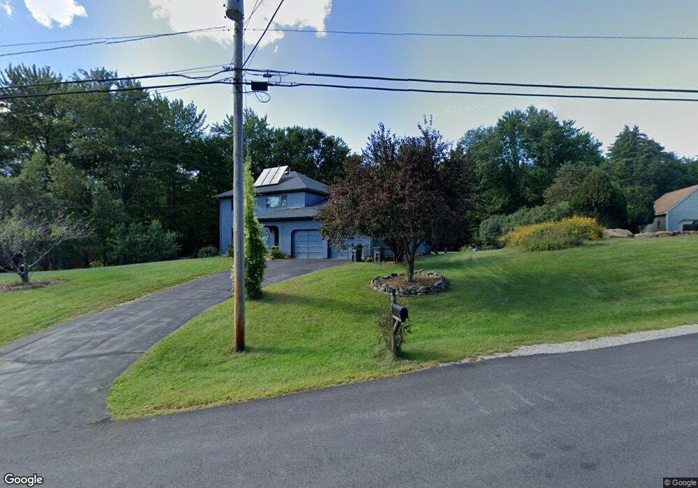
35 Corriveau Dr Hooksett, NH 03106
Estimated Value: $616,071 - $736,000
3
Beds
2
Baths
2,016
Sq Ft
$336/Sq Ft
Est. Value
About This Home
This home is located at 35 Corriveau Dr, Hooksett, NH 03106 and is currently estimated at $677,768, approximately $336 per square foot. 35 Corriveau Dr is a home located in Merrimack County with nearby schools including Fred C. Underhill School, Hooksett Memorial School, and David R. Cawley Middle School.
Ownership History
Date
Name
Owned For
Owner Type
Purchase Details
Closed on
Apr 17, 2017
Sold by
Carle Karen S and Carle Philip P
Bought by
Carle 2017 Ft
Current Estimated Value
Purchase Details
Closed on
Jun 4, 1997
Sold by
Dillon Matthew J and Dillon Dawn M
Bought by
Carle Philip P and Carle Karen S
Home Financials for this Owner
Home Financials are based on the most recent Mortgage that was taken out on this home.
Original Mortgage
$115,900
Interest Rate
7.98%
Create a Home Valuation Report for This Property
The Home Valuation Report is an in-depth analysis detailing your home's value as well as a comparison with similar homes in the area
Home Values in the Area
Average Home Value in this Area
Purchase History
| Date | Buyer | Sale Price | Title Company |
|---|---|---|---|
| Carle 2017 Ft | -- | -- | |
| Carle Philip P | $144,900 | -- |
Source: Public Records
Mortgage History
| Date | Status | Borrower | Loan Amount |
|---|---|---|---|
| Previous Owner | Carle Philip P | $115,900 |
Source: Public Records
Tax History
| Year | Tax Paid | Tax Assessment Tax Assessment Total Assessment is a certain percentage of the fair market value that is determined by local assessors to be the total taxable value of land and additions on the property. | Land | Improvement |
|---|---|---|---|---|
| 2024 | $9,333 | $550,300 | $171,300 | $379,000 |
| 2023 | $8,794 | $550,300 | $168,800 | $381,500 |
| 2022 | $7,845 | $326,200 | $115,500 | $210,700 |
| 2021 | $7,248 | $326,200 | $115,500 | $210,700 |
| 2020 | $7,343 | $326,200 | $115,500 | $210,700 |
| 2019 | $7,030 | $326,200 | $115,500 | $210,700 |
| 2018 | $7,216 | $326,200 | $115,500 | $210,700 |
| 2017 | $7,241 | $270,800 | $101,300 | $169,500 |
| 2016 | $7,146 | $270,800 | $101,300 | $169,500 |
| 2015 | $6,694 | $270,800 | $101,300 | $169,500 |
| 2014 | $6,724 | $270,800 | $101,300 | $169,500 |
| 2013 | $6,358 | $270,800 | $101,300 | $169,500 |
Source: Public Records
Map
Nearby Homes
- 315 Hackett Hill Rd
- 63 Woodview Way
- 163 Woodview Way Unit 2
- 78 Woodview Way
- 500 E Dunbarton Rd
- 237 Woodview Way
- 264 Woodview Way
- 25 Forestedge Way Unit 25
- 55 Forestedge Way
- 30 Ledgewood Dr
- 5 Cross Rd
- 245 W River Rd
- 29 S Bow Dunbarton Rd
- 14 Northbrook Dr Unit 1410
- 14 Northbrook Dr Unit 1408
- 90 Golfview Dr
- 11 E Dunbarton Rd
- 1619 Front St Unit 3
- 278 Exchange Ave
- 1601 Hooksett Rd
- 31 Corriveau Dr
- 34 Corriveau Dr
- 38 Corriveau Dr
- 32 Corriveau Dr
- 0 Valley View
- 39 Corriveau Dr
- 20 Valley View
- 27 Corriveau Dr
- 28 Corriveau Dr
- 44 Corriveau Dr
- 21 Corriveau Dr
- 24 Corriveau Dr
- 47 Corriveau Dr
- 20 Corriveau Dr
- 17 Corriveau Dr
- 50 Corriveau Dr
- 15 Corriveau Dr
- 16 Corriveau Dr
- 14 Corriveau Dr
- 13 Corriveau Dr
Your Personal Tour Guide
Ask me questions while you tour the home.