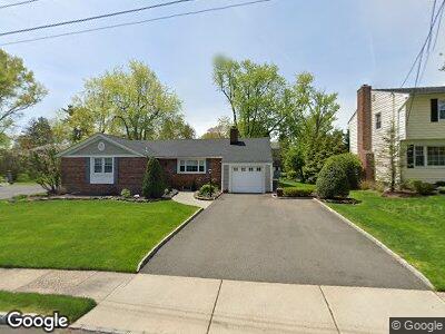
35 Dartmouth Rd Cranford, NJ 07016
Estimated Value: $661,840 - $1,061,000
--
Bed
--
Bath
--
Sq Ft
9,148
Sq Ft Lot
About This Home
This home is located at 35 Dartmouth Rd, Cranford, NJ 07016 and is currently estimated at $837,710. 35 Dartmouth Rd is a home located in Union County with nearby schools including Cranford Sr High School, St Michael School, and Christopher Academy Montessori.
Ownership History
Date
Name
Owned For
Owner Type
Purchase Details
Closed on
Dec 16, 1999
Sold by
Keckeissen Joanne and Nino Joanne
Bought by
Donahue J Keith and Donahue Barbara
Current Estimated Value
Home Financials for this Owner
Home Financials are based on the most recent Mortgage that was taken out on this home.
Original Mortgage
$206,500
Interest Rate
7.81%
Mortgage Type
Stand Alone First
Create a Home Valuation Report for This Property
The Home Valuation Report is an in-depth analysis detailing your home's value as well as a comparison with similar homes in the area
Home Values in the Area
Average Home Value in this Area
Purchase History
| Date | Buyer | Sale Price | Title Company |
|---|---|---|---|
| Donahue J Keith | $310,000 | -- |
Source: Public Records
Mortgage History
| Date | Status | Borrower | Loan Amount |
|---|---|---|---|
| Open | Donahue J Keith J | $150,000 | |
| Closed | Donahue J Keith | $150,000 | |
| Closed | Donahue J Keith | $215,267 | |
| Closed | Donahue J K | $50,000 | |
| Closed | Donahue Joseph K | $206,500 | |
| Closed | Donahue J Keith | $28,000 | |
| Closed | Donahue J Keith | $206,500 |
Source: Public Records
Tax History Compared to Growth
Tax History
| Year | Tax Paid | Tax Assessment Tax Assessment Total Assessment is a certain percentage of the fair market value that is determined by local assessors to be the total taxable value of land and additions on the property. | Land | Improvement |
|---|---|---|---|---|
| 2024 | $13,734 | $206,000 | $105,700 | $100,300 |
| 2023 | $13,734 | $206,000 | $105,700 | $100,300 |
| 2022 | $13,621 | $206,000 | $105,700 | $100,300 |
| 2021 | $13,561 | $206,000 | $105,700 | $100,300 |
| 2020 | $13,518 | $206,000 | $105,700 | $100,300 |
| 2019 | $13,431 | $206,000 | $105,700 | $100,300 |
| 2018 | $13,188 | $206,000 | $105,700 | $100,300 |
| 2017 | $12,735 | $206,000 | $105,700 | $100,300 |
| 2016 | $12,271 | $206,000 | $105,700 | $100,300 |
| 2015 | $11,950 | $206,000 | $105,700 | $100,300 |
| 2014 | $11,705 | $206,000 | $105,700 | $100,300 |
Source: Public Records
Map
Nearby Homes
- 16 Indian Spring Rd
- 6 Cornell Rd
- 484 4th Ave Unit 8
- 484 4th Ave Unit 7
- 305 Cedar St
- 228 3rd Ave
- 41 Sandra Cir Unit A2
- 5 W End Place
- 822 Fairacres Ave
- 34 Spruce St
- 529 Benson Place
- 63 2nd Ave
- 820 E Broad St
- 3 Sandra Cir
- 611 Maple Ct Unit 611
- 816 E Broad St
- 112 Pawnee Rd
- 131 Winslow Place
- 128 Woodland Ave
- 126 Wells St
- 35 Dartmouth Rd
- 37 Dartmouth Rd
- 33 Dartmouth Rd
- 712 Gallows Hill Rd
- 710 Gallows Hill Rd
- 714 Gallows Hill Rd
- 30 Dartmouth Rd
- 33 Cornell Rd
- 708 Gallows Hill Rd
- 38 Cornell Rd
- 31 Dartmouth Rd
- 716 Gallows Hill Rd
- 706 Gallows Hill Rd
- 28 Dartmouth Rd
- 31 Cornell Rd
- 36 Cornell Rd
- 718 Gallows Hill Rd
- 29 Dartmouth Rd
- 704 Gallows Hill Rd
- 34 Cornell Rd