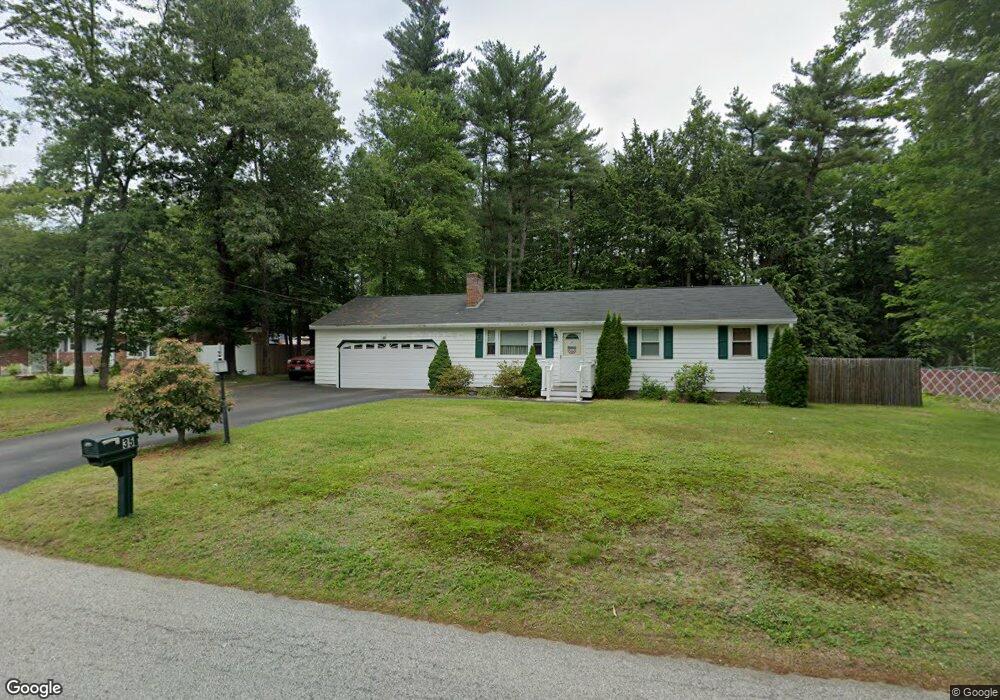
35 Davis Rd MerriMacK, NH 03054
Estimated Value: $501,000 - $540,000
3
Beds
2
Baths
1,700
Sq Ft
$301/Sq Ft
Est. Value
About This Home
This home is located at 35 Davis Rd, MerriMacK, NH 03054 and is currently estimated at $512,144, approximately $301 per square foot. 35 Davis Rd is a home located in Hillsborough County with nearby schools including Reeds Ferry School, James Mastricola Upper Elementary School, and Merrimack Middle School.
Ownership History
Date
Name
Owned For
Owner Type
Purchase Details
Closed on
Oct 9, 2024
Sold by
Nesbitt Robert A and Nesbitt Patricia A
Bought by
Nesbitt Ft and Nesbitt
Current Estimated Value
Purchase Details
Closed on
Oct 7, 1991
Bought by
Nesbitt Robert A and Nesbitt Patricia A
Create a Home Valuation Report for This Property
The Home Valuation Report is an in-depth analysis detailing your home's value as well as a comparison with similar homes in the area
Home Values in the Area
Average Home Value in this Area
Purchase History
| Date | Buyer | Sale Price | Title Company |
|---|---|---|---|
| Nesbitt Ft | -- | None Available | |
| Nesbitt Ft | -- | None Available | |
| Nesbitt Ft | -- | None Available | |
| Nesbitt Robert A | $102,000 | -- |
Source: Public Records
Mortgage History
| Date | Status | Borrower | Loan Amount |
|---|---|---|---|
| Previous Owner | Nesbitt Robert A | $147,000 | |
| Previous Owner | Nesbitt Robert A | $150,000 | |
| Previous Owner | Nesbitt Robert A | $15,000 |
Source: Public Records
Tax History
| Year | Tax Paid | Tax Assessment Tax Assessment Total Assessment is a certain percentage of the fair market value that is determined by local assessors to be the total taxable value of land and additions on the property. | Land | Improvement |
|---|---|---|---|---|
| 2025 | $7,723 | $349,300 | $200,100 | $149,200 |
| 2024 | $7,227 | $349,300 | $200,100 | $149,200 |
| 2023 | $6,794 | $349,300 | $200,100 | $149,200 |
| 2022 | $6,071 | $349,300 | $200,100 | $149,200 |
| 2021 | $5,997 | $349,300 | $200,100 | $149,200 |
| 2020 | $5,950 | $247,300 | $135,000 | $112,300 |
| 2019 | $5,967 | $247,300 | $135,000 | $112,300 |
| 2018 | $5,552 | $230,200 | $135,000 | $95,200 |
| 2017 | $5,377 | $230,100 | $135,000 | $95,100 |
| 2016 | $5,244 | $230,100 | $135,000 | $95,100 |
| 2015 | $5,082 | $205,600 | $121,200 | $84,400 |
| 2014 | $4,953 | $205,600 | $121,200 | $84,400 |
| 2013 | $4,916 | $205,600 | $121,200 | $84,400 |
Source: Public Records
Map
Nearby Homes
- 2 Tanager Ct
- 12 Davis Rd
- 10 Owls Ct
- 29 Bedford Rd
- 18 Templeton Ct
- 28 Pearson Rd
- 131 Indian Rock Rd
- 76 Shelburne Rd
- 9 Kimberly Dr
- 490 Charles Bancroft Hwy
- 1 Killian Ct
- 33 Donovan Ct
- 51 Donovan Ct
- 17 Walnut Cir
- 8 Franconia Dr
- 1 Tallarico St Unit 14
- 0 Tallarico St Unit 3 5032471
- 0 Tallarico St Unit 5 5032751
- 0 Tallarico St Unit 26
- 0 Tallarico St Unit 12 5033131
Your Personal Tour Guide
Ask me questions while you tour the home.