Estimated Value: $301,000 - $363,000
2
Beds
2
Baths
528
Sq Ft
$645/Sq Ft
Est. Value
About This Home
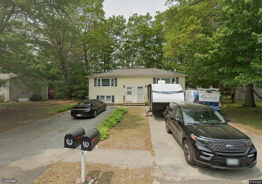
This home is located at 35 Derryfield Rd Unit R, Derry, NH 03038 and is currently estimated at $340,560, approximately $645 per square foot. 35 Derryfield Rd Unit R is a home located in Rockingham County with nearby schools including Grinnell School, Gilbert H. Hood Middle School, and Pinkerton Academy.
Ownership History
Date
Name
Owned For
Owner Type
Purchase Details
Closed on
Apr 23, 2013
Sold by
Amaral Diane and Skulski Andrew
Bought by
Sulski Andrew
Current Estimated Value
Home Financials for this Owner
Home Financials are based on the most recent Mortgage that was taken out on this home.
Original Mortgage
$159,050
Outstanding Balance
$110,581
Interest Rate
3.52%
Mortgage Type
Purchase Money Mortgage
Estimated Equity
$229,979
Purchase Details
Closed on
Jun 29, 2006
Sold by
Pelletier Tammy M and Pelletier Bruno J
Bought by
Amaral Diane
Home Financials for this Owner
Home Financials are based on the most recent Mortgage that was taken out on this home.
Original Mortgage
$167,000
Interest Rate
6.58%
Create a Home Valuation Report for This Property
The Home Valuation Report is an in-depth analysis detailing your home's value as well as a comparison with similar homes in the area
Home Values in the Area
Average Home Value in this Area
Purchase History
| Date | Buyer | Sale Price | Title Company |
|---|---|---|---|
| Sulski Andrew | -- | -- | |
| Amaral Diane | $167,000 | -- |
Source: Public Records
Mortgage History
| Date | Status | Borrower | Loan Amount |
|---|---|---|---|
| Open | Sulski Andrew | $159,050 | |
| Previous Owner | Amaral Diane | $167,000 |
Source: Public Records
Tax History
| Year | Tax Paid | Tax Assessment Tax Assessment Total Assessment is a certain percentage of the fair market value that is determined by local assessors to be the total taxable value of land and additions on the property. | Land | Improvement |
|---|---|---|---|---|
| 2025 | $5,612 | $295,500 | $0 | $295,500 |
| 2024 | $5,530 | $295,900 | $0 | $295,900 |
| 2023 | $4,949 | $239,300 | $0 | $239,300 |
| 2022 | $4,556 | $239,300 | $0 | $239,300 |
| 2021 | $4,328 | $174,800 | $0 | $174,800 |
| 2020 | $4,255 | $174,800 | $0 | $174,800 |
| 2019 | $4,009 | $153,500 | $89,400 | $64,100 |
| 2018 | $3,996 | $153,500 | $89,400 | $64,100 |
| 2017 | $3,810 | $132,000 | $84,900 | $47,100 |
| 2016 | $3,572 | $132,000 | $84,900 | $47,100 |
| 2015 | $2,584 | $88,400 | $42,500 | $45,900 |
| 2014 | $2,601 | $88,400 | $42,500 | $45,900 |
| 2013 | $2,806 | $89,100 | $41,600 | $47,500 |
Source: Public Records
Map
Nearby Homes
- 41 Derryfield Rd
- 6 Michael Ave
- 42 Kendall Pond Rd
- 68 Fordway Extension
- 30 Kendall Pond Rd Unit 77
- 30 Kendall Pond Rd Unit 87
- 65 Fordway Extension
- 44 Sheffield Way Unit 6B
- 4 Norman Dr Unit L
- 8 Blueberry Rd Unit U: R
- 6 Mills Farm Cir Unit R
- 35 Highland Ave
- 12 Elise Ave Unit 6
- 16 Elise Ave Unit Lot 8
- 14 Elise Ave Unit 7
- 67 Forest St
- 8 Elise Ave Unit Lot 4
- 29 Central St
- 1 Elise Ave Unit Lot 96
- 36 Elise Ave Unit Lot 18
- 35 Derryfield Rd Unit L
- 37 Derryfield Rd Unit R
- 37 Derryfield Rd Unit L
- 37R Derryfield Rd Unit 37
- 37R Derryfield Rd
- 37L Derryfield Rd Unit 37
- 37L Derryfield Rd Unit L
- 33 Derryfield Rd Unit R
- 33 Derryfield Rd Unit L
- 33 Derryfield Rd Unit 33R
- 12 Michael Ave
- 40R Derryfield Rd Unit 40r
- 42R Derryfield Rd
- 42L Derryfield Rd
- 31 Derryfield Rd Unit R
- 31 Derryfield Rd Unit L
- 10 Michael Ave
- 39 Derryfield Rd Unit R
- 39 Derryfield Rd Unit L
- 44 Derryfield Rd Unit R
Your Personal Tour Guide
Ask me questions while you tour the home.