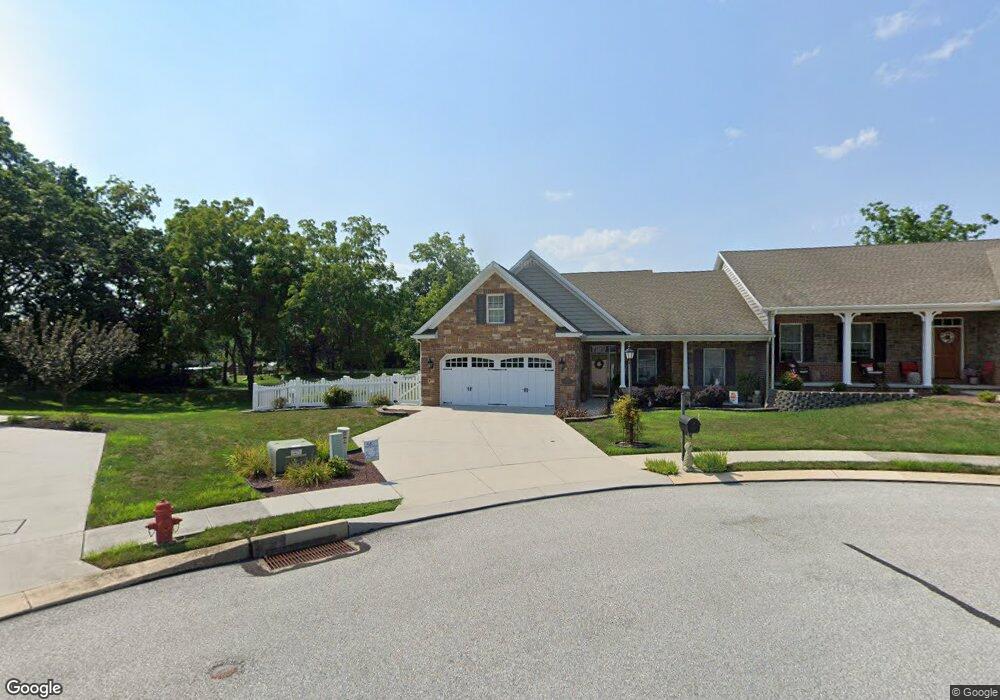
35 Digges Ct Littlestown, PA 17340
Estimated Value: $409,111 - $510,000
2
Beds
2
Baths
2,350
Sq Ft
$194/Sq Ft
Est. Value
About This Home
This home is located at 35 Digges Ct, Littlestown, PA 17340 and is currently estimated at $455,528, approximately $193 per square foot. 35 Digges Ct is a home with nearby schools including Rolling Acres El School, Maple Avenue Middle School, and Littlestown Senior High School.
Ownership History
Date
Name
Owned For
Owner Type
Purchase Details
Closed on
Feb 21, 2020
Sold by
Batterden Roxanne L
Bought by
Pamela S Mougeotte Lt
Current Estimated Value
Purchase Details
Closed on
Dec 12, 2012
Sold by
Batterden Mark L and Batterden Roxanne L
Bought by
Batterden Roxanne L
Purchase Details
Closed on
Mar 26, 2012
Sold by
Heritage Hills Ii
Bought by
Batterden Mark L and Batterden Roxanne L
Home Financials for this Owner
Home Financials are based on the most recent Mortgage that was taken out on this home.
Original Mortgage
$276,000
Interest Rate
3.88%
Mortgage Type
New Conventional
Create a Home Valuation Report for This Property
The Home Valuation Report is an in-depth analysis detailing your home's value as well as a comparison with similar homes in the area
Home Values in the Area
Average Home Value in this Area
Purchase History
| Date | Buyer | Sale Price | Title Company |
|---|---|---|---|
| Pamela S Mougeotte Lt | $352,500 | None Available | |
| Batterden Roxanne L | -- | None Available | |
| Batterden Mark L | $347,732 | None Available |
Source: Public Records
Mortgage History
| Date | Status | Borrower | Loan Amount |
|---|---|---|---|
| Previous Owner | Batterden Mark L | $276,000 |
Source: Public Records
Tax History Compared to Growth
Tax History
| Year | Tax Paid | Tax Assessment Tax Assessment Total Assessment is a certain percentage of the fair market value that is determined by local assessors to be the total taxable value of land and additions on the property. | Land | Improvement |
|---|---|---|---|---|
| 2025 | $6,064 | $263,800 | $65,000 | $198,800 |
| 2024 | $5,844 | $263,800 | $65,000 | $198,800 |
| 2023 | $5,617 | $263,800 | $65,000 | $198,800 |
| 2022 | $5,583 | $263,800 | $65,000 | $198,800 |
| 2021 | $5,418 | $263,800 | $65,000 | $198,800 |
| 2020 | $5,353 | $263,800 | $65,000 | $198,800 |
| 2019 | $5,193 | $263,800 | $65,000 | $198,800 |
| 2018 | $5,098 | $263,800 | $65,000 | $198,800 |
| 2017 | $4,967 | $263,800 | $65,000 | $198,800 |
| 2016 | -- | $263,800 | $65,000 | $198,800 |
| 2015 | -- | $263,800 | $65,000 | $198,800 |
| 2014 | -- | $263,800 | $65,000 | $198,800 |
Source: Public Records
Map
Nearby Homes
- 161 Stoners Cir
- 52 Stayman Way Unit 81
- 58 N Gala Unit 397
- 135 Apple Grove Ln Unit 438
- 58 Windsor Ct
- 48 Windsor Ct
- 1024 Frederick Pike Unit 6
- 140 Apple Grove Ln Unit 425
- 440 N Queen St
- 22 Rita Marie Ave
- 20 Locust Dr
- 20c Locust Dr
- 0 Locust Dr Unit PAAD2015910
- 129 W King St
- 117 Charles St
- 115 Charles St
- 162 Newark St
- 15 Yorktowne Ct Unit 97
- 61 E King St
- 211 E King St
- 33 Digges Ct
- 32 Digges Ct
- 31 Digges Ct
- 28 Digges Ct Unit 12B
- 29 Digges Ct
- 26 Digges Ct Unit 12A
- 23 Digges Ct
- 24 Digges Ct Unit 11B
- 620 Saint Johns Rd
- 22 Digges Ct Unit 11A
- 21 Digges Ct
- 9 Digges Ct
- 153 Stoners Cir
- 155 Stoners Cir
- 7 Digges Ct
- 149 Stoners Cir
- 18 Digges Ct Unit 10A
- 159 Stoners Cir
- 147 Stoners Cir
- 684 Saint Johns Rd