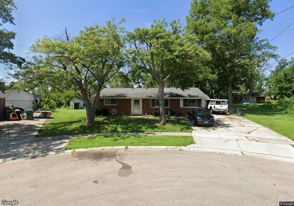
35 King Cir Springboro, OH 45066
Estimated Value: $227,000 - $266,000
3
Beds
2
Baths
1,266
Sq Ft
$189/Sq Ft
Est. Value
About This Home
This home is located at 35 King Cir, Springboro, OH 45066 and is currently estimated at $239,716, approximately $189 per square foot. 35 King Cir is a home located in Warren County with nearby schools including Clearcreek Elementary School, Springboro Intermediate School, and Dennis Elementary School.
Ownership History
Date
Name
Owned For
Owner Type
Purchase Details
Closed on
May 17, 2018
Sold by
Denny David
Bought by
Denny Properties Kb Llc
Current Estimated Value
Purchase Details
Closed on
May 12, 2004
Sold by
Toler Jeffery L and Meador Mary R
Bought by
Denny David
Home Financials for this Owner
Home Financials are based on the most recent Mortgage that was taken out on this home.
Original Mortgage
$78,300
Interest Rate
5.63%
Mortgage Type
Purchase Money Mortgage
Purchase Details
Closed on
Dec 14, 2000
Sold by
Anderson Scott
Bought by
Toler Jeffery L and Toler Mary
Home Financials for this Owner
Home Financials are based on the most recent Mortgage that was taken out on this home.
Original Mortgage
$108,950
Interest Rate
7.8%
Mortgage Type
FHA
Purchase Details
Closed on
May 4, 1999
Sold by
Longworth Carl D
Bought by
Anderson Scott S and Anderson Candace L
Home Financials for this Owner
Home Financials are based on the most recent Mortgage that was taken out on this home.
Original Mortgage
$87,300
Interest Rate
5.49%
Mortgage Type
New Conventional
Purchase Details
Closed on
Oct 3, 1991
Sold by
Sisco Sisco and Sisco John M
Bought by
Longworth Longworth and Longworth Carl Daymon
Purchase Details
Closed on
May 5, 1987
Sold by
Hogan Chee Chee and Chee Chee
Bought by
Sisco and Sisco John M
Purchase Details
Closed on
Jan 19, 1984
Sold by
Wysong James William and James William
Bought by
Hogan and Chee Chee
Create a Home Valuation Report for This Property
The Home Valuation Report is an in-depth analysis detailing your home's value as well as a comparison with similar homes in the area
Home Values in the Area
Average Home Value in this Area
Purchase History
| Date | Buyer | Sale Price | Title Company |
|---|---|---|---|
| Denny Properties Kb Llc | -- | -- | |
| Denny David | $87,000 | Multiple | |
| Toler Jeffery L | $109,900 | -- | |
| Anderson Scott S | $97,000 | -- | |
| Longworth Longworth | $76,500 | -- | |
| Sisco | $56,000 | -- | |
| Hogan | $56,900 | -- |
Source: Public Records
Mortgage History
| Date | Status | Borrower | Loan Amount |
|---|---|---|---|
| Previous Owner | Denny David | $78,300 | |
| Previous Owner | Toler Jeffery L | $108,950 | |
| Previous Owner | Anderson Scott S | $87,300 |
Source: Public Records
Tax History Compared to Growth
Tax History
| Year | Tax Paid | Tax Assessment Tax Assessment Total Assessment is a certain percentage of the fair market value that is determined by local assessors to be the total taxable value of land and additions on the property. | Land | Improvement |
|---|---|---|---|---|
| 2024 | $2,286 | $57,080 | $17,500 | $39,580 |
| 2023 | $2,004 | $45,927 | $10,762 | $35,164 |
| 2022 | $1,975 | $45,927 | $10,763 | $35,165 |
| 2021 | $1,837 | $45,927 | $10,763 | $35,165 |
| 2020 | $1,710 | $37,338 | $8,750 | $28,588 |
| 2019 | $1,581 | $37,338 | $8,750 | $28,588 |
| 2018 | $1,539 | $37,338 | $8,750 | $28,588 |
| 2017 | $1,564 | $34,188 | $8,134 | $26,054 |
| 2016 | $1,631 | $34,188 | $8,134 | $26,054 |
| 2015 | $1,634 | $34,188 | $8,134 | $26,054 |
| 2014 | $1,675 | $33,190 | $7,900 | $25,290 |
| 2013 | $1,674 | $36,770 | $8,750 | $28,020 |
Source: Public Records
Map
Nearby Homes
- 125 W Market St
- 145 Woods Rd
- 125 E Market St
- 145 Redbud Dr
- 775 S Main St
- 310 Elmwood Dr Unit 9
- 261 Myrtle Ln
- 40 Libby Hollow St
- 20 Cinnamon Ct
- 2530 Factory Rd
- 140 Dan Haven Place
- 45 Wadestone St
- 45 Wadestone Ln
- 5 Annie Grove Ln
- 14 Ed Knoll Bend
- 15 Wadestone Ln
- 15 Belvoir Ct
- 473 Mccray Blvd
- 2649 Factory Rd
- 150 Tanglewood Dr