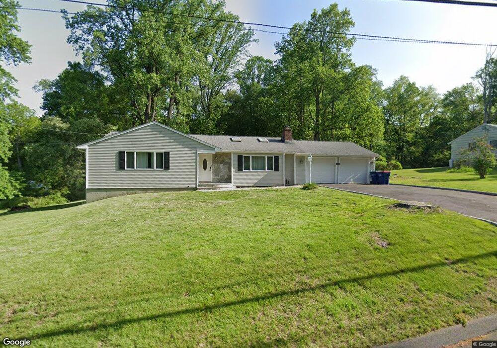
35 Macdonald Rd Trumbull, CT 06611
Nichols NeighborhoodEstimated Value: $652,000 - $785,000
4
Beds
3
Baths
2,143
Sq Ft
$331/Sq Ft
Est. Value
About This Home
This home is located at 35 Macdonald Rd, Trumbull, CT 06611 and is currently estimated at $708,459, approximately $330 per square foot. 35 Macdonald Rd is a home located in Fairfield County with nearby schools including Booth Hill School, Hillcrest Middle School, and Trumbull High School.
Ownership History
Date
Name
Owned For
Owner Type
Purchase Details
Closed on
Jan 13, 2022
Sold by
Page John R
Bought by
Page John R and Page Jessica
Current Estimated Value
Home Financials for this Owner
Home Financials are based on the most recent Mortgage that was taken out on this home.
Original Mortgage
$579,313
Outstanding Balance
$536,976
Interest Rate
3.56%
Mortgage Type
FHA
Estimated Equity
$171,483
Purchase Details
Closed on
Nov 20, 2003
Sold by
Vitale Darryl and Vitale Patricia
Bought by
Madden Christopher and Madden Nancy C
Home Financials for this Owner
Home Financials are based on the most recent Mortgage that was taken out on this home.
Original Mortgage
$310,860
Interest Rate
6.05%
Purchase Details
Closed on
Jan 8, 1997
Sold by
Blees Fred Est
Bought by
Vitale Darryl and Martire Patricia
Create a Home Valuation Report for This Property
The Home Valuation Report is an in-depth analysis detailing your home's value as well as a comparison with similar homes in the area
Home Values in the Area
Average Home Value in this Area
Purchase History
| Date | Buyer | Sale Price | Title Company |
|---|---|---|---|
| Page John R | -- | None Available | |
| Madden Christopher | $345,400 | -- | |
| Vitale Darryl | $168,000 | -- |
Source: Public Records
Mortgage History
| Date | Status | Borrower | Loan Amount |
|---|---|---|---|
| Open | Page John R | $579,313 | |
| Previous Owner | Vitale Darryl | $200,000 | |
| Previous Owner | Vitale Darryl | $580,000 | |
| Previous Owner | Vitale Darryl | $310,860 | |
| Previous Owner | Vitale Darryl | $40,000 |
Source: Public Records
Tax History
| Year | Tax Paid | Tax Assessment Tax Assessment Total Assessment is a certain percentage of the fair market value that is determined by local assessors to be the total taxable value of land and additions on the property. | Land | Improvement |
|---|---|---|---|---|
| 2025 | $12,271 | $332,010 | $160,510 | $171,500 |
| 2024 | $11,918 | $332,010 | $160,510 | $171,500 |
| 2023 | $10,054 | $284,410 | $160,510 | $123,900 |
| 2022 | $9,899 | $284,410 | $160,510 | $123,900 |
| 2021 | $9,257 | $257,460 | $147,140 | $110,320 |
| 2020 | $9,257 | $257,460 | $147,140 | $110,320 |
| 2018 | $9,055 | $257,460 | $147,140 | $110,320 |
| 2017 | $8,882 | $257,460 | $147,140 | $110,320 |
| 2016 | $8,716 | $257,460 | $147,140 | $110,320 |
| 2015 | $8,678 | $257,500 | $147,200 | $110,300 |
| 2014 | $8,492 | $257,500 | $147,200 | $110,300 |
Source: Public Records
Map
Nearby Homes
- 38 Macdonald Rd
- 2449 Huntington Turnpike
- 0 Pinewood Trail
- 244 Strobel Rd
- 10 Foxwood Rd
- 35 Greenfield Dr
- 176 Strobel Rd
- 0 Lot #4 & Lot #5 W Mischa Rd Unit 24138429
- 311 Isinglass Rd
- 68 Old Dike Rd
- 101 Golden Hill St
- 7 E Lake Rd
- 85 Teeter Rock Rd
- 2 Doe Hollow Dr
- 22 Beverly Rd
- 10 Doe Hollow Dr
- 3 Wheeler Dr
- 40 Puritan Rd
- 256 Nichols Ave
- 699 Daniels Farm Rd
- 37 Macdonald Rd
- 25 Macdonald Rd
- 30 Macdonald Rd
- 34 Macdonald Rd
- 36 Macdonald Rd
- 24 Macdonald Rd
- 2453 Huntington Turnpike
- 21 Macdonald Rd
- 2427 Huntington Turnpike
- 20 Macdonald Rd
- 25 Sweetbriar Rd
- 2459 Huntington Turnpike
- 15 Macdonald Rd
- 2379 Huntington Turnpike
- 21 Sweetbriar Rd
- 2426 Huntington Turnpike
- 14 Macdonald Rd
- 16 Shadowood Ln
- 9 Macdonald Rd
- 2456 Huntington Turnpike
Your Personal Tour Guide
Ask me questions while you tour the home.