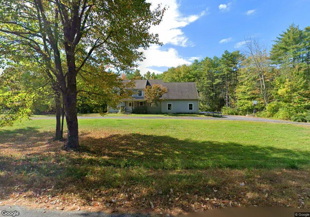
35 Mattson Heights Gardiner, ME 04345
Estimated Value: $435,000 - $612,000
5
Beds
3
Baths
3,500
Sq Ft
$152/Sq Ft
Est. Value
About This Home
This home is located at 35 Mattson Heights, Gardiner, ME 04345 and is currently estimated at $533,693, approximately $152 per square foot. 35 Mattson Heights is a home located in Kennebec County with nearby schools including Gardiner Area High School, Grace Christian Academy, and Spurwink School - Chelsea.
Ownership History
Date
Name
Owned For
Owner Type
Purchase Details
Closed on
Aug 17, 2010
Sold by
Tibbetts Nathan J
Bought by
Tibbetts Melissa J
Current Estimated Value
Purchase Details
Closed on
Mar 20, 2007
Sold by
Nelson Alfred R and Nelson Renee D
Bought by
Tibbetts Nathan J and Tibbetts Melissa J
Home Financials for this Owner
Home Financials are based on the most recent Mortgage that was taken out on this home.
Original Mortgage
$239,000
Outstanding Balance
$145,769
Interest Rate
6.4%
Mortgage Type
Purchase Money Mortgage
Estimated Equity
$387,924
Create a Home Valuation Report for This Property
The Home Valuation Report is an in-depth analysis detailing your home's value as well as a comparison with similar homes in the area
Home Values in the Area
Average Home Value in this Area
Purchase History
| Date | Buyer | Sale Price | Title Company |
|---|---|---|---|
| Tibbetts Melissa J | -- | -- | |
| Tibbetts Nathan J | -- | -- |
Source: Public Records
Mortgage History
| Date | Status | Borrower | Loan Amount |
|---|---|---|---|
| Open | Tibbetts Nathan J | $239,000 |
Source: Public Records
Tax History Compared to Growth
Tax History
| Year | Tax Paid | Tax Assessment Tax Assessment Total Assessment is a certain percentage of the fair market value that is determined by local assessors to be the total taxable value of land and additions on the property. | Land | Improvement |
|---|---|---|---|---|
| 2024 | $6,794 | $265,400 | $38,600 | $226,800 |
| 2023 | $6,290 | $265,400 | $38,600 | $226,800 |
| 2022 | $5,892 | $265,400 | $38,600 | $226,800 |
| 2021 | $5,759 | $265,400 | $38,600 | $226,800 |
| 2020 | $5,759 | $265,400 | $38,600 | $226,800 |
| 2019 | $5,759 | $265,400 | $38,600 | $226,800 |
| 2018 | $5,680 | $265,400 | $38,600 | $226,800 |
| 2017 | $5,839 | $265,400 | $38,600 | $226,800 |
| 2016 | $5,706 | $265,400 | $38,600 | $226,800 |
| 2015 | $5,733 | $265,400 | $38,600 | $226,800 |
| 2014 | $5,467 | $265,400 | $38,600 | $226,800 |
Source: Public Records
Map
Nearby Homes
- Lot 37A Pierce St
- 23 Tilbury Park
- 219 Brunswick Ave
- 11 Partridge Dr
- 29 Freemont St
- 504 Water St
- 33 Ash St Unit 33A & 33B
- 35 Ash St
- 67 Church St
- 0 Brunswick Ave
- 36 Brunswick Ave
- 25 and 27 Pray St
- 25 Summer St
- 25 Pray St
- 13 Brookside Dr
- 1 E Pittston Rd
- 1090 Pittston School St
- 25 Middle St
- 229 Highland Ave
- 32 Spring St
- 0 Mattson Heights (Lot 28) Unit 1452563
- 46 Mattson Heights
- 0 Mattson Heights Unit 579441
- 0 Mattson Heights Unit 217311
- 0 Mattson Heights Unit 217308
- 0 Mattson Heights Unit 217310
- 0 Mattson Heights Unit 217307
- 0 Mattson Heights Unit 217305
- 0 Mattson Heights Unit 217309
- 0 Mattson Heights Unit 217304
- 0 Mattson Heights Unit 217306
- 0 Mattson Heights Unit 1593302
- Lot 36 Mattson Heights
- 0 Mattson Heights
- 51 Mattson Heights
- 56 Mattson Heights
- 31 Pierce St
- 0 Katies Cir Unit 1014362
- 0 Katies Cir Unit 1124693
- 27 Pierce St