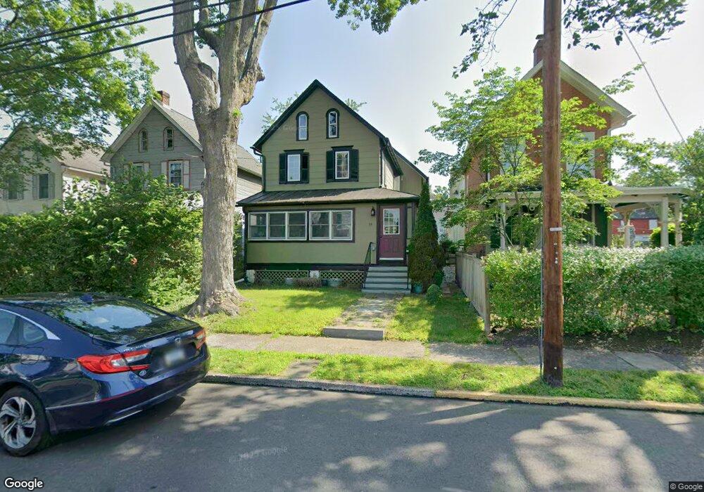
35 N Franklin St Doylestown, PA 18901
Estimated Value: $518,593 - $804,000
3
Beds
1
Bath
1,683
Sq Ft
$427/Sq Ft
Est. Value
About This Home
This home is located at 35 N Franklin St, Doylestown, PA 18901 and is currently estimated at $718,648, approximately $427 per square foot. 35 N Franklin St is a home located in Bucks County with nearby schools including Doyle El School, Lenape Middle School, and Central Bucks High School-West.
Ownership History
Date
Name
Owned For
Owner Type
Purchase Details
Closed on
Mar 18, 1994
Sold by
Rowe Gary John and Rowe Paula
Bought by
Boger Brian P and Boger Dawn A
Current Estimated Value
Home Financials for this Owner
Home Financials are based on the most recent Mortgage that was taken out on this home.
Original Mortgage
$117,900
Interest Rate
6.9%
Purchase Details
Closed on
Jul 5, 1984
Bought by
Rowe Gary John and Rowe Paula
Create a Home Valuation Report for This Property
The Home Valuation Report is an in-depth analysis detailing your home's value as well as a comparison with similar homes in the area
Home Values in the Area
Average Home Value in this Area
Purchase History
| Date | Buyer | Sale Price | Title Company |
|---|---|---|---|
| Boger Brian P | $131,000 | -- | |
| Rowe Gary John | $64,900 | -- |
Source: Public Records
Mortgage History
| Date | Status | Borrower | Loan Amount |
|---|---|---|---|
| Closed | Boger Brian P | $117,900 |
Source: Public Records
Tax History Compared to Growth
Tax History
| Year | Tax Paid | Tax Assessment Tax Assessment Total Assessment is a certain percentage of the fair market value that is determined by local assessors to be the total taxable value of land and additions on the property. | Land | Improvement |
|---|---|---|---|---|
| 2025 | $2,897 | $16,080 | $2,520 | $13,560 |
| 2024 | $2,897 | $16,080 | $2,520 | $13,560 |
| 2023 | $2,760 | $16,080 | $2,520 | $13,560 |
| 2022 | $2,722 | $16,080 | $2,520 | $13,560 |
| 2021 | $2,692 | $16,080 | $2,520 | $13,560 |
| 2020 | $2,662 | $16,080 | $2,520 | $13,560 |
| 2019 | $2,633 | $16,080 | $2,520 | $13,560 |
| 2018 | $2,601 | $16,080 | $2,520 | $13,560 |
| 2017 | $2,573 | $16,080 | $2,520 | $13,560 |
| 2016 | $2,573 | $16,080 | $2,520 | $13,560 |
| 2015 | -- | $16,080 | $2,520 | $13,560 |
| 2014 | -- | $16,080 | $2,520 | $13,560 |
Source: Public Records
Map
Nearby Homes
- 37 N Clinton St
- 215 N Franklin St
- 195 Lafayette St
- 20 E Court St
- 259 W Ashland St
- 69 E Oakland Ave
- 333 Dorset Ct Unit 333
- 169 N Main St
- 4 Barnes Ct
- 110 E Ashland St
- 146 N Church St
- 236 Green St
- 155 E Oakland Ave
- 146 E Court St
- 9 Mill Creek Dr
- 403 S Main St Unit S201
- 89 Homestead Dr
- 339 E Ashland St
- 418 North St
- 121 Cottage St
- 39 N Franklin St
- 33 N Franklin St
- 43 N Franklin St
- 168 Decatur St
- 27 N Franklin St
- 23 N Franklin St
- 58 N Clinton St
- 166 Wood St
- 176 Wood St
- 60 N Clinton St
- 40 N Franklin St
- 164 Wood St
- 164 Wood St
- 21 N Franklin St
- 160 Wood St
- 170 Wood St
- 160 Decatur St Unit A
- 160 Decatur St
- 159 Wood St
- 68 N Clinton St