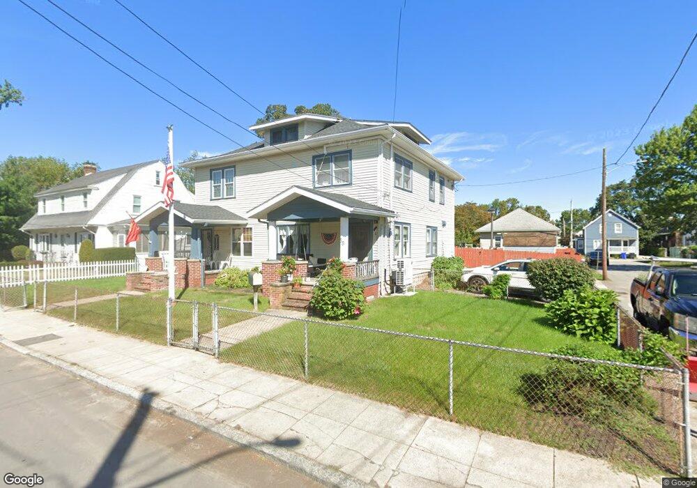
35 Oak Ave Unit 37 Riverside, RI 02915
Riverside NeighborhoodEstimated Value: $539,000 - $588,000
6
Beds
4
Baths
4,212
Sq Ft
$132/Sq Ft
Est. Value
About This Home
This home is located at 35 Oak Ave Unit 37, Riverside, RI 02915 and is currently estimated at $557,018, approximately $132 per square foot. 35 Oak Ave Unit 37 is a home located in Providence County with nearby schools including East Providence High School, St Mary Academy-Bay View, and St Luke Elementary School.
Ownership History
Date
Name
Owned For
Owner Type
Purchase Details
Closed on
Jan 15, 2025
Sold by
Carter Joseph C
Bought by
Carter Ft and Carter
Current Estimated Value
Purchase Details
Closed on
Jun 28, 2019
Sold by
Carter Patrick C and Carter Elizabeth C
Bought by
Carter Joseph C
Home Financials for this Owner
Home Financials are based on the most recent Mortgage that was taken out on this home.
Original Mortgage
$254,353
Interest Rate
4%
Mortgage Type
FHA
Purchase Details
Closed on
Jun 12, 2019
Sold by
Carter Joseph C
Bought by
Carter Patrick C
Home Financials for this Owner
Home Financials are based on the most recent Mortgage that was taken out on this home.
Original Mortgage
$254,353
Interest Rate
4%
Mortgage Type
FHA
Create a Home Valuation Report for This Property
The Home Valuation Report is an in-depth analysis detailing your home's value as well as a comparison with similar homes in the area
Home Values in the Area
Average Home Value in this Area
Purchase History
| Date | Buyer | Sale Price | Title Company |
|---|---|---|---|
| Carter Ft | -- | None Available | |
| Carter Ft | -- | None Available | |
| Carter Joseph C | $249,000 | -- | |
| Carter Joseph C | $249,000 | -- | |
| Carter Joseph C | $249,000 | -- | |
| Carter Patrick C | -- | -- | |
| Carter Patrick C | -- | -- | |
| Carter Patrick C | -- | -- |
Source: Public Records
Mortgage History
| Date | Status | Borrower | Loan Amount |
|---|---|---|---|
| Previous Owner | Carter Joseph C | $254,353 |
Source: Public Records
Tax History Compared to Growth
Tax History
| Year | Tax Paid | Tax Assessment Tax Assessment Total Assessment is a certain percentage of the fair market value that is determined by local assessors to be the total taxable value of land and additions on the property. | Land | Improvement |
|---|---|---|---|---|
| 2025 | $8,439 | $645,700 | $100,200 | $545,500 |
| 2024 | $6,555 | $427,600 | $83,500 | $344,100 |
| 2023 | $6,311 | $427,600 | $83,500 | $344,100 |
| 2022 | $5,719 | $261,600 | $57,500 | $204,100 |
| 2021 | $5,624 | $261,600 | $55,700 | $205,900 |
| 2020 | $5,386 | $261,600 | $55,700 | $205,900 |
| 2019 | $5,237 | $261,600 | $55,700 | $205,900 |
| 2018 | $5,178 | $226,300 | $56,100 | $170,200 |
| 2017 | $5,062 | $226,300 | $56,100 | $170,200 |
| 2016 | $5,037 | $226,300 | $56,100 | $170,200 |
| 2015 | $5,070 | $220,900 | $57,100 | $163,800 |
| 2014 | $5,070 | $220,900 | $57,100 | $163,800 |
Source: Public Records
Map
Nearby Homes
- 33 Pine St Unit 35
- 1 Holly St
- 27 Holly St
- 72 Stowe Ave
- 35 E Knowlton St
- 129 Shore Rd
- 25 Arnold St
- 151 Willett Ave Unit 2
- 151 Willett Ave Unit 5
- 25 Elinora St
- 43 Bullocks Point Ave Unit 4A
- 25 Bullocks Point Ave Unit 5C
- 41 White Ave
- 6 Fuller Ave
- 6 Meadowcrest Dr
- 32 Woodbine St
- 25 Winslow St
- 36 Woodbine St
- 3421 Pawtucket Ave
- 26 Glen St