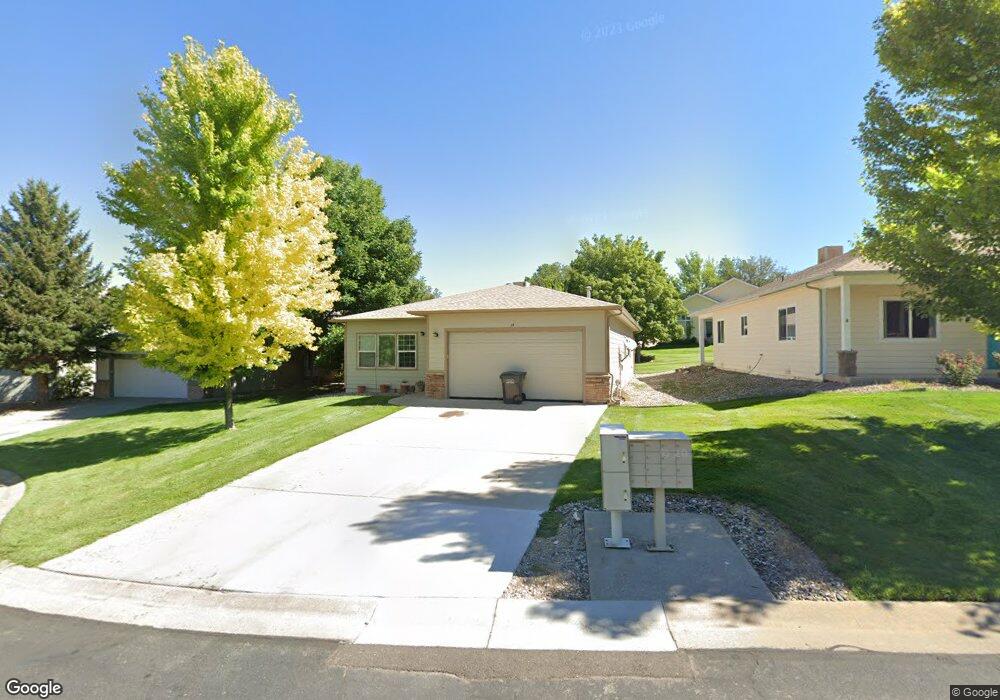
35 Poppy Ct Parachute, CO 81635
Estimated Value: $330,000 - $401,000
3
Beds
2
Baths
1,532
Sq Ft
$238/Sq Ft
Est. Value
About This Home
This home is located at 35 Poppy Ct, Parachute, CO 81635 and is currently estimated at $365,186, approximately $238 per square foot. 35 Poppy Ct is a home located in Garfield County with nearby schools including Bea Underwood Elementary School, Grand Valley Middle School, and Grand Valley High School.
Ownership History
Date
Name
Owned For
Owner Type
Purchase Details
Closed on
Dec 17, 2021
Sold by
Kozuch Mark D
Bought by
Kozuch Mark D and Kozuch Stephanie L
Current Estimated Value
Purchase Details
Closed on
Dec 7, 2011
Sold by
Fannie Mae
Bought by
Kozuch Mark D
Home Financials for this Owner
Home Financials are based on the most recent Mortgage that was taken out on this home.
Original Mortgage
$56,250
Interest Rate
4.14%
Mortgage Type
Purchase Money Mortgage
Purchase Details
Closed on
Jul 15, 2010
Sold by
Strudley William and Strudley Beth
Bought by
Federal National Mortgage Association
Purchase Details
Closed on
Aug 13, 2007
Sold by
Accord Development Inc
Bought by
Strudley William and Strudley Beth
Home Financials for this Owner
Home Financials are based on the most recent Mortgage that was taken out on this home.
Original Mortgage
$198,000
Interest Rate
6.64%
Mortgage Type
Purchase Money Mortgage
Create a Home Valuation Report for This Property
The Home Valuation Report is an in-depth analysis detailing your home's value as well as a comparison with similar homes in the area
Home Values in the Area
Average Home Value in this Area
Purchase History
| Date | Buyer | Sale Price | Title Company |
|---|---|---|---|
| Kozuch Mark D | -- | None Available | |
| Kozuch Mark D | $75,000 | Cat | |
| Federal National Mortgage Association | -- | None Available | |
| Strudley William | $247,500 | None Available |
Source: Public Records
Mortgage History
| Date | Status | Borrower | Loan Amount |
|---|---|---|---|
| Closed | Kozuch Mark D | $56,250 | |
| Previous Owner | Strudley William | $198,000 |
Source: Public Records
Tax History Compared to Growth
Tax History
| Year | Tax Paid | Tax Assessment Tax Assessment Total Assessment is a certain percentage of the fair market value that is determined by local assessors to be the total taxable value of land and additions on the property. | Land | Improvement |
|---|---|---|---|---|
| 2024 | $1,072 | $19,210 | $1,970 | $17,240 |
| 2023 | $1,072 | $19,210 | $1,970 | $17,240 |
| 2022 | $881 | $16,290 | $900 | $15,390 |
| 2021 | $1,021 | $16,760 | $930 | $15,830 |
| 2020 | $803 | $13,960 | $1,000 | $12,960 |
| 2019 | $745 | $13,960 | $1,000 | $12,960 |
| 2018 | $713 | $13,130 | $1,040 | $12,090 |
| 2017 | $669 | $13,130 | $1,040 | $12,090 |
| 2016 | $574 | $12,470 | $960 | $11,510 |
| 2015 | $503 | $12,470 | $960 | $11,510 |
| 2014 | $252 | $6,640 | $960 | $5,680 |
Source: Public Records
Map
Nearby Homes
- 12 Poppy Ct
- 100 Limberpine Cir
- 62 Limberpine Cir
- 190 Limberpine Cir
- 250 Limberpine Cir
- 244 Limberpine Cir
- 489 Lodgepole Cir
- 72 Juniper Ln
- 34 Columbine Ln
- 33 Angelica Cir Unit 2A
- 24 Lupine Ln
- TBD Stone Quarry Rd
- 269 Lodgepole Cir
- 13 Silver Plume Dr
- 318 Eagle Ridge Dr
- 310 Eagle Ridge Dr
- 22 Little Echo Dr
- 115 Silver Queen Cir
- 57 Little Echo Dr
- L 2 B 3 Parachute Park Blvd