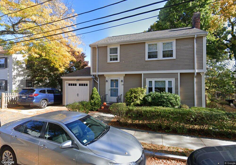
35 Range Rd Dorchester Center, MA 02124
Ashmont NeighborhoodEstimated Value: $627,000 - $793,000
3
Beds
2
Baths
1,372
Sq Ft
$509/Sq Ft
Est. Value
About This Home
This home is located at 35 Range Rd, Dorchester Center, MA 02124 and is currently estimated at $698,244, approximately $508 per square foot. 35 Range Rd is a home located in Suffolk County with nearby schools including Codman Academy Charter Public School, Conservatory Lab Upper School, and Saint John Paul II Catholic Academy.
Ownership History
Date
Name
Owned For
Owner Type
Purchase Details
Closed on
Aug 19, 2011
Sold by
Camden William H and Shea Virginia M
Bought by
Camden Marie S
Current Estimated Value
Home Financials for this Owner
Home Financials are based on the most recent Mortgage that was taken out on this home.
Original Mortgage
$51,000
Outstanding Balance
$35,394
Interest Rate
4.62%
Mortgage Type
Purchase Money Mortgage
Estimated Equity
$662,850
Create a Home Valuation Report for This Property
The Home Valuation Report is an in-depth analysis detailing your home's value as well as a comparison with similar homes in the area
Home Values in the Area
Average Home Value in this Area
Purchase History
| Date | Buyer | Sale Price | Title Company |
|---|---|---|---|
| Camden Marie S | $255,000 | -- |
Source: Public Records
Mortgage History
| Date | Status | Borrower | Loan Amount |
|---|---|---|---|
| Open | Camden Marie S | $51,000 |
Source: Public Records
Tax History Compared to Growth
Tax History
| Year | Tax Paid | Tax Assessment Tax Assessment Total Assessment is a certain percentage of the fair market value that is determined by local assessors to be the total taxable value of land and additions on the property. | Land | Improvement |
|---|---|---|---|---|
| 2025 | $5,733 | $495,100 | $227,400 | $267,700 |
| 2024 | $5,600 | $513,800 | $182,300 | $331,500 |
| 2023 | $5,156 | $480,100 | $170,300 | $309,800 |
| 2022 | $4,880 | $448,500 | $159,100 | $289,400 |
| 2021 | $4,440 | $416,100 | $151,500 | $264,600 |
| 2020 | $3,824 | $362,100 | $149,300 | $212,800 |
| 2019 | $3,575 | $339,200 | $119,800 | $219,400 |
| 2018 | $3,291 | $314,000 | $119,800 | $194,200 |
| 2017 | $3,230 | $305,000 | $119,800 | $185,200 |
| 2016 | $3,106 | $282,400 | $119,800 | $162,600 |
| 2015 | $2,717 | $224,400 | $102,800 | $121,600 |
| 2014 | $2,661 | $211,500 | $102,800 | $108,700 |
Source: Public Records
Map
Nearby Homes
- 58 Bailey St
- 1910 Dorchester Ave Unit 617
- 1910 Dorchester Ave Unit 601
- 72 Bailey St
- 13 Patterson St
- 77 Bailey St
- 2089 Dorchester Ave Unit 1
- 2089 Dorchester Ave Unit 2
- 7 Bailey St Unit 2
- 84 Bailey St
- 74 Burt St Unit 303
- 74 Burt St Unit 201
- 2 Ogden St Unit 1
- 14 Valley Rd
- 47 Roslin St Unit 1
- 37 Rangeley St
- 44 Mora St
- 157-159 Fuller St
- 27 Armandine St Unit 1
- 56 Fairmount St Unit 2
- 31 Range Rd
- 32 Mercier Ave
- 1 Regan Rd
- 23 Hurlcroft Ave Unit 25
- 28 Mercier Ave Unit 30
- 28 Mercier Ave Unit 1
- 27 Range Rd
- 40 Mercier Ave
- 19 Hurlcroft Ave Unit 21
- 2 Regan Rd
- 24 Mercier Ave Unit 26
- 39 Mercier Ave
- 35-37 Mercier Ave
- 5 Regan Rd
- 35 Mercier Ave Unit 37
- 25 Range Rd
- 31 Mercier Ave Unit 33
- 31 Mercier Ave Unit 3
- 31 Mercier Ave Unit 2
- 31 Mercier Ave Unit 1