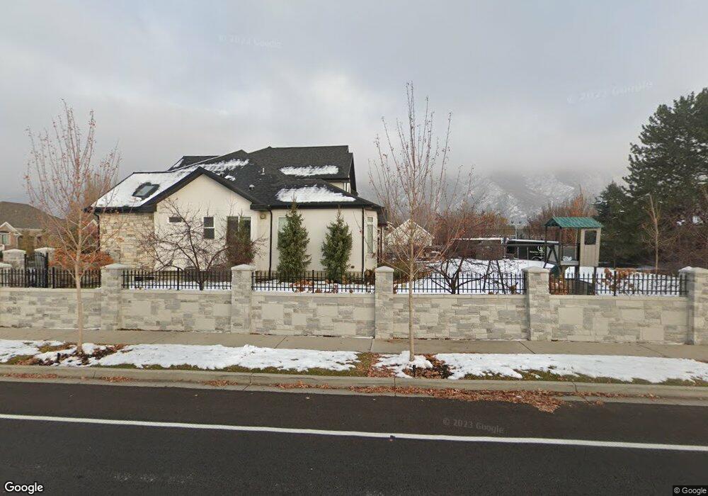
35 S 600 E Alpine, UT 84004
Estimated Value: $1,672,000 - $2,111,000
4
Beds
6
Baths
3,737
Sq Ft
$498/Sq Ft
Est. Value
About This Home
This home is located at 35 S 600 E, Alpine, UT 84004 and is currently estimated at $1,862,350, approximately $498 per square foot. 35 S 600 E is a home located in Utah County with nearby schools including Alpine School, Timberline Middle School, and Lone Peak High School.
Ownership History
Date
Name
Owned For
Owner Type
Purchase Details
Closed on
Jun 30, 2022
Sold by
Smith Matthew W
Bought by
Kitchen Jason and Kitchen Maegan
Current Estimated Value
Home Financials for this Owner
Home Financials are based on the most recent Mortgage that was taken out on this home.
Original Mortgage
$1,168,500
Outstanding Balance
$1,111,695
Interest Rate
5.09%
Mortgage Type
New Conventional
Estimated Equity
$750,655
Purchase Details
Closed on
Jul 12, 2020
Sold by
Smith Matthew Warren
Bought by
Smith Matthew Warren and Smith Whitni Skousen
Purchase Details
Closed on
Nov 5, 2015
Sold by
Conlee Stephanie
Bought by
Smith Matthew W
Home Financials for this Owner
Home Financials are based on the most recent Mortgage that was taken out on this home.
Original Mortgage
$238,500
Interest Rate
3.71%
Mortgage Type
New Conventional
Purchase Details
Closed on
Jun 14, 2013
Sold by
Bricks Holding Llc
Bought by
Conlee Stephanie
Create a Home Valuation Report for This Property
The Home Valuation Report is an in-depth analysis detailing your home's value as well as a comparison with similar homes in the area
Home Values in the Area
Average Home Value in this Area
Purchase History
| Date | Buyer | Sale Price | Title Company |
|---|---|---|---|
| Kitchen Jason | -- | None Listed On Document | |
| Kitchen Jason | -- | None Listed On Document | |
| Smith Matthew Warren | -- | None Available | |
| Smith Matthew W | -- | First American | |
| Conlee Stephanie | -- | None Available |
Source: Public Records
Mortgage History
| Date | Status | Borrower | Loan Amount |
|---|---|---|---|
| Open | Kitchen Jason | $1,168,500 | |
| Closed | Kitchen Jason | $1,168,500 | |
| Previous Owner | Smith Matthew W | $238,500 |
Source: Public Records
Tax History
| Year | Tax Paid | Tax Assessment Tax Assessment Total Assessment is a certain percentage of the fair market value that is determined by local assessors to be the total taxable value of land and additions on the property. | Land | Improvement |
|---|---|---|---|---|
| 2025 | $7,761 | $1,063,150 | -- | -- |
| 2024 | $7,761 | $904,530 | $0 | $0 |
| 2023 | $7,025 | $879,065 | $0 | $0 |
| 2022 | $6,323 | $768,405 | $0 | $0 |
| 2021 | $5,854 | $1,105,000 | $291,200 | $813,800 |
| 2020 | $5,751 | $1,062,500 | $264,700 | $797,800 |
| 2019 | $5,110 | $985,500 | $264,700 | $720,800 |
| 2018 | $4,616 | $879,500 | $235,300 | $644,200 |
| 2017 | $4,401 | $446,270 | $0 | $0 |
| 2016 | $2,489 | $235,300 | $0 | $0 |
| 2015 | $2,208 | $197,500 | $0 | $0 |
| 2014 | $1,995 | $176,500 | $0 | $0 |
Source: Public Records
Map
Nearby Homes
- 887 E Village Way
- 202 E Alpine Dr
- 499 E 300 N
- 1063 E Alpine Dr
- 1103 E Lone Peak Dr
- 48 N 100 E
- 475 Grove Dr
- 1201 E Preston Dr
- 30 S Main St
- 250 S Main St Unit 25
- 250 S Main St Unit 9
- 250 S Main St Unit 7
- 1296 Oakwood Cir
- 596 S Cascade Ct
- 76 N Bald Mountain Dr
- 151 Glacier Lily Dr
- 196 Holly Dr
- 512 Eastridge Cir
- 259 Twin River Loop
- 248 Deerfield Dr
Your Personal Tour Guide
Ask me questions while you tour the home.