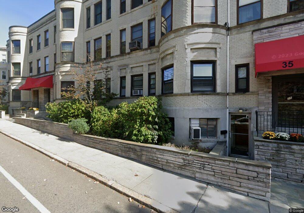
35 Saint Paul St Unit G1 Brookline, MA 02446
Coolidge Corner NeighborhoodEstimated Value: $663,000 - $972,000
2
Beds
2
Baths
945
Sq Ft
$838/Sq Ft
Est. Value
About This Home
This home is located at 35 Saint Paul St Unit G1, Brookline, MA 02446 and is currently estimated at $791,583, approximately $837 per square foot. 35 Saint Paul St Unit G1 is a home located in Norfolk County with nearby schools including Pierce School, Brookline High School, and St. Mary of the Assumption Elementary School.
Ownership History
Date
Name
Owned For
Owner Type
Purchase Details
Closed on
Sep 17, 2018
Sold by
Valentia Batalov
Bought by
Qiu Chenxi and Liu Yu
Current Estimated Value
Home Financials for this Owner
Home Financials are based on the most recent Mortgage that was taken out on this home.
Original Mortgage
$229,500
Outstanding Balance
$200,156
Interest Rate
4.6%
Estimated Equity
$591,427
Purchase Details
Closed on
Jul 15, 2016
Sold by
Pliskin Joseph and Pliskin Nava
Bought by
Pliskin Joseph
Purchase Details
Closed on
Sep 4, 1981
Bought by
Plisken Joseph and Plisken Nava
Create a Home Valuation Report for This Property
The Home Valuation Report is an in-depth analysis detailing your home's value as well as a comparison with similar homes in the area
Home Values in the Area
Average Home Value in this Area
Purchase History
| Date | Buyer | Sale Price | Title Company |
|---|---|---|---|
| Qiu Chenxi | $620,000 | -- | |
| Pliskin Joseph | -- | -- | |
| Plisken Joseph | $56,000 | -- |
Source: Public Records
Mortgage History
| Date | Status | Borrower | Loan Amount |
|---|---|---|---|
| Open | Plisken Joseph | $229,500 | |
| Closed | Plisken Joseph | -- | |
| Previous Owner | Plisken Joseph | $109,000 |
Source: Public Records
Tax History Compared to Growth
Tax History
| Year | Tax Paid | Tax Assessment Tax Assessment Total Assessment is a certain percentage of the fair market value that is determined by local assessors to be the total taxable value of land and additions on the property. | Land | Improvement |
|---|---|---|---|---|
| 2025 | $5,825 | $590,200 | $0 | $590,200 |
| 2024 | $5,653 | $578,600 | $0 | $578,600 |
| 2023 | $5,928 | $594,600 | $0 | $594,600 |
| 2022 | $5,941 | $583,000 | $0 | $583,000 |
| 2021 | $5,657 | $577,200 | $0 | $577,200 |
| 2020 | $5,401 | $571,500 | $0 | $571,500 |
| 2019 | $5,100 | $544,300 | $0 | $544,300 |
| 2018 | $4,822 | $509,700 | $0 | $509,700 |
| 2017 | $4,662 | $471,900 | $0 | $471,900 |
| 2016 | $4,470 | $429,000 | $0 | $429,000 |
| 2015 | $4,165 | $390,000 | $0 | $390,000 |
| 2014 | $3,835 | $336,700 | $0 | $336,700 |
Source: Public Records
Map
Nearby Homes
- 37 Saint Paul St Unit 3
- 57 Saint Paul St Unit 19
- 64 Aspinwall Ave Unit 1
- 157 Aspinwall Ave
- 106 Brook St
- 120 Brook St Unit 1
- 98 Saint Paul St Unit A1
- 65 Francis St Unit 65
- 181 Harvard St
- 6 Perry St Unit 6
- 114 Saint Paul St Unit 5
- 55 Harrison St Unit 2
- 45 Longwood Ave Unit 812
- 45 Longwood Ave Unit PHA
- 45 Longwood Ave Unit 212
- 19 Harris St Unit 2
- 5 Auburn Ct Unit 1
- 60 Longwood Ave Unit 403
- 60 Longwood Ave Unit 802
- 60 Longwood Ave Unit 301
- 35 Saint Paul St Unit 6
- 35 Saint Paul St Unit 5
- 35 Saint Paul St Unit 4
- 35 Saint Paul St Unit 3
- 35 Saint Paul St Unit 2
- 35 Saint Paul St Unit 1
- 35 Saint Paul St Unit 35
- 35 Saint Paul St
- 35 Saint Paul St Unit 430
- 35 Saint Paul St Unit 429
- 35 Saint Paul St Unit 428
- 35 Saint Paul St Unit 427
- 35 Saint Paul St Unit 426
- 35 Saint Paul St Unit 425
- 35 Saint Paul St Unit 421
- 35 Saint Paul St Unit 418
- 35 Saint Paul St Unit 311
- 35 Saint Paul St Unit 417
- 35 Saint Paul St Unit 309
- 35 St Paul St Unit 2, 35