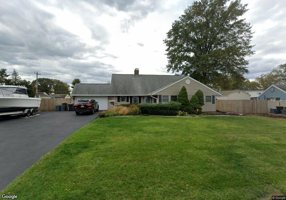
35 Smoketree Rd Levittown, PA 19056
Snowball Gate NeighborhoodEstimated Value: $485,937 - $533,000
3
Beds
2
Baths
2,125
Sq Ft
$240/Sq Ft
Est. Value
About This Home
This home is located at 35 Smoketree Rd, Levittown, PA 19056 and is currently estimated at $510,984, approximately $240 per square foot. 35 Smoketree Rd is a home located in Bucks County with nearby schools including Albert Schweitzer Elementary School, Sandburg Middle School, and Neshaminy High School.
Ownership History
Date
Name
Owned For
Owner Type
Purchase Details
Closed on
Aug 15, 2003
Sold by
Tanzillo Anthony and Tanzillo Tara
Bought by
Mcveigh John J and Mcveigh Jeanette A
Current Estimated Value
Home Financials for this Owner
Home Financials are based on the most recent Mortgage that was taken out on this home.
Original Mortgage
$211,900
Interest Rate
6.35%
Mortgage Type
Purchase Money Mortgage
Purchase Details
Closed on
May 23, 1996
Sold by
Tonkinson Thomas A and Tonkinson Lois M
Bought by
Tanzillo Anthony and Tanzillo Tara
Home Financials for this Owner
Home Financials are based on the most recent Mortgage that was taken out on this home.
Original Mortgage
$133,600
Interest Rate
7.89%
Create a Home Valuation Report for This Property
The Home Valuation Report is an in-depth analysis detailing your home's value as well as a comparison with similar homes in the area
Home Values in the Area
Average Home Value in this Area
Purchase History
| Date | Buyer | Sale Price | Title Company |
|---|---|---|---|
| Mcveigh John J | $264,900 | -- | |
| Tanzillo Anthony | $140,650 | Lawyers Title Insurance Corp |
Source: Public Records
Mortgage History
| Date | Status | Borrower | Loan Amount |
|---|---|---|---|
| Previous Owner | Mcveigh John J | $211,900 | |
| Previous Owner | Tanzillo Anthony | $133,600 | |
| Closed | Mcveigh John J | $39,735 |
Source: Public Records
Tax History Compared to Growth
Tax History
| Year | Tax Paid | Tax Assessment Tax Assessment Total Assessment is a certain percentage of the fair market value that is determined by local assessors to be the total taxable value of land and additions on the property. | Land | Improvement |
|---|---|---|---|---|
| 2025 | $5,747 | $26,400 | $6,080 | $20,320 |
| 2024 | $5,747 | $26,400 | $6,080 | $20,320 |
| 2023 | $5,656 | $26,400 | $6,080 | $20,320 |
| 2022 | $5,508 | $26,400 | $6,080 | $20,320 |
| 2021 | $5,508 | $26,400 | $6,080 | $20,320 |
| 2020 | $5,442 | $26,400 | $6,080 | $20,320 |
| 2019 | $5,320 | $26,400 | $6,080 | $20,320 |
| 2018 | $5,222 | $26,400 | $6,080 | $20,320 |
| 2017 | $5,089 | $26,400 | $6,080 | $20,320 |
| 2016 | $5,089 | $26,400 | $6,080 | $20,320 |
| 2015 | $5,278 | $26,400 | $6,080 | $20,320 |
| 2014 | $5,278 | $26,400 | $6,080 | $20,320 |
Source: Public Records
Map
Nearby Homes
- 33 Red Rose Way
- 94 Juniper Dr
- 301 Snowball Dr
- 283 Snowball Dr
- 7 Canal Rd
- L:070 Trenton Rd
- 14 Cleft Rock Rd
- 28 Cloister Rd
- 23 Crystal Place
- 46 Hydrangea Rd
- 19 Cobalt Ridge Dr N
- 43 Petunia Rd
- 212 Plumbridge Dr
- 0 Fir Ave
- 62 Indian Creek Dr
- 14 Harp Rd
- 35 Parkside Cir
- 18 Harvest Rd
- 114 Nursery Ave
- 26 Queen Lily Rd
- 31 Smoketree Rd
- 28 Steeplebush Rd
- 34 Steeplebush Rd
- 36 Smoketree Rd
- 32 Smoketree Rd
- 22 Steeplebush Rd
- 38 Steeplebush Rd
- 23 Smoketree Rd
- 43 Smoketree Rd
- 26 Smoketree Rd
- 44 Smoketree Rd
- 46 Steeplebush Rd
- 33 Steeplebush Rd
- 27 Steeplebush Rd
- 37 Steeplebush Rd
- 39 Sugarplum Rd
- 17 Smoketree Rd
- 22 Smoketree Rd
- 49 Smoketree Rd
- 33 Sugarplum Rd