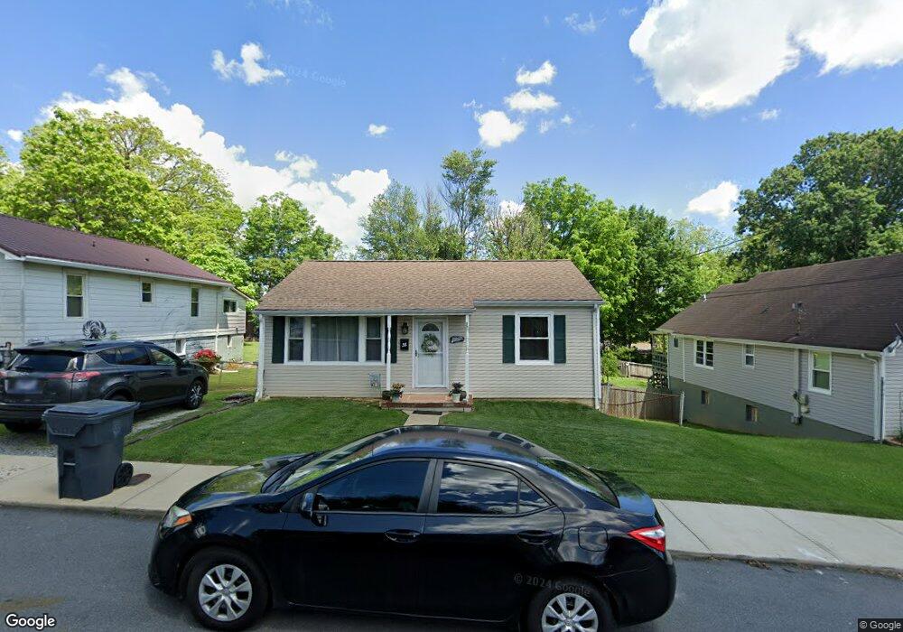
35 W 22nd Bristol, TN 37620
Estimated Value: $128,676 - $179,000
3
Beds
1
Bath
1,161
Sq Ft
$135/Sq Ft
Est. Value
About This Home
This home is located at 35 W 22nd, Bristol, TN 37620 and is currently estimated at $156,669, approximately $134 per square foot. 35 W 22nd is a home located in Sullivan County with nearby schools including Anderson Elementary School, Vance Middle School, and Tennessee High School.
Ownership History
Date
Name
Owned For
Owner Type
Purchase Details
Closed on
Jul 22, 2005
Sold by
Matthew Thomas William
Bought by
Murphy White
Current Estimated Value
Home Financials for this Owner
Home Financials are based on the most recent Mortgage that was taken out on this home.
Original Mortgage
$65,920
Outstanding Balance
$34,077
Interest Rate
5.51%
Estimated Equity
$122,592
Purchase Details
Closed on
Jun 16, 1994
Purchase Details
Closed on
Apr 9, 1991
Create a Home Valuation Report for This Property
The Home Valuation Report is an in-depth analysis detailing your home's value as well as a comparison with similar homes in the area
Home Values in the Area
Average Home Value in this Area
Purchase History
| Date | Buyer | Sale Price | Title Company |
|---|---|---|---|
| Murphy White | $64,000 | -- | |
| -- | $41,500 | -- | |
| -- | $38,000 | -- |
Source: Public Records
Mortgage History
| Date | Status | Borrower | Loan Amount |
|---|---|---|---|
| Open | -- | $65,920 |
Source: Public Records
Tax History Compared to Growth
Tax History
| Year | Tax Paid | Tax Assessment Tax Assessment Total Assessment is a certain percentage of the fair market value that is determined by local assessors to be the total taxable value of land and additions on the property. | Land | Improvement |
|---|---|---|---|---|
| 2024 | -- | $18,175 | $1,675 | $16,500 |
| 2023 | $798 | $18,175 | $1,675 | $16,500 |
| 2022 | $798 | $18,175 | $1,675 | $16,500 |
| 2021 | $798 | $18,175 | $1,675 | $16,500 |
| 2020 | $825 | $18,175 | $1,675 | $16,500 |
| 2019 | $825 | $17,425 | $1,675 | $15,750 |
| 2018 | $821 | $17,425 | $1,675 | $15,750 |
| 2017 | $821 | $17,425 | $1,675 | $15,750 |
| 2016 | $649 | $13,450 | $1,675 | $11,775 |
| 2014 | $612 | $13,443 | $0 | $0 |
Source: Public Records
Map
Nearby Homes
- 2228 Bay St
- 2000 Euclid Ave
- 000 Hemlock Dr
- 1614 Broad St
- 2177 Randolph St
- 1057 Moorland Ave
- 60 Peters St
- 2121 2123 Randolph St
- 2412,14,16 Bradley St
- 2400 Bradley St
- 2241 Bradley St
- 460 Vance St
- 1724 & 1728 Euclid Ave
- 2461 Bradley St
- 728 Randolph St
- 2413 Catherine St
- 548 Floyd St
- Tbd Clifton Rd
- 401 Crockett St
- 420 Douglas St