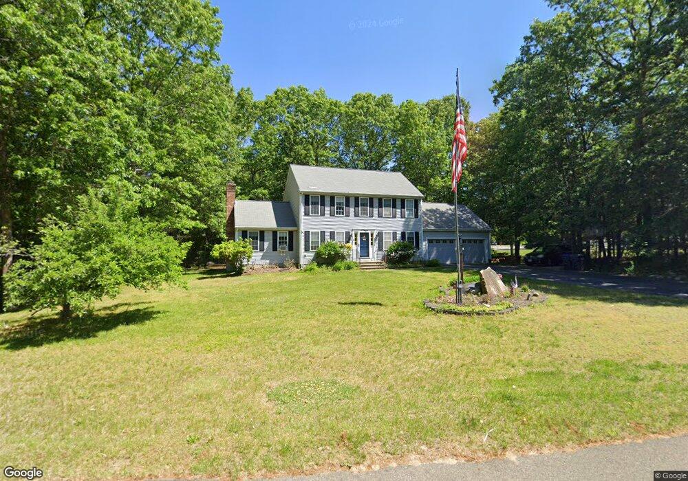
35 Willow Ln Uxbridge, MA 01569
Estimated Value: $599,000 - $703,000
3
Beds
3
Baths
1,896
Sq Ft
$334/Sq Ft
Est. Value
About This Home
This home is located at 35 Willow Ln, Uxbridge, MA 01569 and is currently estimated at $633,315, approximately $334 per square foot. 35 Willow Ln is a home located in Worcester County with nearby schools including Uxbridge High School, Our Lady of the Valley Regional School, and Whitinsville Christian School.
Ownership History
Date
Name
Owned For
Owner Type
Purchase Details
Closed on
Jun 2, 1999
Sold by
John W Audet Inc
Bought by
Jones Michael F and Jones Carla A
Current Estimated Value
Purchase Details
Closed on
Aug 30, 1993
Sold by
Dkm Building Enterp
Bought by
Jones Michael F and Jones Carla A
Create a Home Valuation Report for This Property
The Home Valuation Report is an in-depth analysis detailing your home's value as well as a comparison with similar homes in the area
Home Values in the Area
Average Home Value in this Area
Purchase History
| Date | Buyer | Sale Price | Title Company |
|---|---|---|---|
| Jones Michael F | $212,320 | -- | |
| Jones Michael F | $117,000 | -- |
Source: Public Records
Mortgage History
| Date | Status | Borrower | Loan Amount |
|---|---|---|---|
| Open | Jones Michael F | $274,933 | |
| Closed | Jones Michael F | $273,108 | |
| Closed | Jones Michael F | $268,620 |
Source: Public Records
Tax History
| Year | Tax Paid | Tax Assessment Tax Assessment Total Assessment is a certain percentage of the fair market value that is determined by local assessors to be the total taxable value of land and additions on the property. | Land | Improvement |
|---|---|---|---|---|
| 2025 | $6,880 | $524,800 | $153,200 | $371,600 |
| 2024 | $6,525 | $505,000 | $145,400 | $359,600 |
| 2023 | $6,223 | $446,100 | $125,700 | $320,400 |
| 2022 | $5,635 | $371,700 | $110,000 | $261,700 |
| 2021 | $5,880 | $371,700 | $110,000 | $261,700 |
| 2020 | $6,184 | $369,400 | $117,800 | $251,600 |
| 2019 | $6,333 | $365,000 | $129,600 | $235,400 |
| 2018 | $6,174 | $359,600 | $129,600 | $230,000 |
| 2017 | $5,693 | $335,700 | $124,300 | $211,400 |
| 2016 | $5,478 | $311,800 | $95,200 | $216,600 |
| 2015 | $5,354 | $307,700 | $95,200 | $212,500 |
Source: Public Records
Map
Nearby Homes
- 376 Douglas St
- 61 Spring Hill Dr Unit 61
- 86 Hunter Rd
- 395 High St
- 11 Summerfield Dr Unit 11
- 145 Mantell Rd
- 5 Peter St Unit D
- 95 High St Unit C
- 79 High St
- 16 Farnum St
- 26 Rivulet St
- 35 Beverly Ave
- 197 Crownshield Ave Unit 16B
- 197 Crownshield Ave Unit 16C
- 197 Crownshield Ave Unit 16A
- 71 Rivulet St Unit B
- 12 Hartford Ave E
- 405 West St
- 138 Elm St
- 0 Homestead Ave
- 55 Willow Ln
- 16 Vine St
- 25 Willow Ln
- 26 Willow Ln
- 36 Willow Ln
- 46 Willow Ln
- 56 Willow Ln
- 20 Vine St
- 61 Willow Ln
- 16 Willow Ln
- 15 Willow Ln
- 19 Vine St
- 0 Mantell Rd Unit 37826628
- 0 Mantell Rd Unit 37826606
- 0 Mantell Rd Unit 37826586
- 0 Mantell Rd Unit 37826486
- 0 Mantell Rd Unit 37826467
- 0 Mantell Rd Unit 37826392
- 0 Mantell Rd Unit 37826283
- 96 Chamberlain Rd
Your Personal Tour Guide
Ask me questions while you tour the home.