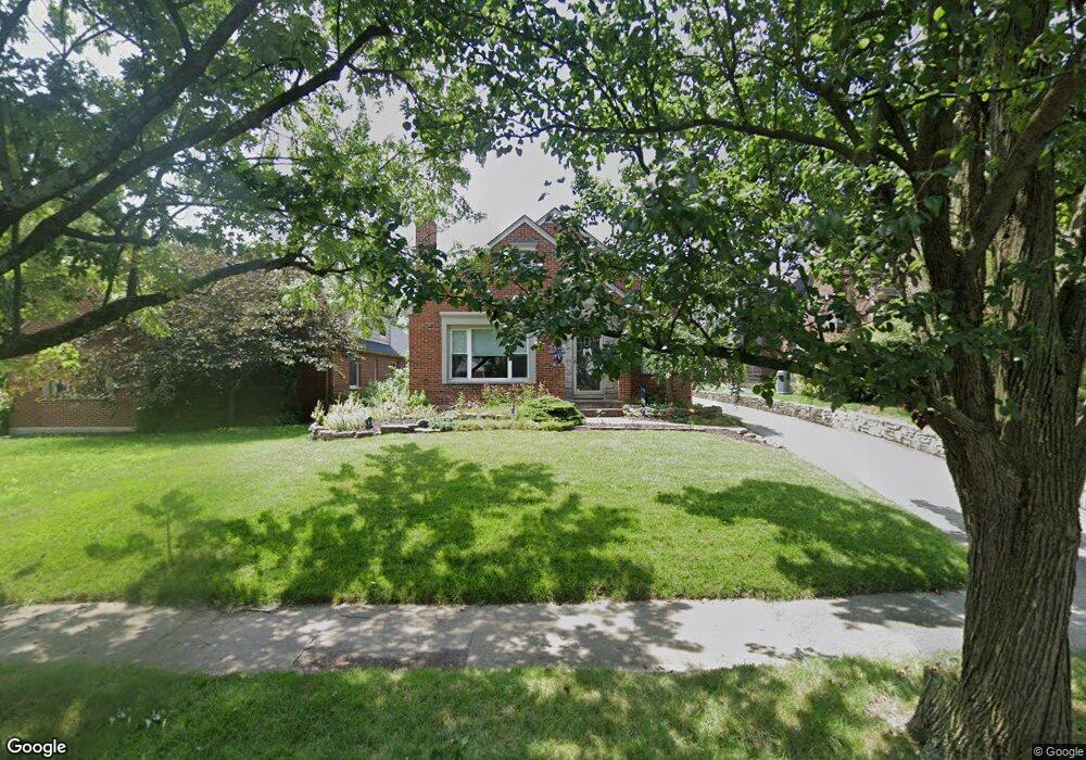
350 Greenmount Blvd Dayton, OH 45419
Estimated Value: $353,022 - $430,000
2
Beds
3
Baths
1,644
Sq Ft
$228/Sq Ft
Est. Value
About This Home
This home is located at 350 Greenmount Blvd, Dayton, OH 45419 and is currently estimated at $375,256, approximately $228 per square foot. 350 Greenmount Blvd is a home located in Montgomery County with nearby schools including Smith Elementary School, Julian & Marjorie Lange School Elementary School, and Oakwood Junior High School.
Ownership History
Date
Name
Owned For
Owner Type
Purchase Details
Closed on
Aug 1, 2007
Sold by
Rainsberger Anthony J and Knupp Shelly K
Bought by
Rainsberger Anthony J and Knupp Shelly K
Current Estimated Value
Purchase Details
Closed on
Jun 30, 2000
Sold by
Yaomin Dong
Bought by
Rainsberger Anthony J and Knupp Shelly K
Home Financials for this Owner
Home Financials are based on the most recent Mortgage that was taken out on this home.
Original Mortgage
$137,750
Interest Rate
8.64%
Create a Home Valuation Report for This Property
The Home Valuation Report is an in-depth analysis detailing your home's value as well as a comparison with similar homes in the area
Home Values in the Area
Average Home Value in this Area
Purchase History
| Date | Buyer | Sale Price | Title Company |
|---|---|---|---|
| Rainsberger Anthony J | -- | Attorney | |
| Rainsberger Anthony J | $145,000 | -- |
Source: Public Records
Mortgage History
| Date | Status | Borrower | Loan Amount |
|---|---|---|---|
| Closed | Rainsberger Anthony J | $137,750 |
Source: Public Records
Tax History Compared to Growth
Tax History
| Year | Tax Paid | Tax Assessment Tax Assessment Total Assessment is a certain percentage of the fair market value that is determined by local assessors to be the total taxable value of land and additions on the property. | Land | Improvement |
|---|---|---|---|---|
| 2024 | $7,004 | $93,730 | $27,840 | $65,890 |
| 2023 | $7,004 | $93,730 | $27,840 | $65,890 |
| 2022 | $6,502 | $72,610 | $21,580 | $51,030 |
| 2021 | $6,499 | $72,610 | $21,580 | $51,030 |
| 2020 | $6,475 | $72,610 | $21,580 | $51,030 |
| 2019 | $6,725 | $69,870 | $21,580 | $48,290 |
| 2018 | $6,190 | $69,870 | $21,580 | $48,290 |
| 2017 | $6,105 | $69,870 | $21,580 | $48,290 |
| 2016 | $5,840 | $60,730 | $21,580 | $39,150 |
| 2015 | $5,417 | $60,730 | $21,580 | $39,150 |
| 2014 | $5,417 | $60,730 | $21,580 | $39,150 |
| 2012 | -- | $61,400 | $18,730 | $42,670 |
Source: Public Records
Map
Nearby Homes
- 430 Forrer Blvd
- 1622 Shroyer Rd
- 613 Gainsborough Rd
- 332 Telford Ave
- 1809 Shroyer Rd
- 226 Telford Ave
- 334 Wiltshire Blvd
- 1305 E Schantz Ave
- 212 Wiltshire Blvd
- 1029 Tudor Rd
- 538 Wiltshire Blvd
- 233 Wisteria Dr
- 15 Lonsdale Ave
- 726 Acorn Dr
- 401 Hadley Ave
- 2004 Shroyer Rd
- 252 Hadley Ave
- 1120 Yorkshire Place
- 439 Monteray Ave
- 2119 Shroyer Rd
- 346 Greenmount Blvd
- 354 Greenmount Blvd
- 342 Greenmount Blvd
- 351 Lonsdale Ave
- 359 Lonsdale Ave
- 336 Greenmount Blvd
- 400 Greenmount Blvd
- 343 Lonsdale Ave
- 332 Greenmount Blvd
- 337 Lonsdale Ave
- 401 Lonsdale Ave
- 353 Greenmount Blvd
- 406 Greenmount Blvd
- 1321 Delaine Ave
- 343 Greenmount Blvd
- 331 Lonsdale Ave
- 407 Lonsdale Ave
- 337 Greenmount Blvd
- 401 Greenmount Blvd
- 327 Lonsdale Ave