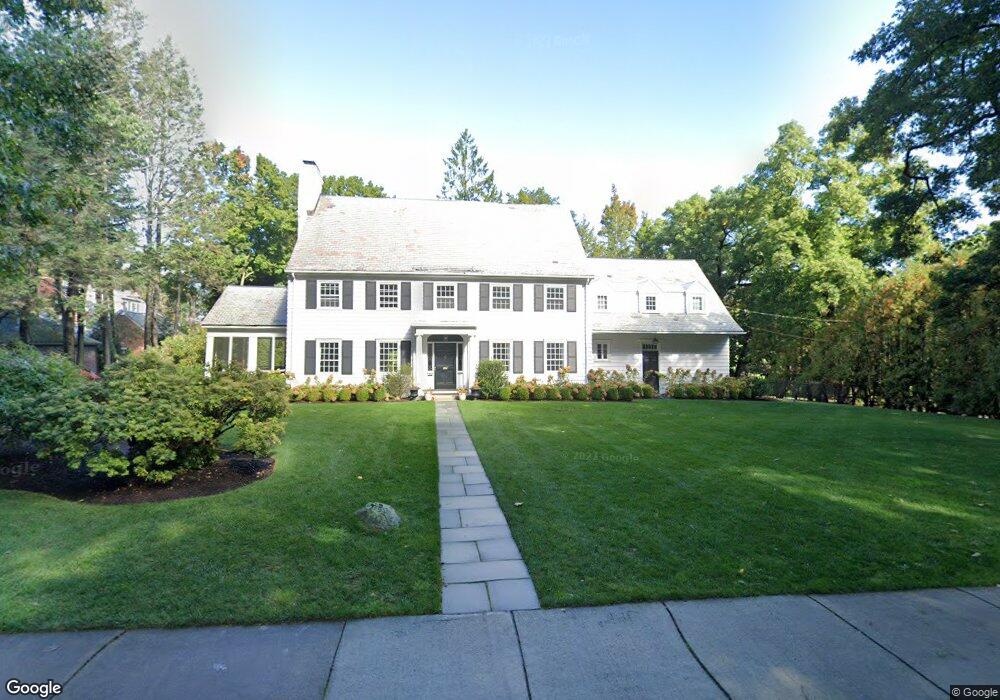
350 Highland St West Newton, MA 02465
West Newton NeighborhoodEstimated Value: $3,086,962 - $3,644,000
6
Beds
5
Baths
3,780
Sq Ft
$890/Sq Ft
Est. Value
About This Home
This home is located at 350 Highland St, West Newton, MA 02465 and is currently estimated at $3,364,991, approximately $890 per square foot. 350 Highland St is a home located in Middlesex County with nearby schools including Peirce Elementary School, F.A. Day Middle School, and Newton North High School.
Ownership History
Date
Name
Owned For
Owner Type
Purchase Details
Closed on
Oct 7, 2021
Sold by
Bresnahan David J and Bresnahan
Bought by
D J Bresnahan 2016 Ret and Bresnahan
Current Estimated Value
Home Financials for this Owner
Home Financials are based on the most recent Mortgage that was taken out on this home.
Original Mortgage
$636,150
Outstanding Balance
$572,890
Interest Rate
2.13%
Mortgage Type
Adjustable Rate Mortgage/ARM
Estimated Equity
$2,792,101
Purchase Details
Closed on
Apr 29, 2016
Sold by
Kelley Edward C and Kelley Mary E
Bought by
David J Bresnahan Ret
Home Financials for this Owner
Home Financials are based on the most recent Mortgage that was taken out on this home.
Original Mortgage
$600,000
Interest Rate
2%
Mortgage Type
Unknown
Create a Home Valuation Report for This Property
The Home Valuation Report is an in-depth analysis detailing your home's value as well as a comparison with similar homes in the area
Home Values in the Area
Average Home Value in this Area
Purchase History
| Date | Buyer | Sale Price | Title Company |
|---|---|---|---|
| D J Bresnahan 2016 Ret | -- | None Available | |
| D J Bresnahan 2016 Ret | -- | None Available | |
| Bresnaham David J | -- | None Available | |
| David J Bresnahan Ret | $2,250,000 | -- |
Source: Public Records
Mortgage History
| Date | Status | Borrower | Loan Amount |
|---|---|---|---|
| Open | D J Bresnahan 2016 Ret | $636,150 | |
| Closed | D J Bresnahan 2016 Ret | $636,150 | |
| Previous Owner | David J Bresnahan Ret | $600,000 |
Source: Public Records
Tax History Compared to Growth
Tax History
| Year | Tax Paid | Tax Assessment Tax Assessment Total Assessment is a certain percentage of the fair market value that is determined by local assessors to be the total taxable value of land and additions on the property. | Land | Improvement |
|---|---|---|---|---|
| 2025 | $32,331 | $3,299,100 | $1,512,100 | $1,787,000 |
| 2024 | $31,261 | $3,203,000 | $1,468,100 | $1,734,900 |
| 2023 | $29,927 | $2,939,800 | $1,168,900 | $1,770,900 |
| 2022 | $28,635 | $2,722,000 | $1,082,300 | $1,639,700 |
| 2021 | $27,631 | $2,567,900 | $1,021,000 | $1,546,900 |
| 2020 | $26,809 | $2,567,900 | $1,021,000 | $1,546,900 |
| 2019 | $26,053 | $2,493,100 | $991,300 | $1,501,800 |
| 2018 | $24,858 | $2,297,400 | $883,000 | $1,414,400 |
| 2017 | $18,477 | $1,661,600 | $833,000 | $828,600 |
| 2016 | $16,018 | $1,407,600 | $778,500 | $629,100 |
| 2015 | $15,273 | $1,315,500 | $727,600 | $587,900 |
Source: Public Records
Map
Nearby Homes
- 70 Bigelow Rd
- 4 Hosmer Cir
- 140 Mount Vernon St
- 33 Birch Hill Rd
- 39 Valentine Park
- 123 Mount Vernon St Unit 2
- 20 Birch Hill Rd
- 318 Austin St Unit A
- 308 Prince St
- 46 Ellis Rd
- 222 Prince St
- 12 Wiswall St
- 4 Wiswall St
- 279 Chestnut St
- 154 Beaumont Ave
- 79 Chestnut St Unit 2
- 27 Cross St Unit 27
- 1230 Commonwealth Ave
- 61 Lakeview Ave
- 18 Sewall St
- 133 Forest Ave
- 56 Somerset Rd
- 146 Forest Ave
- 46 Somerset Rd
- 138 Forest Ave
- 161 Forest Ave
- 343 Highland St
- 363 Highland St
- 130 Forest Ave
- 121 Forest Ave
- 8 Sylvan Ave
- 325 Highland Ave
- 374 Highland St
- 34 Somerset Rd
- 326 Highland St
- 29 Leonard Ave
- 371 Highland St
- 170 Forest Ave
- 120 Forest Ave
- 14 Sylvan Ave