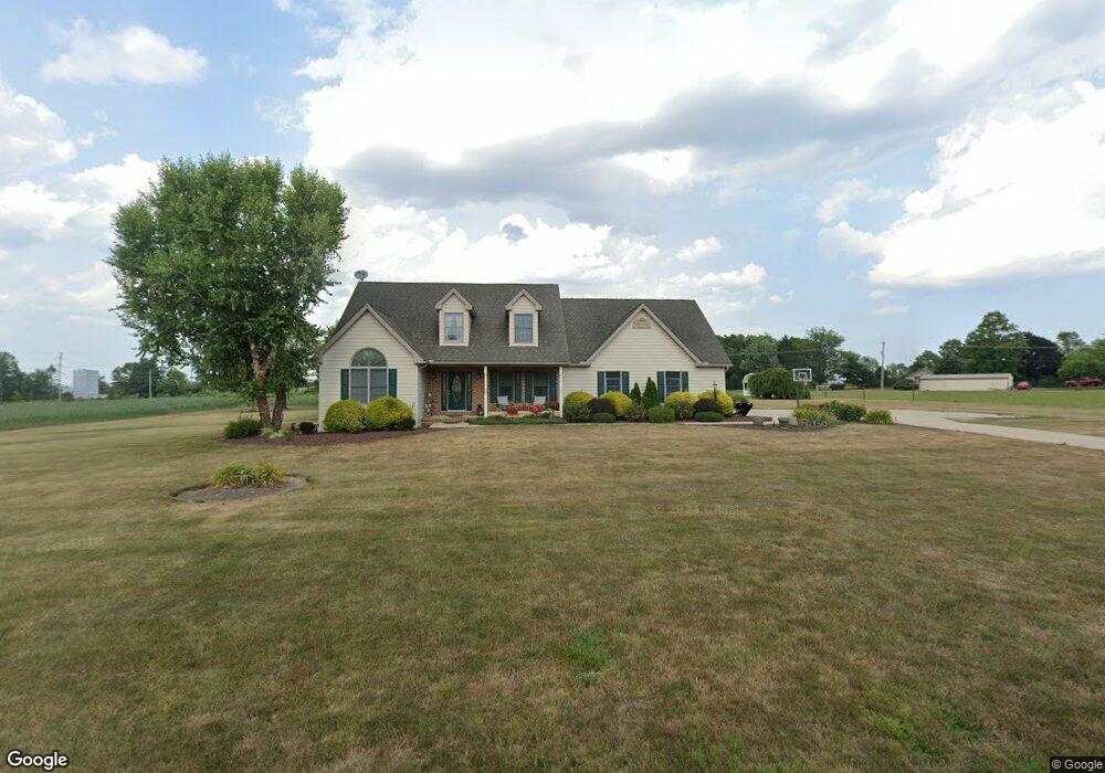
350 Locust Ln Unit 2 Abbottstown, PA 17301
Estimated Value: $430,000 - $547,000
4
Beds
4
Baths
2,643
Sq Ft
$190/Sq Ft
Est. Value
About This Home
This home is located at 350 Locust Ln Unit 2, Abbottstown, PA 17301 and is currently estimated at $501,787, approximately $189 per square foot. 350 Locust Ln Unit 2 is a home located in Adams County with nearby schools including New Oxford Senior High School and Paradise School.
Ownership History
Date
Name
Owned For
Owner Type
Purchase Details
Closed on
Nov 20, 2009
Sold by
Furr Karl D and Furr Lisa E
Bought by
Still David K and Still Amy L
Current Estimated Value
Home Financials for this Owner
Home Financials are based on the most recent Mortgage that was taken out on this home.
Original Mortgage
$225,000
Outstanding Balance
$146,991
Interest Rate
5.01%
Mortgage Type
New Conventional
Estimated Equity
$354,796
Create a Home Valuation Report for This Property
The Home Valuation Report is an in-depth analysis detailing your home's value as well as a comparison with similar homes in the area
Home Values in the Area
Average Home Value in this Area
Purchase History
| Date | Buyer | Sale Price | Title Company |
|---|---|---|---|
| Still David K | $315,000 | -- |
Source: Public Records
Mortgage History
| Date | Status | Borrower | Loan Amount |
|---|---|---|---|
| Open | Still David K | $225,000 |
Source: Public Records
Tax History Compared to Growth
Tax History
| Year | Tax Paid | Tax Assessment Tax Assessment Total Assessment is a certain percentage of the fair market value that is determined by local assessors to be the total taxable value of land and additions on the property. | Land | Improvement |
|---|---|---|---|---|
| 2025 | $7,411 | $326,900 | $74,100 | $252,800 |
| 2024 | $6,814 | $326,900 | $74,100 | $252,800 |
| 2023 | $6,547 | $326,900 | $74,100 | $252,800 |
| 2022 | $6,062 | $312,900 | $74,100 | $238,800 |
| 2021 | $5,897 | $312,900 | $74,100 | $238,800 |
| 2020 | $5,749 | $312,900 | $74,100 | $238,800 |
| 2019 | $5,623 | $312,900 | $74,100 | $238,800 |
| 2018 | $5,496 | $312,900 | $74,100 | $238,800 |
| 2017 | $5,253 | $312,900 | $74,100 | $238,800 |
| 2016 | -- | $312,900 | $74,100 | $238,800 |
| 2015 | -- | $312,900 | $74,100 | $238,800 |
| 2014 | -- | $312,900 | $74,100 | $238,800 |
Source: Public Records
Map
Nearby Homes
- 60 Hunters Cir Unit 19
- 278 Runaway Rd
- 484 Brough Rd
- 702 Wind In the Willows
- 334 Rolling Ln Unit 2
- 115 Creekland Dr Unit 4
- 224 W King St
- 486 W King St
- 290 Woods Rd Unit 1
- 28 Town Cir Unit 12A
- 0 Woods Rd
- 508 Beaver St
- 507 Bullet Way
- 134 Pleasant View Ct Unit 4
- 7435 Saint Patrick Ct Unit 6
- 7461 Saint Patrick Ct
- 7463 Saint Patrick Ct
- 7459 Saint Patrick Ct
- 7457 Saint Patrick Ct
- 7455 Saint Patrick Ct Unit 28
- 294 Locust Ln Unit 1
- 402 Locust Ln
- 300 Locust Ln
- 286 Locust Ln Unit 2
- 315 Locust Ln
- 385 Locust Ln Unit 3
- 92 Mummerts Church Rd
- 420 Locust Ln
- 54 Mummerts Church Rd
- 42 Mummerts Church Rd
- 440 Locust Ln Unit 2
- 249 Locust Ln
- 65 Mummerts Church Rd
- 776 Route 194 N Unit 3
- 216 Locust Ln
- 470 Locust Ln Unit 1
- 750 Route 194 N Unit 4
- 51 Mummerts Church Rd
- 65 Jefferson Dr Unit 16
- 155 Foxtown Dr Unit 12