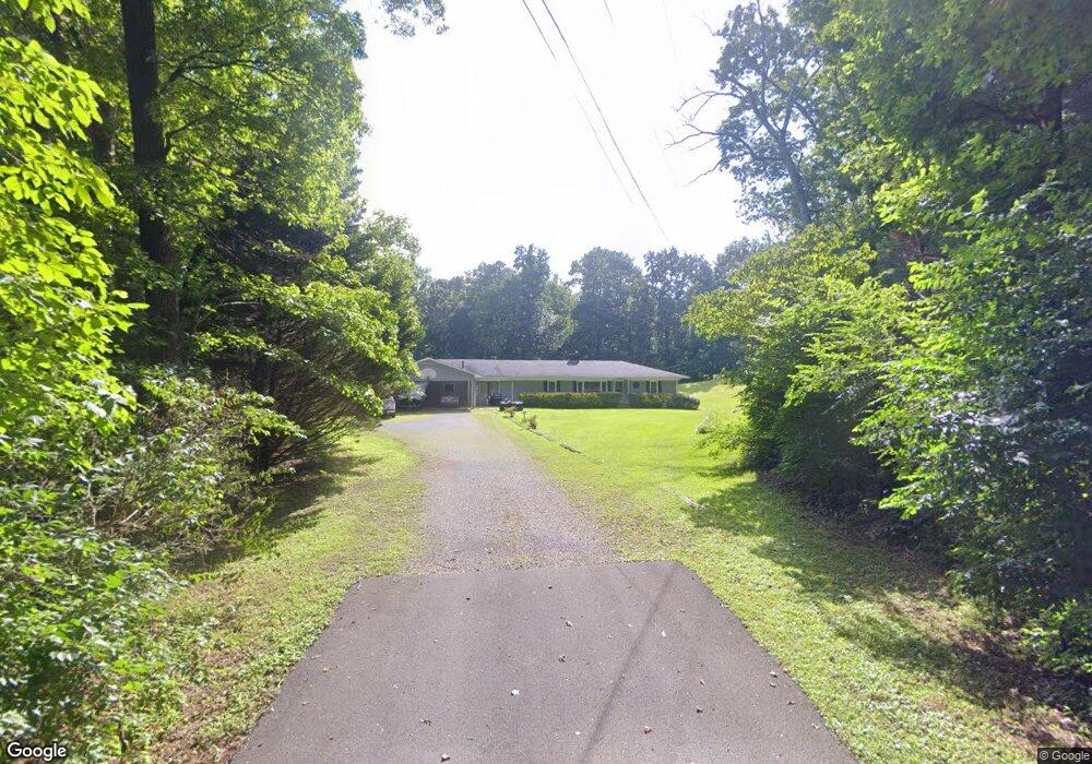
350 Southbrook Dr Jasper, GA 30143
Estimated Value: $272,000 - $373,000
Studio
3
Baths
2,152
Sq Ft
$154/Sq Ft
Est. Value
About This Home
This home is located at 350 Southbrook Dr, Jasper, GA 30143 and is currently estimated at $331,504, approximately $154 per square foot. 350 Southbrook Dr is a home located in Pickens County with nearby schools including Harmony Elementary School, Pickens County Middle School, and Pickens County High School.
Ownership History
Date
Name
Owned For
Owner Type
Purchase Details
Closed on
Jan 26, 2018
Sold by
Hill Allan Ray
Bought by
Hill Allan Ray and Hill Deborah D
Current Estimated Value
Purchase Details
Closed on
Dec 4, 1992
Bought by
Hill Allan Ray and Hill Deborah D
Purchase Details
Closed on
Sep 12, 1988
Bought by
Wigington Bob
Purchase Details
Closed on
Mar 19, 1987
Bought by
Lowe Thomas M
Purchase Details
Closed on
Feb 25, 1987
Bought by
Smith Robert
Purchase Details
Closed on
Dec 18, 1984
Bought by
Higdon Andrew
Purchase Details
Closed on
Dec 7, 1984
Bought by
Lowe Jimmy
Purchase Details
Closed on
Jan 1, 1977
Bought by
Lowe Michael
Create a Home Valuation Report for This Property
The Home Valuation Report is an in-depth analysis detailing your home's value as well as a comparison with similar homes in the area
Home Values in the Area
Average Home Value in this Area
Purchase History
| Date | Buyer | Sale Price | Title Company |
|---|---|---|---|
| Hill Allan Ray | -- | -- | |
| Hill Allan Ray | $69,900 | -- | |
| Wigington Bob | $12,000 | -- | |
| Lowe Thomas M | $9,500 | -- | |
| Smith Robert | $1,800 | -- | |
| Higdon Andrew | $5,000 | -- | |
| Lowe Jimmy | $10,000 | -- | |
| Lowe Michael | -- | -- |
Source: Public Records
Tax History
| Year | Tax Paid | Tax Assessment Tax Assessment Total Assessment is a certain percentage of the fair market value that is determined by local assessors to be the total taxable value of land and additions on the property. | Land | Improvement |
|---|---|---|---|---|
| 2025 | $1,631 | $95,791 | $18,000 | $77,791 |
| 2024 | $1,792 | $95,544 | $18,000 | $77,544 |
| 2023 | $1,841 | $95,544 | $18,000 | $77,544 |
| 2022 | $1,361 | $71,911 | $18,000 | $53,911 |
| 2021 | $980 | $49,980 | $12,000 | $37,980 |
| 2020 | $1,009 | $49,980 | $12,000 | $37,980 |
| 2019 | $1,033 | $49,980 | $12,000 | $37,980 |
| 2018 | $1,042 | $49,980 | $12,000 | $37,980 |
| 2017 | $1,059 | $49,980 | $12,000 | $37,980 |
| 2016 | $1,076 | $49,980 | $12,000 | $37,980 |
| 2015 | $1,051 | $49,980 | $12,000 | $37,980 |
| 2014 | $1,054 | $49,980 | $12,000 | $37,980 |
| 2013 | -- | $49,980 | $12,000 | $37,980 |
Source: Public Records
Map
Nearby Homes
- 12 Sammy McGhee Blvd Unit 203
- 217 Robin Rd
- 2860 Camp Rd
- 174 Golden Springs Dr
- 80 Mountain Mint Dr
- 5566 Red Fox Ln
- 0 Hunters Ridge Rd Unit 7714906
- 2668 Highland Trail
- 5574 Red Fox Ln
- 0 Hunters Ridge Rd Unit 10685847
- 280 Vistaview Pkwy
- 0 Mulberry Cir Unit 409241
- 0 Hunters Ridge Rd Unit 10685863
- 0 Hunters Ridge Rd Unit 7714898
- 00 Nector Ct
- 387 Windflower Dr
- 840 McElroy Mountain Dr
- 0 Lower Sassafras Pkwy Unit 24570415
- 279 Vistaview Pkwy
- 0 Wilderness Pkwy Unit 10703433
- 370 Southbrook Dr
- 31 W Eden Way
- 270 Southbrook Dr
- 54 E Eden Way
- 380 Southbrook Dr
- 44 W Eden Way
- 33 E Eden Way
- 58 E Eden Way
- 33 Starr Dr W
- 51 Starr Dr W
- 40 Starr Dr E
- 32 Starr Dr E
- 13N Eagles Nest Dr
- 228 Southbrook Dr
- 53 Starr Dr W
- 00 Sammy McGhee Blvd
- 40 Eastwood Cir
- 143 Southbrook Dr
- 0 Aw Lawson Blvd Unit 20013174
- W Aw Lawson Blvd
Your Personal Tour Guide
Ask me questions while you tour the home.