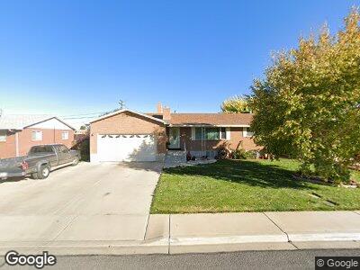
350 W 470 N Spanish Fork, UT 84660
Estimated Value: $481,000 - $503,612
5
Beds
4
Baths
1,372
Sq Ft
$359/Sq Ft
Est. Value
About This Home
This home is located at 350 W 470 N, Spanish Fork, UT 84660 and is currently estimated at $492,153, approximately $358 per square foot. 350 W 470 N is a home located in Utah County with nearby schools including Brockbank Elementary School, Spanish Fork Jr High School, and Spanish Fork High School.
Ownership History
Date
Name
Owned For
Owner Type
Purchase Details
Closed on
Mar 22, 2023
Sold by
Ford Mary Ann
Bought by
Mary Ann Ford Family Trust
Current Estimated Value
Purchase Details
Closed on
Jan 23, 2023
Sold by
James Carl W
Bought by
Ford Mary Ann
Purchase Details
Closed on
Apr 25, 2011
Sold by
Ford Mary Ann
Bought by
James Carl W
Purchase Details
Closed on
Jan 29, 2007
Sold by
James Mary Ann
Bought by
Ford Mary Ann and Ford James Carl
Create a Home Valuation Report for This Property
The Home Valuation Report is an in-depth analysis detailing your home's value as well as a comparison with similar homes in the area
Home Values in the Area
Average Home Value in this Area
Purchase History
| Date | Buyer | Sale Price | Title Company |
|---|---|---|---|
| Mary Ann Ford Family Trust | -- | Accommodation/Courtesy Recordi | |
| Ford Mary Ann | -- | Wasatch Land & Title | |
| James Carl W | -- | Bartlett Title Insurance Ag | |
| Ford Mary Ann | -- | Pro Title & Escrow Inc |
Source: Public Records
Mortgage History
| Date | Status | Borrower | Loan Amount |
|---|---|---|---|
| Previous Owner | James Mary Ann | $50,000 |
Source: Public Records
Tax History Compared to Growth
Tax History
| Year | Tax Paid | Tax Assessment Tax Assessment Total Assessment is a certain percentage of the fair market value that is determined by local assessors to be the total taxable value of land and additions on the property. | Land | Improvement |
|---|---|---|---|---|
| 2024 | $2,204 | $227,150 | $0 | $0 |
| 2023 | $2,217 | $228,800 | $0 | $0 |
| 2022 | $2,374 | $240,240 | $0 | $0 |
| 2021 | $2,123 | $343,700 | $82,700 | $261,000 |
| 2020 | $1,931 | $304,000 | $68,900 | $235,100 |
| 2019 | $1,650 | $273,300 | $68,900 | $204,400 |
| 2018 | $1,547 | $247,600 | $68,900 | $178,700 |
| 2017 | $1,365 | $117,480 | $0 | $0 |
| 2016 | $1,272 | $108,020 | $0 | $0 |
| 2015 | $1,283 | $107,635 | $0 | $0 |
| 2014 | $1,159 | $97,570 | $0 | $0 |
Source: Public Records
Map
Nearby Homes
- 900 N 200 St W
- 691 N 300 W
- 145 W 500 N
- 727 N Mitchell Dr
- 294 W 200 N
- 279 N 200 W
- 380 N 100 W
- 1815 N 630 St W Unit 67
- 1841 N 630 St W Unit 71
- 1828 N 630 St W Unit 100
- 1787 N 630 St W
- 1788 N 630 St W Unit 47
- 1786 N 630 St W Unit 48
- 1824 N 630 St W Unit 102
- 1826 N 630 St W Unit 101
- 134 N 300 W
- 253 N 680 W
- 254 N 700 W
- 164 N 700 W
- 654 W 100 N