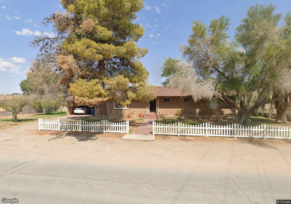
350 W Perkins Ave Overton, NV 89040
Estimated Value: $331,000 - $515,000
5
Beds
4
Baths
3,630
Sq Ft
$124/Sq Ft
Est. Value
About This Home
This home is located at 350 W Perkins Ave, Overton, NV 89040 and is currently estimated at $449,680, approximately $123 per square foot. 350 W Perkins Ave is a home with nearby schools including Grant Bowler Elementary School, Mack Lyon Middle School, and Moapa Valley High School.
Ownership History
Date
Name
Owned For
Owner Type
Purchase Details
Closed on
Jun 16, 2011
Sold by
J Lee & Noreen Bishop Family Trust
Bought by
Leavitt Darren and Leavitt Mindy
Current Estimated Value
Home Financials for this Owner
Home Financials are based on the most recent Mortgage that was taken out on this home.
Original Mortgage
$257,000
Outstanding Balance
$175,304
Interest Rate
4.56%
Mortgage Type
Purchase Money Mortgage
Estimated Equity
$274,376
Create a Home Valuation Report for This Property
The Home Valuation Report is an in-depth analysis detailing your home's value as well as a comparison with similar homes in the area
Home Values in the Area
Average Home Value in this Area
Purchase History
| Date | Buyer | Sale Price | Title Company |
|---|---|---|---|
| Leavitt Darren | $265,000 | Fidelity Title Mesquite |
Source: Public Records
Mortgage History
| Date | Status | Borrower | Loan Amount |
|---|---|---|---|
| Open | Leavitt Darren | $257,000 |
Source: Public Records
Tax History Compared to Growth
Tax History
| Year | Tax Paid | Tax Assessment Tax Assessment Total Assessment is a certain percentage of the fair market value that is determined by local assessors to be the total taxable value of land and additions on the property. | Land | Improvement |
|---|---|---|---|---|
| 2025 | $2,285 | $136,609 | $16,748 | $119,861 |
| 2024 | $2,506 | $136,609 | $16,748 | $119,861 |
| 2023 | $2,506 | $126,545 | $13,703 | $112,842 |
| 2022 | $2,155 | $108,894 | $11,165 | $97,729 |
| 2021 | $2,451 | $104,036 | $11,165 | $92,871 |
| 2020 | $2,009 | $103,043 | $11,165 | $91,878 |
| 2019 | $1,883 | $96,506 | $11,165 | $85,341 |
| 2018 | $1,797 | $92,612 | $10,150 | $82,462 |
| 2017 | $2,374 | $93,953 | $10,150 | $83,803 |
| 2016 | $1,956 | $79,395 | $9,135 | $70,260 |
| 2015 | $1,954 | $64,315 | $9,135 | $55,180 |
| 2014 | $1,901 | $63,475 | $10,150 | $53,325 |
Source: Public Records
Map
Nearby Homes
- 279 Behmer St
- 390 W Thomas Ave
- 192 W Alma
- 542 Bonelli Ave
- 156 N Moapa Valley Blvd
- 370 W McDonald Ave
- 1080 N Moapa Valley Blvd
- 775 N Moapa Valley Blvd
- 347 Tres Palomas St
- 470 N Moapa Valley Blvd
- 450 W Ingram Ave
- 0 N Moapa Valley Blvd and N Oliver St
- 468 Adelle Ave
- 0 Adelle Ave
- 0 N Cooper St
- 0 Ryan Unit 2735789
- 2080 Lou St
- 467 Muddy Peak Ct
- 0 Lewis Unit 2593098
- 203 Trailzend Ave
- 362 W Perkins Ave
- 340 W Perkins Ave
- 223 S Andersen St
- 330 W Perkins Ave
- 420 W Perkins Ave
- 264 Gentry
- 251 S Andersen St
- 240 Gentry St
- 310 W Perkins Ave
- 225 S Andersen St
- 205 S Andersen St
- 195 S Andersen St
- 455 W Perkins Ave
- 359 W Perkins Ave
- 325 W Perkins Ave
- 0 W Perkins Ave
- 225 Gentry St
- 460 W Perkins Ave
- 258 S Andersen St
- 295 W Perkins Ave