Estimated Value: $237,000 - $288,000
4
Beds
2
Baths
2,096
Sq Ft
$125/Sq Ft
Est. Value
About This Home
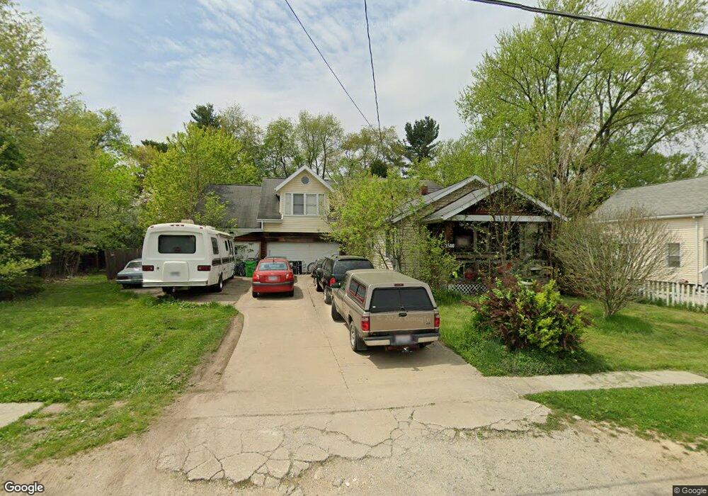
This home is located at 3500 Deidrick Rd, Kent, OH 44240 and is currently estimated at $262,553, approximately $125 per square foot. 3500 Deidrick Rd is a home located in Summit County with nearby schools including Stow-Munroe Falls High School and St Patrick Elementary School.
Ownership History
Date
Name
Owned For
Owner Type
Purchase Details
Closed on
Feb 8, 2016
Sold by
Barnes Charles A
Bought by
Barnes Wayne D
Current Estimated Value
Purchase Details
Closed on
Sep 22, 2010
Sold by
Barnes Wayne D and Barnes Jurinda P
Bought by
Barnes Charles
Purchase Details
Closed on
Sep 8, 2006
Sold by
Home Savings Bank
Bought by
Barnes Wayne
Home Financials for this Owner
Home Financials are based on the most recent Mortgage that was taken out on this home.
Original Mortgage
$100,000
Outstanding Balance
$60,152
Interest Rate
6.7%
Mortgage Type
Purchase Money Mortgage
Estimated Equity
$202,401
Purchase Details
Closed on
May 3, 2006
Sold by
Linger Terrance M
Bought by
Home Savings Bank
Create a Home Valuation Report for This Property
The Home Valuation Report is an in-depth analysis detailing your home's value as well as a comparison with similar homes in the area
Home Values in the Area
Average Home Value in this Area
Purchase History
| Date | Buyer | Sale Price | Title Company |
|---|---|---|---|
| Barnes Wayne D | -- | None Available | |
| Barnes Charles | -- | Attorney | |
| Barnes Wayne | $100,000 | None Available | |
| Home Savings Bank | $106,000 | None Available |
Source: Public Records
Mortgage History
| Date | Status | Borrower | Loan Amount |
|---|---|---|---|
| Open | Barnes Wayne | $100,000 |
Source: Public Records
Tax History
| Year | Tax Paid | Tax Assessment Tax Assessment Total Assessment is a certain percentage of the fair market value that is determined by local assessors to be the total taxable value of land and additions on the property. | Land | Improvement |
|---|---|---|---|---|
| 2025 | $301 | $5,275 | $5,275 | -- |
| 2024 | $301 | $5,275 | $5,275 | -- |
| 2023 | $301 | $5,275 | $5,275 | $0 |
| 2020 | $236 | $62,720 | $8,110 | $54,610 |
| 2019 | $392 | $46,310 | $8,110 | $38,200 |
| 2018 | $385 | $46,310 | $8,110 | $38,200 |
| 2017 | $2,408 | $46,310 | $8,110 | $38,200 |
| 2016 | $408 | $40,220 | $8,110 | $32,110 |
| 2015 | $2,408 | $40,220 | $8,110 | $32,110 |
| 2014 | $2,410 | $40,220 | $8,110 | $32,110 |
| 2013 | $2,171 | $36,470 | $8,110 | $28,360 |
Source: Public Records
Map
Nearby Homes
- 1245 Chelton Dr
- 350 Silver Meadows Blvd
- 1302 Carol Dr
- 511 Suzanne Dr
- 1189 Garth Dr
- 3313 Crown Pointe Dr
- 726 Hughey Dr
- 884 Highridge Ln
- 895 Highridge Ln
- 876 Middlebury Rd
- 0 Middlebury Rd
- 3753 Lake Run Blvd
- 2721 Santa Anita Dr
- 3767 Lake Run Blvd
- 957 Edgewater Cir Unit 20
- 3874 Lake Run Blvd
- 994 Erin Dr
- 3958 Lake Run Blvd
- 1067 Erin Dr
- 3905 Kent Rd
- 3506 Deidrick Rd
- 3510 Deidrick Rd
- 3510 Deidrick Rd
- 3490 Deidrick Rd
- 393 Deidrick Rd
- 399 Deidrick Rd
- 3497 Verner Rd Unit 3501
- 385 Deidrick Rd
- 3509 Verner Rd
- 3489 Verner Rd
- 1349 Parmalee Dr
- 3522 Deidrick Rd
- 3474 Deidrick Rd
- 3120 Powell Rd
- 3519 Verner Rd
- 390 Louise Ave
- 3530 Deidrick Rd
- 0 Parmalee St Unit 4407360
- 415 Deidrick Rd
- 3527 Verner Rd
Your Personal Tour Guide
Ask me questions while you tour the home.