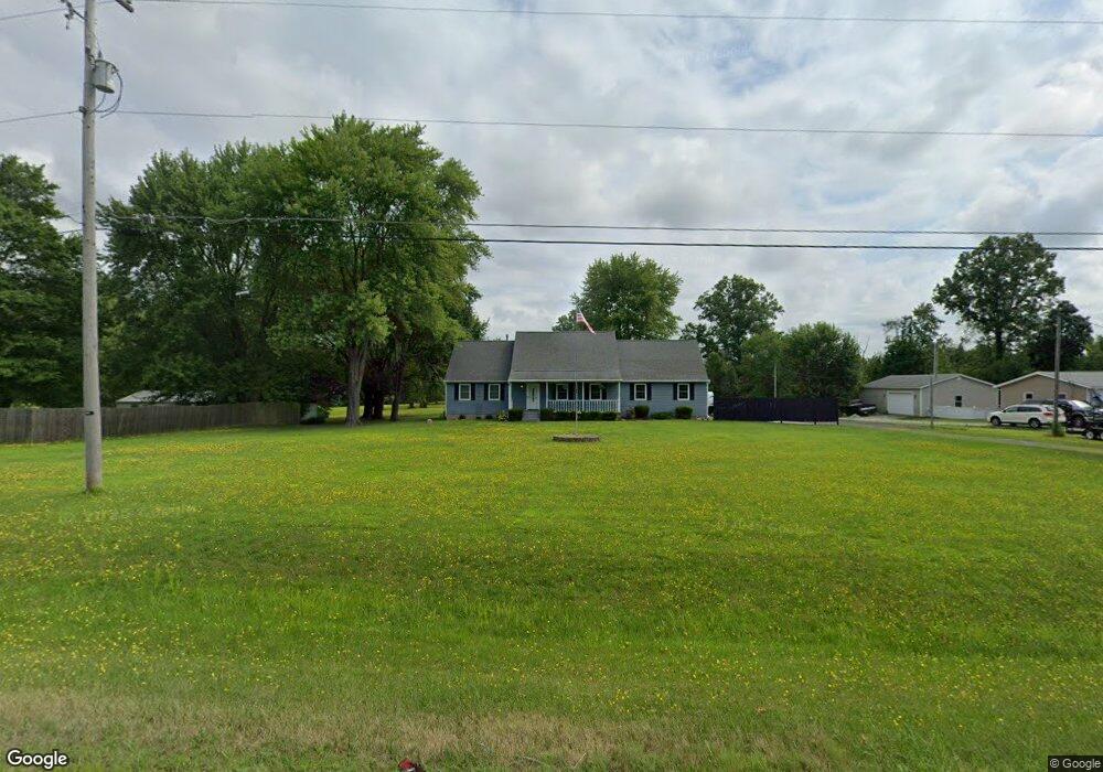
3500 State Route 14 Rootstown, OH 44272
Estimated Value: $211,000 - $366,000
3
Beds
3
Baths
1,857
Sq Ft
$165/Sq Ft
Est. Value
About This Home
This home is located at 3500 State Route 14, Rootstown, OH 44272 and is currently estimated at $306,672, approximately $165 per square foot. 3500 State Route 14 is a home located in Portage County with nearby schools including Southeast High School.
Ownership History
Date
Name
Owned For
Owner Type
Purchase Details
Closed on
Sep 26, 2011
Sold by
Bradfield Harold R and Bradfield Martha B
Bought by
Staton Marc E and Staton Alicia G
Current Estimated Value
Home Financials for this Owner
Home Financials are based on the most recent Mortgage that was taken out on this home.
Original Mortgage
$165,592
Outstanding Balance
$111,262
Interest Rate
4.25%
Mortgage Type
FHA
Estimated Equity
$195,410
Purchase Details
Closed on
Jan 29, 1987
Bought by
Bradfield Harold R
Create a Home Valuation Report for This Property
The Home Valuation Report is an in-depth analysis detailing your home's value as well as a comparison with similar homes in the area
Purchase History
| Date | Buyer | Sale Price | Title Company |
|---|---|---|---|
| Staton Marc E | $169,900 | Diamond Title Co | |
| Bradfield Harold R | -- | -- |
Source: Public Records
Mortgage History
| Date | Status | Borrower | Loan Amount |
|---|---|---|---|
| Open | Staton Marc E | $165,592 |
Source: Public Records
Tax History
| Year | Tax Paid | Tax Assessment Tax Assessment Total Assessment is a certain percentage of the fair market value that is determined by local assessors to be the total taxable value of land and additions on the property. | Land | Improvement |
|---|---|---|---|---|
| 2025 | $3,352 | $90,580 | $10,010 | $80,570 |
| 2024 | $3,273 | $90,580 | $10,010 | $80,570 |
| 2023 | $2,673 | $66,260 | $8,610 | $57,650 |
| 2022 | $2,773 | $66,260 | $8,610 | $57,650 |
| 2021 | $2,796 | $66,260 | $8,610 | $57,650 |
| 2020 | $2,508 | $57,120 | $7,840 | $49,280 |
| 2019 | $2,515 | $57,120 | $7,840 | $49,280 |
| 2018 | $2,466 | $52,820 | $7,630 | $45,190 |
| 2017 | $2,466 | $52,820 | $7,630 | $45,190 |
| 2016 | $2,457 | $52,820 | $7,630 | $45,190 |
| 2015 | $2,351 | $52,820 | $7,630 | $45,190 |
| 2014 | $2,291 | $50,260 | $7,630 | $42,630 |
| 2013 | $2,232 | $50,260 | $7,630 | $42,630 |
Source: Public Records
Map
Nearby Homes
- 3545 Porter Rd
- 3798 State Route 183
- 6747 Giddings Rd
- 2639 Ohio 183
- 8464 & 8446 Tallmadge Rd
- 8492 & 8476 Tallmadge Rd
- 4087 Industry
- 941 Porter Rd
- 2434 Taft Ave
- 0 Yale Rd Unit 5190725
- 0 Wayland Rd Unit 5191883
- 0 John Thomas
- 3207 Prairie Cir
- 0 Tallmadge Rd Unit 5189301
- 0 Tallmadge Rd Unit 5189314
- 3609 State Route 225
- 0 Ohio 225 Unit 5174573
- 4133 State Route 225
- 1491 Whittlesey Ave
- 1454 Hillcrest Dr
- 3490 State Route 14
- 3516 State Route 14
- 3530 State Route 14
- 3449 State Route 14
- 3446 State Route 14
- 3529 State Route 14
- 3428 Ohio 14
- 3428 State Route 14
- 3554 State Route 14
- 3509 Porter Rd
- 3483 Porter Rd
- 3580 Ohio 14
- 3577 Porter Rd
- 3495 Porter Rd
- 3410 Ohio 14
- 3471 Porter Rd
- 0 Porter Rd Unit 1060498
- 0 Porter Rd Unit 4386187
- 3433 Porter Rd
- 3625 Porter Rd
Your Personal Tour Guide
Ask me questions while you tour the home.