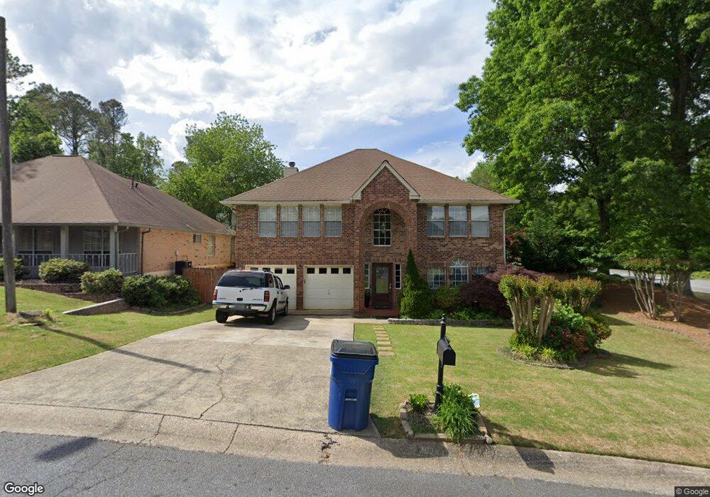
3500 Steve Dr NW Unit 1 Marietta, GA 30064
West Cobb NeighborhoodEstimated Value: $423,000 - $537,000
3
Beds
3
Baths
2,769
Sq Ft
$173/Sq Ft
Est. Value
About This Home
This home is located at 3500 Steve Dr NW Unit 1, Marietta, GA 30064 and is currently estimated at $477,977, approximately $172 per square foot. 3500 Steve Dr NW Unit 1 is a home located in Cobb County with nearby schools including Due West Elementary School, Lost Mountain Middle School, and Harrison High School.
Ownership History
Date
Name
Owned For
Owner Type
Purchase Details
Closed on
Dec 5, 2003
Sold by
Dodd Teresa and Dodd Robert
Bought by
Zanabria Edgar and Zanabria Amelia
Current Estimated Value
Home Financials for this Owner
Home Financials are based on the most recent Mortgage that was taken out on this home.
Original Mortgage
$136,500
Outstanding Balance
$63,693
Interest Rate
5.98%
Mortgage Type
New Conventional
Estimated Equity
$414,284
Purchase Details
Closed on
Feb 1, 1999
Sold by
Richardson Udel
Bought by
Dodd Robert and Dodd Teresa
Home Financials for this Owner
Home Financials are based on the most recent Mortgage that was taken out on this home.
Original Mortgage
$142,350
Interest Rate
6.85%
Mortgage Type
New Conventional
Purchase Details
Closed on
Nov 18, 1998
Sold by
Richardson Jr Udel
Bought by
Richardson Sr Udel
Create a Home Valuation Report for This Property
The Home Valuation Report is an in-depth analysis detailing your home's value as well as a comparison with similar homes in the area
Home Values in the Area
Average Home Value in this Area
Purchase History
| Date | Buyer | Sale Price | Title Company |
|---|---|---|---|
| Zanabria Edgar | $172,000 | -- | |
| Dodd Robert | $149,900 | -- | |
| Richardson Sr Udel | -- | -- |
Source: Public Records
Mortgage History
| Date | Status | Borrower | Loan Amount |
|---|---|---|---|
| Open | Zanabria Edgar | $136,500 | |
| Previous Owner | Dodd Robert | $142,350 |
Source: Public Records
Tax History Compared to Growth
Tax History
| Year | Tax Paid | Tax Assessment Tax Assessment Total Assessment is a certain percentage of the fair market value that is determined by local assessors to be the total taxable value of land and additions on the property. | Land | Improvement |
|---|---|---|---|---|
| 2024 | $1,561 | $160,616 | $26,000 | $134,616 |
| 2023 | $1,355 | $160,616 | $26,000 | $134,616 |
| 2022 | $4,180 | $137,736 | $22,000 | $115,736 |
| 2021 | $3,268 | $107,672 | $16,000 | $91,672 |
| 2020 | $3,044 | $100,284 | $16,000 | $84,284 |
| 2019 | $3,090 | $101,828 | $16,000 | $85,828 |
| 2018 | $2,725 | $89,772 | $6,000 | $83,772 |
| 2017 | $2,438 | $84,808 | $6,000 | $78,808 |
| 2016 | $2,364 | $82,220 | $6,400 | $75,820 |
| 2015 | $2,029 | $68,860 | $6,400 | $62,460 |
| 2014 | $2,046 | $68,860 | $0 | $0 |
Source: Public Records
Map
Nearby Homes
- 3470 Whisperwood Ct NW
- 3494 Due West Rd NW
- 140 Whisperwood Ln NW
- 100 Whisperwood Ln NW
- 191 Whisperwood Ln NW
- 240 Whisperwood Ln NW
- 3462 Due West Rd NW
- 120 Westwood Dr NW
- 3570 Morishop Cove NW
- 3414 Old Due West Rd NW Unit 15
- 3414 Old Due Rd W
- 000 Dallas Hwy
- 3457 Horseback Trail NW
- 3275 Bob Cox Rd NW
- 3308 Equestrian Trail NW
- 3392 Bridle Run Trail NW
- 3910 Lisas Dr NW
- 345 Vineyard Dr NW
- 3510 Steve Dr NW
- 3510 Steve Dr NW Unit 71
- 3467 Whisperwood Ct NW
- 3466 Whisperwood Ct NW
- 0 Steve Dr Unit 7335470
- 0 Steve Dr Unit 7280589
- 0 Steve Dr Unit 7076637
- 0 Steve Dr Unit 8626491
- 0 Steve Dr Unit 8607238
- 0 Steve Dr Unit 8580918
- 0 Steve Dr Unit 8450227
- 0 Steve Dr Unit 8421377
- 0 Steve Dr Unit 8288606
- 0 Steve Dr Unit 8129988
- 3520 Steve Dr NW Unit 1
- 3468 Whisperwood Ct NW
- 3469 Whisperwood Ct NW Unit 2
- 110 Whisperwood Ln NW
- 120 Whisperwood Ln NW
- 3471 Whisperwood Ct NW Unit 2