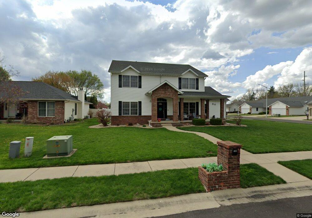
3501 Carnoustie Dr Springfield, IL 62712
Estimated Value: $405,939 - $507,000
4
Beds
3
Baths
2,993
Sq Ft
$150/Sq Ft
Est. Value
About This Home
This home is located at 3501 Carnoustie Dr, Springfield, IL 62712 and is currently estimated at $448,235, approximately $149 per square foot. 3501 Carnoustie Dr is a home located in Sangamon County with nearby schools including Rochester Elementary Ec-1 School, Rochester Elementary School, and Rochester Intermediate School.
Ownership History
Date
Name
Owned For
Owner Type
Purchase Details
Closed on
Jun 15, 2022
Sold by
Reidy Brittney D
Bought by
Orebaugh Jeffrey L and Orebaugh Gretchen L
Current Estimated Value
Purchase Details
Closed on
Mar 19, 2014
Purchase Details
Closed on
May 4, 2011
Purchase Details
Closed on
May 15, 2006
Purchase Details
Closed on
Apr 29, 2005
Create a Home Valuation Report for This Property
The Home Valuation Report is an in-depth analysis detailing your home's value as well as a comparison with similar homes in the area
Purchase History
| Date | Buyer | Sale Price | Title Company |
|---|---|---|---|
| Orebaugh Jeffrey L | $350,000 | Barber Segatto Hoffee Wilke & | |
| -- | -- | -- | |
| -- | $267,500 | -- | |
| -- | $284,000 | -- | |
| -- | $34,000 | -- |
Source: Public Records
Mortgage History
| Date | Status | Borrower | Loan Amount |
|---|---|---|---|
| Closed | Orebaugh Jeffrey L | $0 |
Source: Public Records
Tax History
| Year | Tax Paid | Tax Assessment Tax Assessment Total Assessment is a certain percentage of the fair market value that is determined by local assessors to be the total taxable value of land and additions on the property. | Land | Improvement |
|---|---|---|---|---|
| 2024 | $9,199 | $133,401 | $16,851 | $116,550 |
| 2023 | $8,665 | $121,850 | $15,392 | $106,458 |
| 2022 | $8,334 | $115,586 | $14,601 | $100,985 |
| 2021 | $7,267 | $101,052 | $14,054 | $86,998 |
| 2020 | $7,222 | $101,204 | $14,075 | $87,129 |
| 2019 | $7,077 | $100,851 | $14,026 | $86,825 |
| 2018 | $6,962 | $98,403 | $13,957 | $84,446 |
| 2017 | $6,850 | $97,131 | $13,777 | $83,354 |
| 2016 | $6,758 | $95,714 | $13,576 | $82,138 |
| 2015 | $6,690 | $94,570 | $13,414 | $81,156 |
| 2014 | $6,351 | $93,959 | $13,327 | $80,632 |
| 2013 | $6,313 | $90,031 | $13,327 | $76,704 |
Source: Public Records
Map
Nearby Homes
- 3120 Red Bud Ln
- 66 White Birch Rd
- 4112 Blair Dr
- 2632 Hilltop Rd
- 5 Swannanoa Unit 1
- 53 Mishawaka Dr Unit 1
- 329-331 Harbor Point Place
- 312 Harbor Point Place
- 314 Harbor Point Place
- 2632 Steiler Place
- 2906 Taylor Ave Unit 11
- 2875 Taylor Ave
- 3518 Sheffield Rd Unit 1
- 0 Oak Hill Rd
- 0 Varsity Ct
- 3100 Butler St Unit 1833
- 2800 Via Rosso St Unit 135
- 4013 S Milan Rd
- 3301 Stanton St Unit 1
- 3719 E Hooker St Unit 1
- 3505 Carnoustie Dr
- 3618 Troon Dr
- 3509 Carnoustie Dr
- 3500 Lytham Dr
- 3504 Lytham Dr
- 3500 Carnoustie Dr
- 3506 Lytham Dr
- 3504 Carnoustie Dr
- 3629 Troon Dr
- 3623 Troon Dr
- 3513 Carnoustie Dr
- 3508 Lytham Dr
- 3510 Lytham Dr
- 3621 Troon Dr
- 3508 Carnoustie Dr
- 3637 Troon Dr
- 3619 Troon Dr
- 3512 Carnoustie Dr
- 3617 Troon Dr
- 3512 Lytham Dr
Your Personal Tour Guide
Ask me questions while you tour the home.