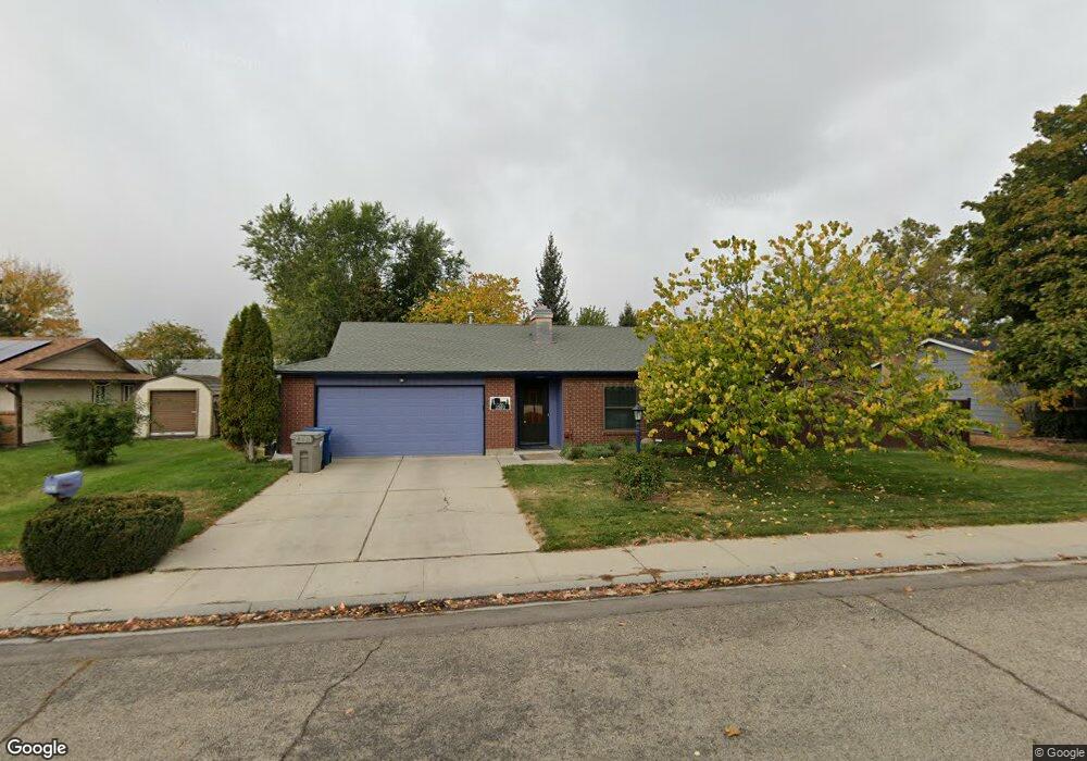
3503 Covered Wagon Way Boise, ID 83713
West Boise NeighborhoodEstimated Value: $386,000 - $409,000
3
Beds
2
Baths
1,288
Sq Ft
$308/Sq Ft
Est. Value
About This Home
This home is located at 3503 Covered Wagon Way, Boise, ID 83713 and is currently estimated at $396,727, approximately $308 per square foot. 3503 Covered Wagon Way is a home located in Ada County with nearby schools including Frontier Elementary School, Lowell Scott Middle School, and Centennial High School.
Ownership History
Date
Name
Owned For
Owner Type
Purchase Details
Closed on
Dec 15, 2017
Sold by
Cooper D Lavon and Cooper Family Trust Under Trust Agreemen
Bought by
Hall John M
Current Estimated Value
Home Financials for this Owner
Home Financials are based on the most recent Mortgage that was taken out on this home.
Original Mortgage
$107,250
Outstanding Balance
$58,382
Interest Rate
3.27%
Mortgage Type
New Conventional
Estimated Equity
$338,345
Purchase Details
Closed on
May 18, 1999
Sold by
Cooper Robert W and Cooper Lavon D
Bought by
Cooper Robert W and Lavon Cooper D
Create a Home Valuation Report for This Property
The Home Valuation Report is an in-depth analysis detailing your home's value as well as a comparison with similar homes in the area
Home Values in the Area
Average Home Value in this Area
Purchase History
| Date | Buyer | Sale Price | Title Company |
|---|---|---|---|
| Hall John M | -- | Fidelity National Title | |
| Cooper Robert W | -- | -- |
Source: Public Records
Mortgage History
| Date | Status | Borrower | Loan Amount |
|---|---|---|---|
| Open | Hall John M | $107,250 |
Source: Public Records
Tax History Compared to Growth
Tax History
| Year | Tax Paid | Tax Assessment Tax Assessment Total Assessment is a certain percentage of the fair market value that is determined by local assessors to be the total taxable value of land and additions on the property. | Land | Improvement |
|---|---|---|---|---|
| 2025 | $1,319 | $343,500 | -- | -- |
| 2024 | $1,405 | $324,400 | -- | -- |
| 2023 | $1,405 | $326,800 | $0 | $0 |
| 2022 | $1,669 | $372,200 | $0 | $0 |
| 2021 | $1,433 | $288,400 | $0 | $0 |
| 2020 | $1,210 | $221,400 | $0 | $0 |
| 2019 | $1,280 | $199,900 | $0 | $0 |
| 2018 | $1,217 | $171,400 | $0 | $0 |
| 2017 | $1,162 | $153,900 | $0 | $0 |
| 2016 | $1,159 | $149,800 | $0 | $0 |
| 2015 | $1,063 | $139,600 | $0 | $0 |
| 2012 | -- | $94,200 | $0 | $0 |
Source: Public Records
Map
Nearby Homes
- 3552 N Covered Wagon Way
- 11000 W Ramrod Dr
- 11143 W Ramrod Dr
- 11175 W Hinsdale St
- 10974 W Edna St
- 3845 N Shamrock Ave
- 10778 W Ripley St
- 3958 N Bryson Way
- 4256 N Buckboard Way
- 10742 W Ardyce Ln Unit 11
- 11288 W Race Ct
- 10490 W Wildrose Ct
- 10679 W Richey Ct
- 3289 N Dove Place
- 11301 W Goldenrod Ave
- 4432 N Wisteria Place
- 11900 W Ramrod Dr
- 10319 W Ardyce St
- 2573 & 2575 N Dusty Ln
- 3832 N Jullion Way
- 3503 N Covered Wagon Way
- 3537 Covered Wagon Way
- 3481 Covered Wagon Way
- 11047 W Ramrod Dr
- 11059 W Ramrod Dr
- 11035 W Ramrod Dr
- 3490 Covered Wagon Way
- 3526 Covered Wagon Way
- 10999 W
- 3565 Covered Wagon Way
- 11002 W Flintlock Dr
- 10968 W Flintlock Dr
- 11023 W Ramrod Dr
- 3552 Covered Wagon Way
- 11071 W Ramrod Dr
- 3473 Frontier Way
- 11030 W Flintlock Dr
- 3489 Frontier Way
- 3589 Covered Wagon Way
- 11072 W Ramrod Dr