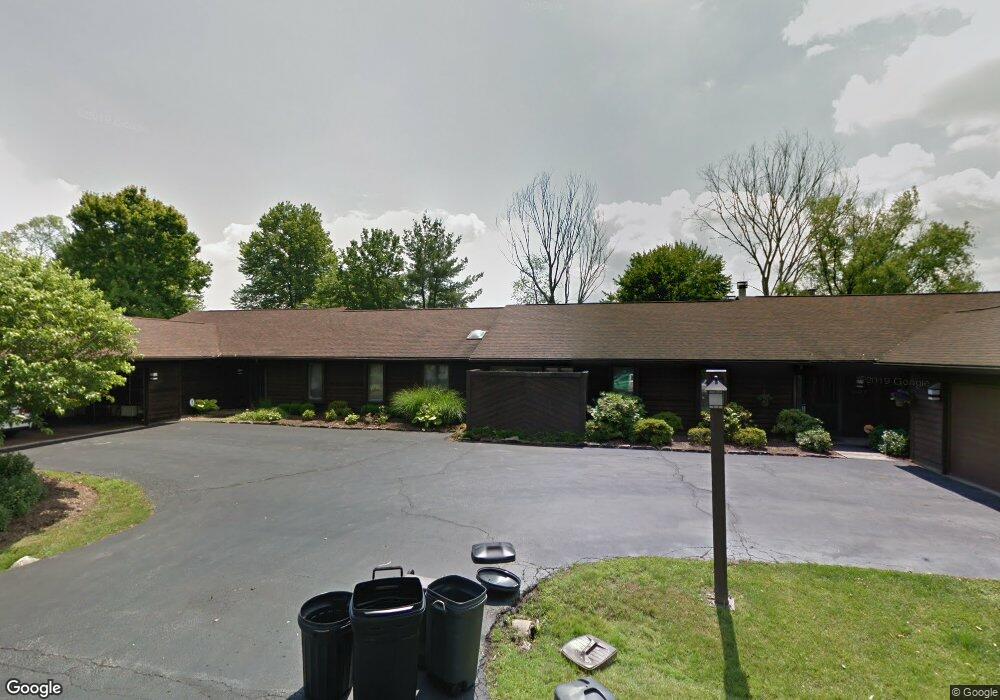
3504 Somerset Dr Unit A Youngstown, OH 44505
Estimated Value: $158,000 - $251,000
3
Beds
2
Baths
2,240
Sq Ft
$89/Sq Ft
Est. Value
About This Home
This home is located at 3504 Somerset Dr Unit A, Youngstown, OH 44505 and is currently estimated at $198,417, approximately $88 per square foot. 3504 Somerset Dr Unit A is a home located in Trumbull County with nearby schools including E.J. Blott Elementary School, William S. Guy Middle School, and Liberty High School.
Ownership History
Date
Name
Owned For
Owner Type
Purchase Details
Closed on
Feb 19, 2009
Sold by
Oesterling Robert F
Bought by
Davis Keith and Davis Christina E
Current Estimated Value
Home Financials for this Owner
Home Financials are based on the most recent Mortgage that was taken out on this home.
Original Mortgage
$103,098
Outstanding Balance
$64,505
Interest Rate
4.91%
Mortgage Type
FHA
Estimated Equity
$133,912
Purchase Details
Closed on
Aug 10, 1994
Sold by
Cowen Elliott S
Bought by
Cestone Jean C
Home Financials for this Owner
Home Financials are based on the most recent Mortgage that was taken out on this home.
Original Mortgage
$76,000
Interest Rate
8.62%
Mortgage Type
New Conventional
Purchase Details
Closed on
Jan 1, 1990
Bought by
Elliott S Cowen
Create a Home Valuation Report for This Property
The Home Valuation Report is an in-depth analysis detailing your home's value as well as a comparison with similar homes in the area
Home Values in the Area
Average Home Value in this Area
Purchase History
| Date | Buyer | Sale Price | Title Company |
|---|---|---|---|
| Davis Keith | $105,000 | Barristers Of Ohio | |
| Cestone Jean C | $155,500 | -- | |
| Elliott S Cowen | -- | -- |
Source: Public Records
Mortgage History
| Date | Status | Borrower | Loan Amount |
|---|---|---|---|
| Open | Davis Keith | $103,098 | |
| Previous Owner | Cestone Jean C | $76,000 |
Source: Public Records
Tax History Compared to Growth
Tax History
| Year | Tax Paid | Tax Assessment Tax Assessment Total Assessment is a certain percentage of the fair market value that is determined by local assessors to be the total taxable value of land and additions on the property. | Land | Improvement |
|---|---|---|---|---|
| 2024 | $2,956 | $55,410 | $6,300 | $49,110 |
| 2023 | $2,956 | $55,410 | $6,300 | $49,110 |
| 2022 | $2,606 | $39,200 | $5,250 | $33,950 |
| 2021 | $2,611 | $39,200 | $5,250 | $33,950 |
| 2020 | $2,617 | $39,200 | $5,250 | $33,950 |
| 2019 | $2,965 | $39,200 | $5,250 | $33,950 |
| 2018 | $2,947 | $39,200 | $5,250 | $33,950 |
| 2017 | $2,868 | $39,200 | $5,250 | $33,950 |
| 2016 | $3,479 | $46,900 | $5,250 | $41,650 |
| 2015 | $3,489 | $46,900 | $5,250 | $41,650 |
| 2014 | $3,469 | $46,900 | $5,250 | $41,650 |
| 2013 | $3,376 | $46,900 | $5,250 | $41,650 |
Source: Public Records
Map
Nearby Homes
- 3502 Somerset Dr Unit B
- 2010 Powder Mill Run
- 3943 Logangate Rd
- 2012 Crestwood Blvd
- 0 Powder Mill Run Unit 5127327
- 0 Powder Mill Run Unit 5127333
- 2021 Crestwood Blvd
- 2046 Burning Tree Ln
- 3712 Logan Way
- 9 Redfern Dr
- 1363 Country Club Dr
- 1303 Stonington Dr
- 4260 Logan Way
- 0 Stonington Dr
- 5843 Fairlawn Ave
- 28 Wildfern Dr
- 0 Homestead Rd
- 2160 Lansdowne Blvd
- 3735 Sampson Rd
- 0 Townsend Ave
- 3504 Somerset Dr Unit B
- 185 Somerset Dr Unit 2
- 3506 Somerset Dr Unit B
- 3506 Somerset Dr Unit A
- 3502 Somerset Unit B Dr Unit 2
- 3507 Somerset Dr Unit A
- 3507 Somerset Dr Unit B
- 3505 Somerset Dr Unit A
- 3509 Somerset Dr Unit B
- 3509 Somerset Dr Unit A
- 4128 Logangate Rd
- 4151-4201 Logan Gate Rd
- 4151 Logangate Rd
- 4151-4201 Logan Gate Rd
- 2004 Powder Mill Run
- 2006 Powder Mill Run
- 2008 Powder Mill
- 2008 Powder Mill Run
- 0 Logangate Rd Unit 4015315
- 0 Logangate Rd Unit 4445478