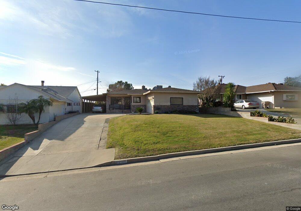
3506 Cal Dr Bakersfield, CA 93305
College Heights NeighborhoodEstimated Value: $302,315 - $340,000
3
Beds
2
Baths
1,372
Sq Ft
$231/Sq Ft
Est. Value
About This Home
This home is located at 3506 Cal Dr, Bakersfield, CA 93305 and is currently estimated at $317,329, approximately $231 per square foot. 3506 Cal Dr is a home located in Kern County with nearby schools including Myra A. Noble Elementary School, Washington Middle School, and East Bakersfield High School.
Ownership History
Date
Name
Owned For
Owner Type
Purchase Details
Closed on
Mar 29, 2001
Sold by
Daniels Robert H and Daniels Marian E
Bought by
Daniels Robert H and Daniels Marian E
Current Estimated Value
Purchase Details
Closed on
May 21, 1997
Sold by
Horton James H and Horton Lesley L
Bought by
Daniels Robert H and Daniels Marian E
Home Financials for this Owner
Home Financials are based on the most recent Mortgage that was taken out on this home.
Original Mortgage
$47,000
Interest Rate
7.83%
Mortgage Type
Balloon
Create a Home Valuation Report for This Property
The Home Valuation Report is an in-depth analysis detailing your home's value as well as a comparison with similar homes in the area
Home Values in the Area
Average Home Value in this Area
Purchase History
| Date | Buyer | Sale Price | Title Company |
|---|---|---|---|
| Daniels Robert H | -- | -- | |
| Daniels Robert H | $85,000 | American Title Co |
Source: Public Records
Mortgage History
| Date | Status | Borrower | Loan Amount |
|---|---|---|---|
| Previous Owner | Daniels Robert H | $47,000 |
Source: Public Records
Tax History Compared to Growth
Tax History
| Year | Tax Paid | Tax Assessment Tax Assessment Total Assessment is a certain percentage of the fair market value that is determined by local assessors to be the total taxable value of land and additions on the property. | Land | Improvement |
|---|---|---|---|---|
| 2025 | $2,190 | $135,696 | $35,114 | $100,582 |
| 2024 | $2,139 | $133,036 | $34,426 | $98,610 |
| 2023 | $2,139 | $130,428 | $33,751 | $96,677 |
| 2022 | $2,081 | $127,872 | $33,090 | $94,782 |
| 2021 | $1,974 | $125,366 | $32,442 | $92,924 |
| 2020 | $1,938 | $124,082 | $32,110 | $91,972 |
| 2019 | $1,899 | $124,082 | $32,110 | $91,972 |
| 2018 | $1,855 | $119,265 | $30,864 | $88,401 |
| 2017 | $1,842 | $116,927 | $30,259 | $86,668 |
| 2016 | $1,699 | $114,635 | $29,666 | $84,969 |
| 2015 | $1,686 | $112,914 | $29,221 | $83,693 |
| 2014 | $1,631 | $110,703 | $28,649 | $82,054 |
Source: Public Records
Map
Nearby Homes
- 1105 Acacia Ave
- 1105 Vanderbilt Dr
- 1416 Duke Dr
- 1312 Shattuck Ave
- 1513 University Ave
- 1013 Oxford Ct
- 1208 W Point Dr
- 3300 Bucknell St
- 1601 University Ave
- 925 Radcliffe Ave
- 1006 Princeton Ave
- 2918 Dartmouth St
- 0 Acacia Ave
- 3007 Bucknell St
- 909 Oberlin Ct
- 3417 River Blvd
- 1321 Panorama Dr
- 929 Panorama Dr
- 941 Panorama Dr
- 2904 Cornell St
- 3500 Cal Dr
- 3512 Cal Dr
- 1232 University Ave
- 1228 University Ave
- 1225 Telegraph Ave
- 3507 Cal Dr
- 1221 Telegraph Ave
- 1133 Acacia Ave
- 3513 Cal Dr
- 1308 University Ave
- 1217 Telegraph Ave
- 1136 Acacia Ave
- 1224 University Ave
- 1301 Telegraph Ave
- 1213 Telegraph Ave
- 1129 Acacia Ave
- 1312 University Ave
- 1305 Telegraph Ave
- 1209 Telegraph Ave
- 1220 University Ave